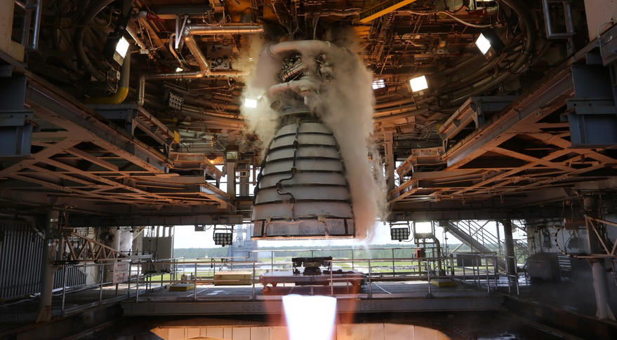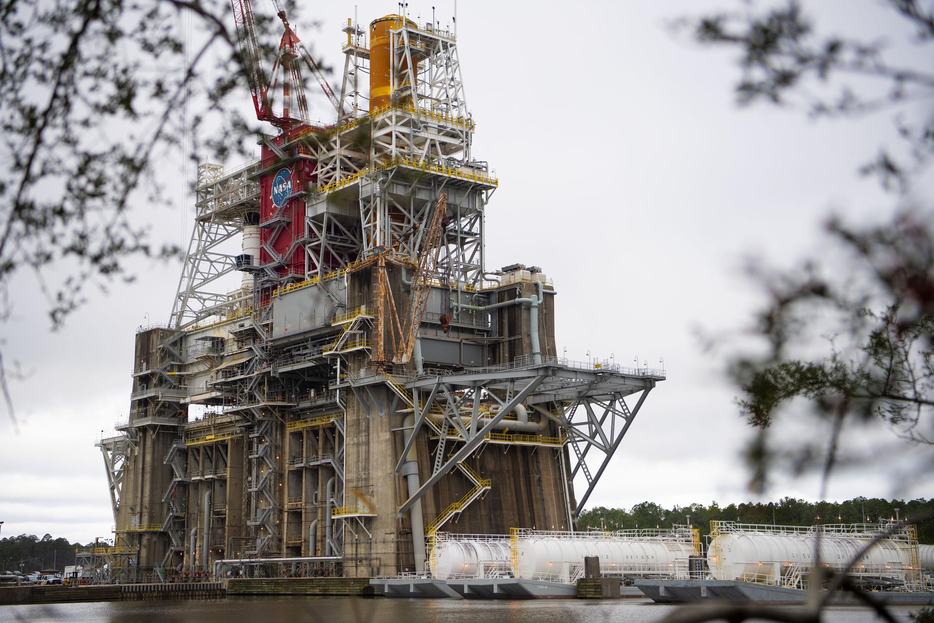


Stennis Space Center
Air and Marine Range Operations
NASA Range and Aviation Operations Office operates and uses ranges for the purpose of operations and testing space, aeronautical, unmanned vehicles and associated technologies. These range operations may involve personnel and property hazards. To address these hazards, NASA’s Range Safety Program provides for the safety and health of the public, the workforce, and property during range operations. This program is managed through the Range and Aviation Operations Office and supported by the Range Safety Office at NASA Stennis Space Center along with additional efforts of people and organizations throughout the agency.
Special Use Airspace
Unique capabilities – restricted airspace, waterway, and buffer zone – and infrastructure to support testing and operation of unmanned systems at NASA Stennis
Learn More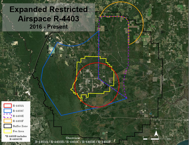
Ranges
NASA Stennis schedules and maintains restricted airspace (R-4403A/B) in order to reduce hazards to the public for both propulsion testing and unmanned operations.
R-4403A extends from the surface to 12,000 feet for propulsion testing and operations.
R-4403B, extends from the surface to 6,000 feet used for Unmanned Systems that includes Unmanned Aircraft Systems (UAS) and lander type systems. R-4403B is approximately 100 square miles. Stennis Space Center has multiple areas that can be utilized for unmanned systems launch and recovery depending on type of operations.
The Department of Defense owns and operates R-4403C/E/F for military training.
NASA Stennis Restricted Airspace
| R-4403A | R-4403B | |
|---|---|---|
| Boundaries | Within a 2.5 Nautical Mile (NM) radius centered at lat. 30°21′51″ N., long. 89°35′39″ W. | Boundaries- Beginning at lat. 30°29′37″ N., long. 89°35′16″ W.; to lat. 30°29′37″ N., long. 89°32′33″ W.; thence clockwise along a 0.85–NM arc centered at lat. 30°28′46″ N., long. 89°32′33″ W.; to lat. 30°28′46″ N., long. 89°31′34″ W.; to lat. 30°26′25″ N., long. 89°31′34″ W.; to lat. 30°24′02″ N., long. 89°31′34″ W.; thence counterclockwise along a 4.2–NM arc centered at lat. 30°22′04″ N., long. 89°27′17″ W.; to lat. 30°20′28″ N., long. 89°31′46″ W.; to lat. 30°19′19″ N., long. 89°35′32″ W.; to lat. 30°18′23″ N., long. 89°40′17″ W.; to lat. 30°21′08″ N., long. 89°42′25″ W.; to lat. 30°22′22″ N., long. 89°42′58″ W.; to lat. 30°23′44″ N., long. 89°42′43″ W.; to lat. 30°26′40″ N., long. 89°40′51″ W.; thence counterclockwise along a 3–NM arc centered at lat. 30°29′15″ N., long. 89°39′04″ W.; to lat. 30°27′08″ N., long. 89°36′37″ W.; to lat. 30°27′58″ N., long. 89°35′27″ W.; to lat. 30°28′47″ N., long. 89°35′27″ W.; to the point of beginning. |
| Designated Altitudes | Surface to 6,000 feet MSL. | Surface to 6,000 feet MSL. |
| Time of Designation | Intermittent by NOTAM at least 24 hours in advance. | Intermittent, 1000 to 0300 local time, as activated by NOTAM at least 24 hours in advance. |
| Controlling Agency | FAA, Houston ARTCC. | FAA, Houston ARTCC. |
| Using Agency | NASA, Director, Stennis Space Center, Bay St. Louis, MS. | NASA, Director, Stennis Space Center, Bay St. Louis, MS. |
| Scheduling Agency | NASA, Director, Stennis Space Center, Bay St. Louis, MS. | NASA, Director, Stennis Space Center, Bay St. Louis, MS. |
The FAA provides a detailed airspace legal description at https://www.federalregister.gov/
Range Requests
The NASA Stennis Range Office requires a Range Request Application for all aircraft and marine operations within the Stennis Space Center’s buffer zone or federal property. Each submission will give the NASA Stennis Range Control Officer an opportunity to properly schedule and educate the user of the hazards within the center. Key locations at the center must be avoided due to increased flight risks to Department of Defense training and ground hazards (i.e. areas which contain high stores of highly pressurized cryogenic material). The pilot or crew will be emailed a permit number that allows for safe flight operations to be conducted. To begin, select “New Range Request” from the main menu or contact the Range Operations Manager for additional information and assistance. In addition, please submit the appropriate completed questionnaire.
Unmanned Underwater Surface Vehicle Questionnaire
Contact Stennis Range Office for UAS Research and Development
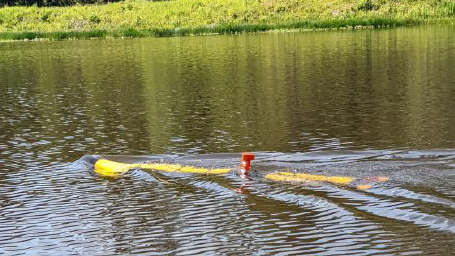
Marine Operations
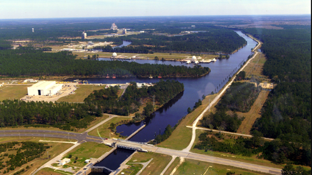
NASA Stennis has an interlocked 7.5-mile canal system that can be used for testing and operations. All maritime range operations go through the Range and Aviation Operations Manager for scheduling, area of operations and mission requirements.
Range Control Operations
Range control provides the communications link between range users, the Range Safety Officer, FAA Air Traffic Control organizations, and pilots in order to ensure the safety of airspace operations. Range control must be active for all airspace activations. NASA Stennis Range Control procedures and Range Safety Officer duties are outlined in SCWI-7900-0002, John C. Stennis Space Center Range Control Procedures.
When range control is active, the contact phone number is 228-688-7264. The Very High Frequency (VHF) radio frequency is 123.00 Megahertz (MHz), callsign “Stennis Range Control.”
Radio Frequency (RF) Spectrum Management
All operations located at Stennis Space Center transmitting radio frequencies must be approved through the NASA Stennis RF Spectrum Management Office prior to operations. Frequencies will be submitted through the Range and Aviation Operations Manager at least 30 days prior via email.
Range Scheduling Procedures
All users utilizing R-4403A/B or conducting operations at SSC may be required to enter into a formal agreement with NASA Stennis to ensure compliance with established laws, federal regulations, executive orders, and NASA directives. Roles and responsibilities for both NASA and the requesting user will be clearly identified in order to conduct operations at NASA Stennis.
Users must submit range requests to the Range and Aviation Operations Manager 60 days prior to the planned event for new flights and 30 days prior for repeat events. This will allow for operational and safety reviews and time to establish appropriate agreements. Timelines can be adjusted based on frequencies and operation’s complexity. The 60-day window also provides time to create necessary partnership agreements and appropriate scheduling.
Cellphone Tower Inspection Procedures
Personnel requiring site access for tower inspections must be vetted and receive prior approval. A minimum of 24 hours is required in order complete visitor access request. Please contact Catriona Shaw for request and information.
Contact Us
Range and Aviation Operations Manager
Jason Peterson
John C. Stennis Space Center
Office: 228-688-1257
Cell: 228-342-1525
Jason.e.peterson@nasa.gov