


![Request for Information – Potential [Placeholder for Prize]](https://assets.science.nasa.gov/dynamicimage/assets/science/psd/solar/2023/09/s/solarsystem_0.jpg?w=1024)


Audience
Educators
Grade Levels
Grades 5-8, Grades 9-12, Informal Education
Subject
Earth Science, Geology, Weather and Climate
Type
Hands-on Activities, Lesson Plans / Activities, Play and Learn
Earth-observing satellites like the Joint Polar Satellite System (JPSS) help scientists measure land surface temperature, soil moisture, and precipitation daily – important data for farmers and home gardeners.
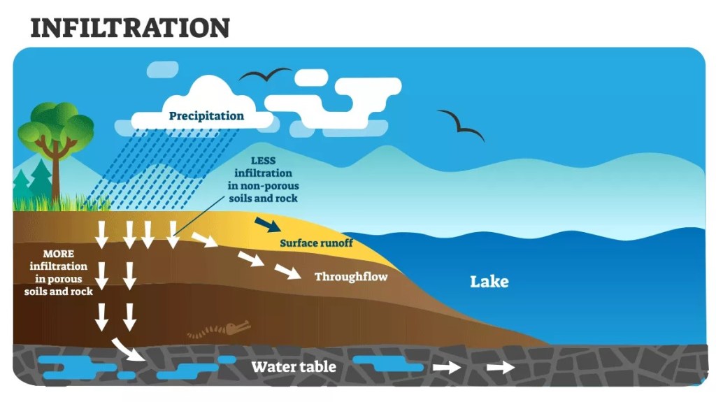
In this activity, students will experiment with the conditions that affect how much groundwater certain types of soil can absorb. Groundwater is water that is stored in the tiny spaces, called pores that are found in rock. The type of the rock dictates how much water can be stored due to the porosity and permeability of the rock. Porosity is the percentage of the total volume of rock or sediment that consists of pore spaces or open holes. Permeability is the ability of a material to transmit fluid.
Click here to download the activity.