


Episode description:
Earth has an incredibly varied and ever-changing landscape—jagged mountains, arid deserts, lush rainforests, rolling wheat fields. Before NASA came on the scene, no one was keeping a systematic eye on the ground from above. NASA scientist Brad Doorn explains how one long-running satellite program collects the data farmers need to grow the crops that feed the world. 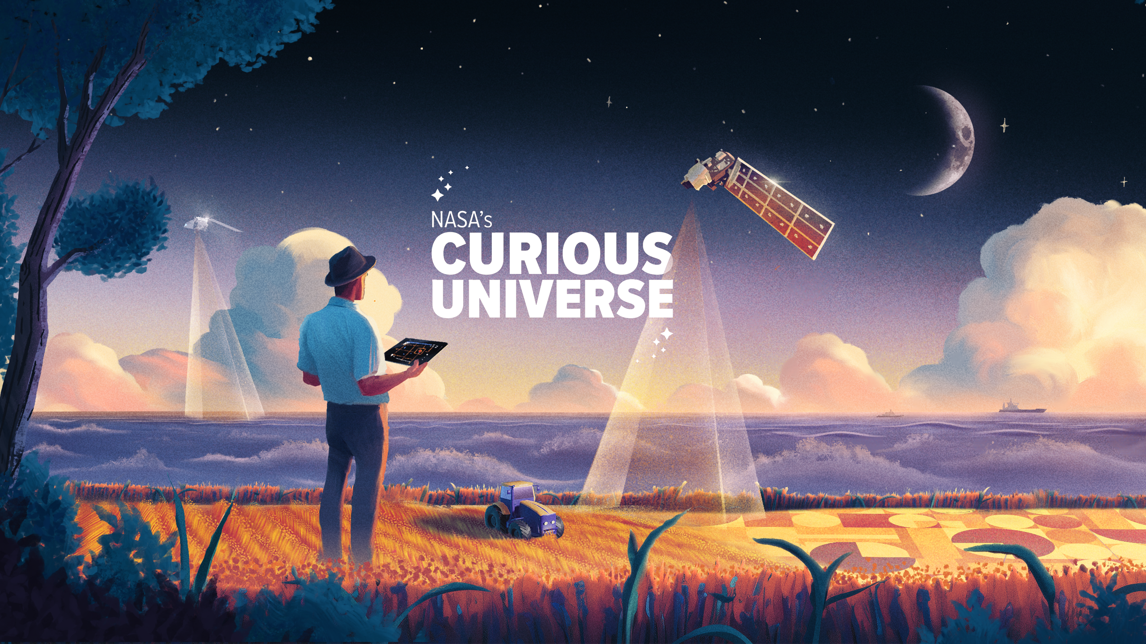
[Music: Curiosity by SYSTEM Sounds
JACOB PINTER: Hey there, I’m your host Jacob Pinter.
PADI BOYD: And I’m your host Padi Boyd. You’re listening to NASA’s Curious Universe.
This is the third episode of our series about how we study our favorite planet… Earth!
JACOB: Now, we spent some time on the water last week… exploring what makes our world an ocean planet.
This week, we’re back on land, which is where I belong, honestly.
PADI: [Laughs]
JACOB: Now Padi, I don’t know about you, but at the beginning of the COVID-19 pandemic I was at home and I was really, really bored… And I picked up a new hobby. It wasn’t sourdough, like a lot of people. But what I did is I would take out my phone, I would open up one of the map apps, and I would just find some random place somewhere on the world where I had never actually been, a place I didn’t know anything about, and I would just zoom in and see what I could see. It wasn’t as good as actually traveling, but it wasn’t bad. It was like the next best thing.
PADI: I love that because the whole world was experiencing that at the same time, right? So you were kind of looking at the global Earth, looking at us all on that blue marble. I go in the opposite direction Jacob. I love maps too. I love thinking about where things are, but I also love zooming out and getting that big broad picture of the Earth as a single place, looking at what it looks like over the poles or at the tropics. So you know, maps are so important and cool.
JACOB: The thing that hit me I guess is that we just take it for granted. Like, you have this thing in your pocket that can zoom in on any part of our globe, or zoom out and see the entire thing. You can see what it looks like on the ground pretty much anywhere.
PADI: NASA satellites power those mapping apps on our phones. But they give us a lot more really important information than just the things that are fun on our phones.
[Music: The Finishing Touch by Lawrence]
PADI: From space, we’re constantly keeping track of how the landscape changes as we build new cities… or convert forests to farmlands.
We have satellites that can measure the height of trees from space…
Satellites that can detect wildfires as soon as they start…
Some that can identify slopes that are susceptible to landslides…
And even ones that can measure how much water is in the soil… which is really important for growing crops.
JACOB: And all of that is amazing, and also pretty new in the grand scheme of things. If you rewind to half a century ago, none of that existed. At that point, if you wanted to see a place from above, you had to fly a plane over it and take film photos.
PADI: Or go up into space on Apollo!
[Laughter]
PADI: Those early Apollo photos of Earth’s land masses from space… the ones we talked about in the first episode of this series… inspired scientists at NASA and the U.S. Geological Survey.
Landsat archival video: From far out in space, the Earth appears serene and beautiful, displaying no hint of our crowded planet’s many problems.
PADI: We were facing a lot of challenges… crop shortages from diseases, a growing population to feed, concerns about pollution and deforestation.
Landsat archival video: As we have used and changed our planet, we have become aware that in many ways, we are exhausting it.
PADI: We already had weather satellites keeping an eye on the atmosphere. Why not add satellites dedicated to observing the ground into the mix?
[Landsat archival video: Scientists are striving to apply the technology of the space age. The quest for more and better information about these complex relationships.]
JACOB: In 1972, NASA launched Landsat 1… or, as it was called then, the Earth Resources Technology Satellite.
The spacecraft started beaming down high-resolution imagery…
Landsat archival video: Transmitter drive is on. 2A, go for command…
JACOB: Not film photos, but detailed spectral images… using sensors that see far more wavelengths of light, which means more colors, than humans can see.
Here & There In Maryland NASA Goddard video: Can this strangely colored map really tell us things we can use? Absolutely if you know what to look for…
PADI: This video from 1979 showed how Landsat brought Earth to life in brilliant color.
Here & There In Maryland NASA Goddard video: By studying these patterns of color, scientists can see how the cities we live in are growing. The effects of pollution can be seen. Floods can be studied, and lives can be saved as more knowledge is now known about areas where rivers will overflow.
PADI: In the so-called false color images… created as different wavelengths of infrared light bounced off the surface into its instruments… forests showed up dark red, fields light red, sea ice light blue.
Landsat archival video: By combining these separate black and white images and printing them through color filters, the differences in them can be used to emphasize specific Earth features. For many uses, these photographic products of NASA data are a great advancement over any other form of aerial surveillance.
JACOB: In an era of film photography, NASA’s Earth scientists explained the newfangled concept of digital pixels to Americans. And here’s a fun fact: Pixels originally stood for “Picture Elements.” That’s something NASA scientists had to explain too.
In the early Landsat images, one pixel captured by the spacecraft’s sweeping multispectral scanner represented an area about the size of two hockey rinks, side by side, down on Earth’s surface.
[Music: One Step At A Time by Boyd]
PADI: NASA’s administrator at the time called Landsat a “second giant stride for mankind.”
For the first time, scientists had a continuous, astronaut-eye view of the Earth’s surface from space… from coral reefs to corn fields… volcanoes to landslides.
JACOB: And the Landsats kept coming… each one building on the last.
Landsat 9 launched in 2021.
Landsat 9 launch video: Go Atlas. Go Centaur. Go Landsat 9. T-10, 9, 8…
JACOB: It’s a pretty remarkable legacy. For over 50 years, Landsat satellites have continuously orbited Earth.
Landsat 9 launch video: Ignition and liftoff of an Atlas 5 rocket and Landsat 9. Continuing the legacy of an irreplaceable 50-year record of our ever-changing planet…
JACOB: And technology has come a long way. The first few Landsats could collect data in four ranges of light wavelengths… also called bands.
Landsat 9 has 11 bands. That means it can detect a lot more stuff… from cirrus clouds high in the sky… to the infrared radiation emitted by everything on Earth.
And Landsat 9 can see Earth’s surface in much higher resolution…
Each pixel corresponds to a 10-meter scale on Earth, compared to the original Landsat’s 60 meters.
I mean, imagine how TVs have changed over the past 50 years. We went from black and white to color…. and the picture got clearer and clearer.
Landsat also added more colors and higher resolution.
PADI: Under the watchful eye of these satellites, the world’s population has doubled… from 3.8 billion to 8.1 billion. And humanity has transformed our planet.
Lakes have dried up… forests have disappeared… cities have grown and changed to accommodate all those people
Over the decades, we’ve constantly faced challenges: about how to manage natural resources and grow enough food to support Earth’s population.
And over these decades, the Landsat program provides the data to make hard decisions possible.
BRAD DOORN: We monitor the global food supply, just like when astronauts say how when they see the Earth and that, you know, the atmosphere and how thin it is, how vulnerable it is, when I look at the majority of the food and the calories that are consumed and where that comes from. It’s, it’s scary. It only comes from relatively small regions of the globe.
JACOB: This is Brad Doorn. He’s a NASA scientist, and I met him recently at NASA’s headquarters in Washington, D.C.
PADI: A big focus of NASA’s Earth scientists is making sure our critical monitoring data gets into the hands of people who need it most…. Like American farmers. It sounds like that’s what Brad does, right?
JACOB: Yes, exactly, his official title is “NASA program manager for agriculture and Earth action.”
BRAD DOORN: What that means is, largely, I try to take what NASA has been doing for decades now in Earth observations, technology, science, and find ways to get it in front of the agriculture industry, farmers, agency, decision makers that need it. So it’s, in some ways, I’m kind of like a translator.
JACOB: Brad speaks “Science” because … well, he’s a NASA scientist.
But he’s fluent in “Agriculture” too.
Brad spends a lot of time listening to farmers talk about the problems they’re facing. And he knows some of their challenges firsthand. He grew up in rural South Dakota…
BRAD: My dad was a milk hauler for Land ‘O Lakes, and spent a lot of time on farms, delivering feed, and I still have family there now, but that’s not why I got involved in agriculture.
JACOB: No, he started down that path after high school.
Brad didn’t have enough money for college, and he joined the U.S. Army.
BRAD: The army really saved me. They sent me to my grad school and geodetic science, which is really mapping the Earth from space. So that’s how I learned about all the technologies, satellite technologies and space technologies.
JACOB: When he got out, he joined the U.S. Department of Agriculture in the 1990s.
BRAD: And lo and behold, they were using satellite data, and have been using satellite data to assess global food supply. And I loved it. and there, I realized that we needed NASA help, because USDA, you know, we weren’t keeping up with the latest technologies, the latest solutions. NASA had this program and their sciences that said, hey, you know, we want you to use our data and use the latest and greatest data. And eventually I transferred over here. So it wasn’t a planned route, but it was very cool. I owe a lot to my country, you know, whether it was Army or NASA, I love serving my country and so I found a way to do it, and I didn’t plan on it. But hey, it works.
JACOB: Sometimes those are the best ways, right? So as far as the technology that NASA has, what? What is there that no one else has access to, like when you were at USDA, for instance, you know, what? What did you see NASA having that you really wanted to get your hands on, and especially get the farmers?
BRAD: NASA Data is unique.
[Music: The Process by Harms]
BRAD: NASA observations and systems monitor the globe all the time, always on, have been for decades, and they tie all that data together. No one else does that. You know, it’s, private sector doesn’t do that. And that is so important, because one, you want the data to be reliable. You want it to be reliable over time, so people will trust it. And obviously, you want it to be the best data available. You don’t want it to be the second rate data. NASA provides all those elements. And with being in NASA, you really have that cutting edge. You know, our next satellite is flying with an antenna that was developed on Venus and Mars missions. You know, you just have the latest technology driving it. So I think it’s, it’s doing its mission right where the United States and people want it, want it and need it to be.
JACOB: One thing about agriculture that I think is so interesting is that we all depend on it, right? But the number of people who do it is so small and most of us just have no interaction with that. Is there anything that you find that most of the rest of the world gets wrong about farming?
BRAD: Yeah, I think first, no one’s more concerned about sustainability than the farmers. You know, when all this climate stuff started happening, climate smart ag, and all this, and immediately I was like, well, the farmers have to own it, because they’re the ones that are going to implement. They’re the ones that know about their farms, you know, they’re there, so it has to start there. And that’s partly what drove us a little bit to, you know, no, they drive the requirements, because if they don’t accept them, if they can’t implement them, it’s not going to be successful. And so those small groups of farmers are unbelievably concerned about sustainability. The worry in the farming community is that, because there’s so few of them, it seems like when they look out beyond their communities, all they see is the bad things you know in the press about what farming is doing. And one of the commitments that I have is to make sure all of the stories get published. Hey, let’s show all these good things that are happening, how you’re sustaining water, how that’s improved over the decades, whether it’s water availability or water quality, how we were able to feed the you know, the world and the country with fewer people you know, over time, and not much more support into the farming community. And so, you know, sort of my commitment, I think NASA’s commitment, is to, you know, to engage with them, to be honest with them, and also, you know, be a partner with them.
JACOB: When you talk about wanting to share these positive stories about farming, is there a specific example that we should all know about?
[Music: Searching for Clues by Berger]
BRAD: One that’s coming online now is a lot of people know about the Ogallala reservoir that’s in the western part of our central plain states, and how reliant we are on that groundwater. And also the concerns. We’ve had drought after drought, we have a lot more demand on water, less predicable rainfall. NASA is engaged in that. And in fact, if you look at these big policies like that, what they have realized on the ground, and what I believe is that you’re not going to get a sustainable solution for those types of big issues without NASA. Our capabilities to monitor over time, to understand if you implement a policy, we can be able to assess whether it’s improving or not improving, and also just the ability to really engage the technology and science that NASA can provide into these solutions. It’s also states, farmers, agencies, all working together for a common cause, and we do that a lot, and I don’t think people see it often enough. You know, we’re really driving towards a solution there on a major issue that impacts all of us. Because, you know, that’s the wheat belt. You know, that’s, that’s a huge part of our agriculture industry, both crop and livestock. And and we need to find a solution for it. And you know, we’re all teaming together to do it. So I think it’s a wonderful story.
JACOB: So now what kind of data do you and farmers actually have at your fingertips when you go look, can you kind of give me, like, a primer on what’s out there?
BRAD: Let’s go back to the 70s. We really had a good picture of what was going on, maybe near or at harvest. So when the crop was fully up, leaves ripening. So you could see, you know, and assess, you know, what crop was going to be harvested. Now, what you really, what I look at is you really go backwards. Now we’re able to see, well, how’s that crop developing over time? Even further before the crop has even exposed, emerged, you have soil moisture and we’ve had great soil moisture measurements, we’re going to have even better in the next few months, when we have the NISAR satellite launched. All that time we’ve also included better bands so we understand the types of crops that are grown, we have better models. And so it’s really started at the point of harvest, assessing what that food supply is. Now we can start predicting it. Now we can start getting a little bit better indication of what it’s going to be before it happens. Soon, we’ll be doing a lot more on pests and disease. So right now you go, yeah, that crop isn’t healthy. Why isn’t it healthy? Is it because it doesn’t have enough water, you know? Is there a nutrient issue? Is there a pest and disease issue? All important factors for a farmer in the industry to understand how to manage it. Back in those days when you had yield at harvest, it was like that’s good, it was critical information, but a farmer was like I already know that, I get that. So now we’re able to start getting that information that’s still useful in decision making flows that a farmer has.
JACOB: And how do you actually see all those things from space? I mean, we’re talking, what’s available at harvest, crop development, soil moisture, insects and pests and things like that. But like, what are you actually looking at that tells you that?
[Music: Political Storm by Berger]
BRAD: Well, yeah, in a very simple way, you know what? What you and I see, obviously, is in that visible spectrum, right? No, RGB, red, green, blue, and those bands. And that gives us some information. We can tell if a plant is green or not green. So that’s an indicator of health, obviously. But before that all happens, before, say, a plant dies or senesces or is impacted by, you know, a disease, the plant is reacting. Before we can see it with our eyes. Farmers can go out there and look at a plant, and they can kind of tell it’s curling, and they can understand at a plant level. Now, from space, we’re able to sort of do that a little bit better with more bands outside of what we see. So that plant is emitting different types of energy signals that you might say that give our agronomists, our specialists in crops, indicators that, hey, it doesn’t have enough water, or hey, it’s got some sort of disease. Similarly, we can now look at soils from different bands in the microwave and the radar parts of the spectrum to understand the soil moisture content of the surface. Tying that into some of our measurements of underground water movement, which is a whole different subject of how we measure gravity and can assess changes in underground water aquifers. All that information can go into models that hydrologists use to really nail down, you know, what the surface oil moisture is, what the moisture is at the root zone and below. And so the U.S. Drought Monitor gets all this information. So it’s really being able to take the electromagnetic spectrum that we all see in red, green, blue in that small area, NASA can take and observe things beyond that, things that we don’t see.
JACOB: You mentioned earlier also Earth satellites going up that have technology that was originally developed to study Mars and Venus, right? Are there, like in the kind of data you work with? Do you know of other examples when this instrument, or this technique was developed to study astrophysical stuff or something, and now we’re using it for this kind of work?
BRAD: A lot of our initial mapping technologies on how to map topography, came from mapping the Moon.
[Music: Scientific Investigation by Davoli]
BRAD: We’ve been able, at NASA, to so refine these systems, these measurements, these sensors that then, you know, we’ve discovered things and ways of doing things, and we can apply them to Earth. This antenna I was talking about is a radar antenna. And so the importance of that is they’re figured out how to do this in space. A lot of the stuff we develop on our own at NASA Earth sciences, we’re developing on the ground with airborne systems on the Earth and sensors, and some of these things though, that come from, you know, what NASA has done in planetary systems has you know, they’ve already tested, hey, we know this works. You know, in these space environments, which is huge, to be able to have that legacy and lineage so we can, you know, feel secure that this is going to go up, and that’s why so many of our satellites are successful. Is because of that lineage.
JACOB: So you have all of this data and science available, and then, how often are you actually interfacing with farmers directly, like visiting them?
BRAD: So I can say right now, we’re constantly working with them and I meet with them on a regular basis, and I bring leadership. And at least once a year we go out. We call it space for ag tours. So we go out to a part of agriculture in America. Last year we were in Illinois, in New York, in grape industry. We’ve been to the Midwest, the Great Plains, and we just, we call them listening tours. We just go and listen, listen what they have to say, talk to farmers, see what they’re doing, look at their technology, how they’re implementing it, what they think about satellite data. You know, are you getting what you want out of it? That’s always a great question, because you have a lot of different ideas on that. right now our goal is to be just constantly at the hip talking to the farming community.
JACOB: I was wondering if there is one success story that really comes to mind for you, when you ended the day you left here and turned out the lights and it you said, “Man, this just feels really good. This is like what our team does.”
BRAD: The one that comes to mind, we have a project called OpenET.
[Music: Secretive Marimba by Montazud]
BRAD: And it developed over the years, it was to support irrigation management, and we it is a unqualified success, with a lot of learning that went along the way. But we also directly hit an issue. When we worked with water managers across the West, they said the number one issue was water use. There was just no reliable measurement. And we said, hey, remember that Landsat mission? I talked about Landsat 1. Well, that Landsat mission has a thermal band that can do evapotranspiration, which is basically helping us understand what a what, what a plant waters needs are, you know, and so it can give it the right amount of water. So it gives us a signal that allows farmers to give just the right amount of water, keep the yields, but don’t put too much or too little on.
JACOB: If I asked you to close your eyes and picture the future of agriculture, and especially the future of the technology and data that you work with, what would you see?
BRAD: Oh, God, I’ve been thinking about this, and so I don’t have to close my eyes. The vision that we have is really that farmers are able to whether it’s on their phone, their own data systems. They have on the ground. They can easily access our data, you know, whether it’s through models, whether it’s through algorithms, just like now they go to the Weather Channel, you know, see their weather but now they have a management system in their hand. They’re not giving away anything. They’re not sharing their data. Their data is coming to them, and so that’s a big challenge on our data systems, to get this data in such a way that they can access it. It’s a bandwidth issue. But to me, that’s, that’s the dream, that’s the vision that we should have be that, because that really empowers farmers with the best data, the best information. So I, you know, that’s, that’s what I dream of. And, you know, I think the technology has gone well ahead of our ability to access and leverage it. And I think getting that, you know, really being able to use that technology to access that data for the farmers is, is my dream.
JACOB: We all live on Earth, obviously, but NASA scientists and NASA program managers like you just see this planet in ways that most of us don’t. If you could share one thing that people don’t know about our home planet or take for granted, what would that be?
[Music: Searching for Clues by Berger]
BRAD: When you look at the whole globe and you go, wow, what happened if we had a crisis in a certain part of the globe, or the US and and it hit just a relatively small area, like a state area, how that would ripple through the system and and how important it is to have this information, because we want to be able to say, listen, if something is at risk. And we did this when the war broke out in Ukraine and Russia, that was a bread basket of that region of the world, and provide lots of data. All of a sudden it was like, “Oh, my goodness, what are the options if this food doesn’t go and get exported to these countries?” And you realize that, “Oh, you know, there aren’t a lot of options,” you realize that, okay, you can’t change a lot of that, but we have the information that we should be able to at least provide some form of confidence and resiliency, that, hey, it’s like a war game that was in the military and these things before, where you go, hey, what if something happened here? Yeah, where does, where do we get our food? You know, how does this all get transported? You know, who’s going to respond.
JACOB: But that’s how you stay ready, right? If no one’s doing that, then you get caught off guard.
BRAD: That’s right, and you have to have the data to do it, the right data to do it.
JACOB: One thing we ask everyone we talk to is, what are you still curious about?
BRAD: Oh, goodness, yeah, I’m one of those guys, I’m almost constantly amazed, I walk into these meetings with our scientists, and they just overwhelm me with what they doing. So my curiosity doesn’t seem…
JACOB: [Laughs] That happens a lot at NASA.
BRAD: Yeah, I don’t, but, you know, my curiosity is, is, you know, going back to the data system side, you know I, you know, I go back to my military training, and was always, you know, your your technology, your weapons, or whatever is far exceeds your ability to implement them. They’re always a step ahead. And so I look at all our data and our technology and our capabilities, and sometimes we seem to implement them in decades old processes.
[Music: Relentless Builders by Zarobyan]
BRAD: You know, our water system in the West, you know, all those things, was built on the technologies we had at hand right then. So could we do that now in a small test case and just say this, this is what it could be, yeah, and and show, you know, the possibilities. Yeah, we’re not a, you know, we can’t drive those policies and a lot of those systems. You know, that’s not part of NASA’s mandate, but I think we could test them and show an image of the future that maybe no one else can.
JACOB: Cool. Well, that’s exciting. It’s inspiring.
BRAD: It is to me.
JACOB: Thank you so much, Brad. This has been, it’s been really interesting.
BRAD: Oh thanks. This has been a great conversation. I really enjoyed it.
JACOB: Brad Doorn is NASA’s program manager for agriculture in the agency’s applied sciences division.
If you want to learn about how NASA gets Earth data to the people who need it most, you can find out more at appliedsciences.nasa.gov.
PADI: Thanks so much for listening to our Earth Series so far. We’ve been to the ocean, we’ve dried off today on land… and coming up next week, we’re taking to the air!
Stay tuned for the story of how NASA solved an atmospheric mystery that threatened life here on Earth.
This is NASA’s Curious Universe. Our Earth series was written and produced by Jacob Pinter and Christian Elliott.
Our executive producer is Katie Konans. Krystofer Kim is our show artist. Our theme song was composed by Matt Russo and Andrew Santaguida of SYSTEM Sounds.
Special thanks to NASA’s Earth Science team… including Mike Carlowicz and Ginger Butcher.
Clips from the 1979 film about Landsat were used courtesy Maryland Public Television.
If you enjoyed this episode of NASA’s Curious Universe, please let us know. We love to hear what you think—so don’t be afraid to leave us a review.
You probably have a friend who lives on Earth and relies on crops grown here on this planet’s land.
Why not send them this episode, so they can learn more about this blue marble we all call home?
And remember… you can follow NASA’s Curious Universe in your favorite podcast app to get a notification each time we post a new episode.