


Geostationary Platforms
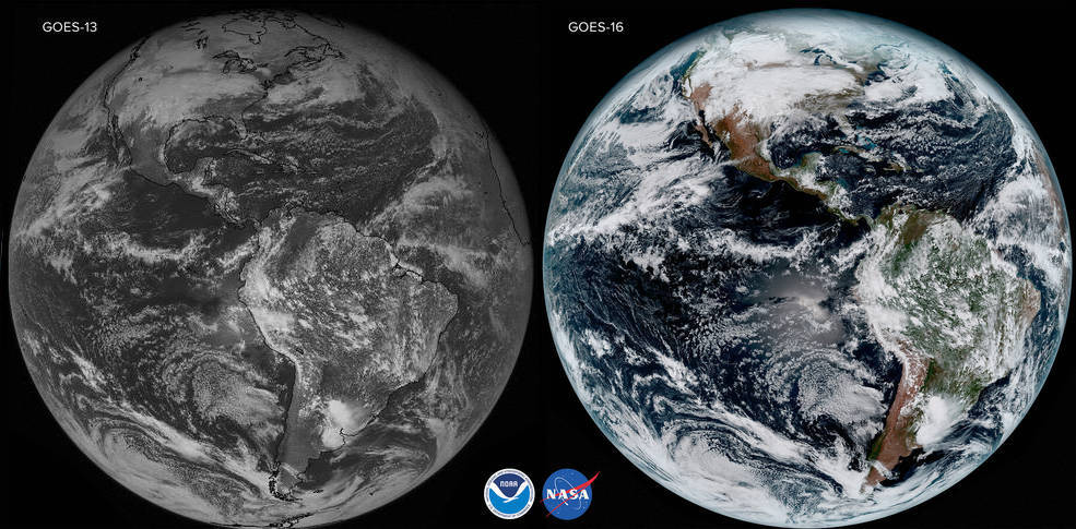
New sensors on geostationary satellites have great promise for planetary monitoring. In particular, the new capabilities of NOAA’s GOES and JAXA’s Himawari have significant spectral, radiometric, temporal and scan rate improvements. For example, GOES sensors have three times more spectral channels, four times better spatial resolution and five times faster scan rate than earlier versions.
The graphs below compare spectral band positions across these sensors alongside those of polar-orbiting missions for land surface monitoring, NASA’s MODIS and NOAA’s VIIRS. The black line is solar transmittance and radiance from HITRAN.
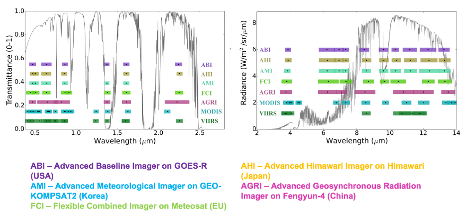
- ABI – Advanced Baseline Imager on GOES-16/17 (United States)
- AHI – Advanced Himawari Imager on Himawari 8/9 (Japan)
- AMI – Advanced Meteorological Imager on GEO-KOMPSAT2 (South Korea)
- FCI – Flexible Combined Imager on MTG (Europe)
- AGRI – Advanced Geosynchronous Radiation Imager on Fengyun-4 (China)
- MODIS – Moderate Resolution Imaging Spectroradiometer (United States)
- VIIRS – Visible/Infrared Imaging Radiometer Suite (United States)
GeoNEX Common Grid
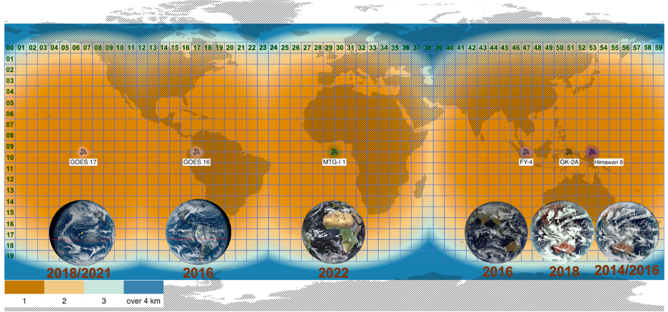
We define a common tiled grid in the geographic (latitude/longitude) projection for the GeoNEX products. Spanning from 60◦N and 180◦W at the upper-left corner to 60◦S and 180◦E at the lower-right corner, the grid was divided into 6◦ × 6◦ tiles that were numbered from 0 to 59 in the longitudinal (horizontal) direction and from 0 to 19 in the latitudinal (vertical) direction. Pixels (grid cells) were created at regular 0.005◦, 0.01◦, and 0.02◦ resolutions, where a 0.02◦ pixel contained exactly four 0.01◦ pixels and a 0.01◦ pixel contained exactly four 0.005◦ pixels. The layout and the resolutions of the pixels were in correspondence to the three native spatial resolutions (i.e., 500 m, 1 km, and 2 km) common to the geostationary satellite data in different spectral bands. The geographic projection of the grid was chosen to facilitate intercomparisons between geostationary and polar-orbiting sensors.