


Tropical Cyclone 02P Dissipated in South Pacific
NOAA’s GOES-West satellite caught Tropical Cyclone 02P dissipating on Oct. 17, 2015, at 1800 UTC (2 p.m. EDT) in the South Pacific Ocean.
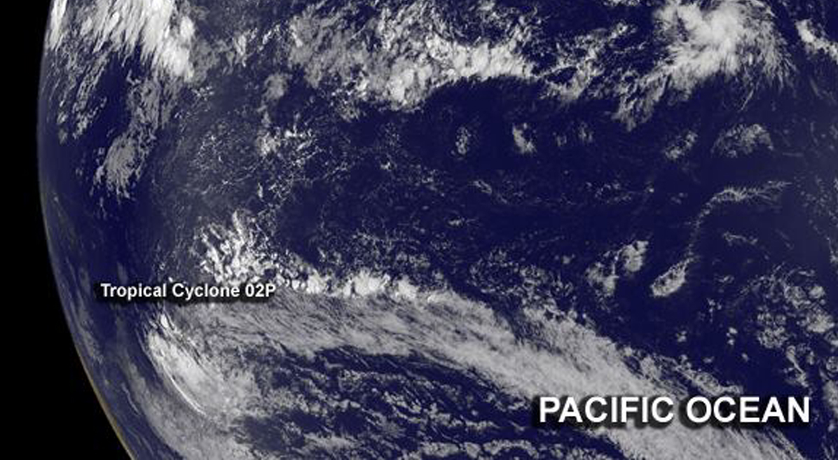
The Joint Typhoon Warning Center issued their final bulletin on Tropical Cyclone 02P at 2100 UTC (5 p.m. EDT) on Oct. 17. At that time, Tropical Cyclone 02P was located near 18.8 South latitude and 171.5 East longitude. That’s about 362 miles east-northeast of Noumea, New Caledonia.
At the time, Tropical Cyclone 02P was a tropical depression with maximum sustained winds near 30 knots (35 mph) and weakening. Tropical Cyclone 02P was moving southwest and was dissipating under adverse atmospheric conditions.
By Oct. 18, the vertical wind shear weakened the system into a remnant low pressure area.
Rob Gutro
NASA’s Goddard Space Flight Center, Greenbelt, Md.
Oct. 16, 2015 – NASA-NOAA’s Suomi NPP Satellite Spots Formation of Second Southern Pacific Tropical Cyclone
Tropical Storm 02P developed about 300 miles away from Fiji as NASA-NOAA’s Suomi NPP satellite captured a visible image of the storm.
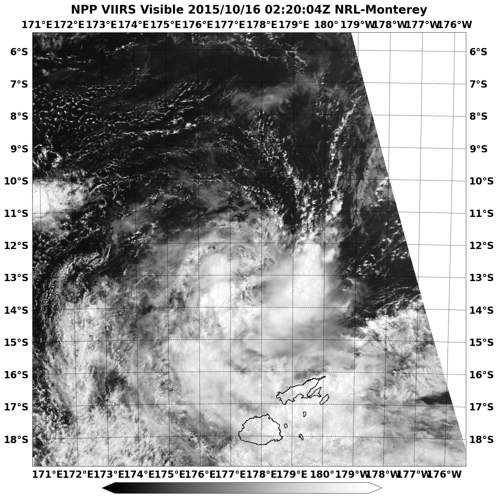
The Visible Infrared Imaging Radiometer Suite (VIIRS) instrument aboard NASA-NOAA’s Suomi NPP satellite saw Tropical Storm 02P on October 16 at 0220 (Oct. 15 at 10:20 p.m. EDT). The visible-light VIIRS image showed a band of thunderstorms southwest to southeast of the center of circulation.
On October 16, 2015 at 5 a.m. EDT/0900 UTC, the center of Tropical Storm 02P was located near latitude 13.1 South and longitude 177.1 East. The storm is about 309 nautical miles north-northwest of Suva, Fiji and moving south-southwest at 10 knots (11.5 mph/18.5 kph). Maximum sustained winds were near 35 knots (40 mph/62 kph).
02P is moving southwest and is expected to strengthen a little over the next day before running into wind shear. The wind shear is expected to weaken it to a remnant low pressure area in a couple of days.