


From the Earth-facing window of the International Space Station‘s (ISS) Destiny module, nearly 95 percent of the planet’s populated area is visible during the station’s orbit. This unique vantage point provides the opportunity to take photos of Earth from space. With the installation and activation of the ISS SERVIR Environmental Research and Visualization System (ISERV), NASA will be able to provide even higher resolution images of Earth!
The ISERV camera system’s mission is to gain experience and expertise in automated data acquisition from the space station. ISERV is expected to provide useful images for disaster monitoring and assessment and environmental decision making. A system like ISERV could aid in delivering imagery and data to help officials in developing nations monitor impacts of disasters such as floods, landslides and forest fires. Its images also could help decision makers address other environmental issues.
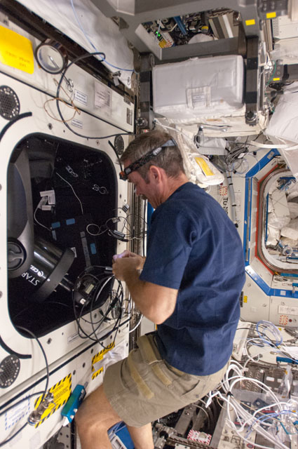
The instrument recently transmitted back its first images to scientists on Earth from its location in the Window Observational Research Facility (WORF). ISERV is a commercial camera, telescope and pointing system operated remotely from Earth by researchers at NASA’s Marshall Space Flight Center in Huntsville, Ala.
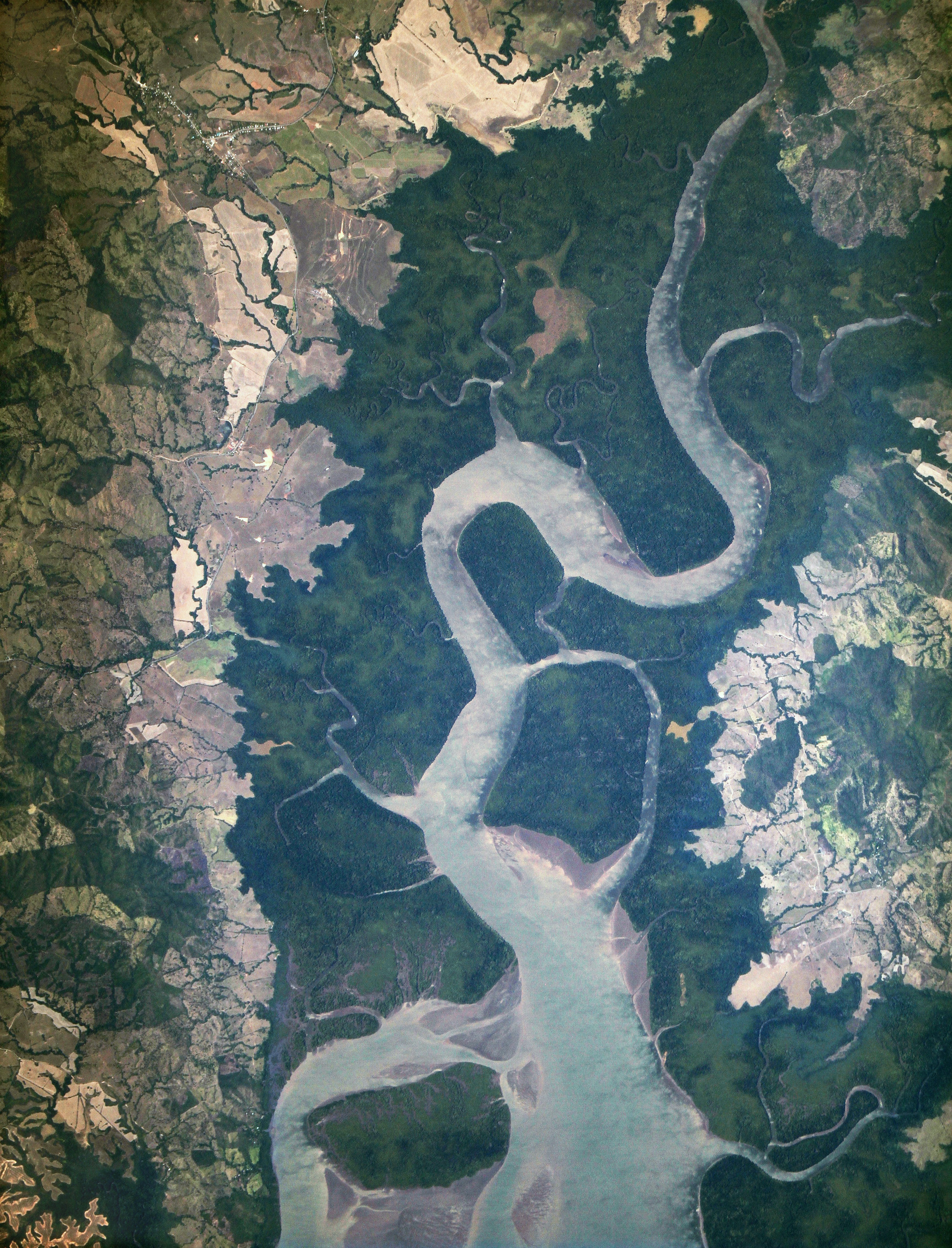
This “first light” image, captured on Feb. 16, shows the mouth of the Rio San Pablo in Veraguas, Panama, as it empties into the Gulf of Montijo. This wetland supports an important local fishery and provides habitat for many mammals and reptiles, as well as several species of nesting and wintering water birds.
Acting on commands from the ground, ISERV can photograph specific areas of the Earth’s surface as the space station passes over them. The goal for ISERV is to help scientists gain operational experience and expertise and to influence the design of a more capable system for future space station expeditions. The space station provides researchers a unique opportunity to develop ISERV’s capability by conducting global observations from space.
“ISERV’s full potential is yet to be seen, but we hope ISERV or a successor will really make a difference in people’s lives,” said ISERV Principal Investigator Burgess Howell, a scientist at NASA’s Marshall Space Flight Center in Huntsville, Ala. “For example, if an earthen dam gives way in Bhutan, we want to be able to show officials, via our images, where the bridge or a road is washed out, or where a power substation has been inundated. This kind of information is critical to focus and speed rescue efforts.”
Watch video highlights of SERVIR’s new camera system on ISS from https://servirglobal.net:
An operational system with ISERV’s optical characteristics could, in many cases, acquire near-real-time images of areas on the ground and transmit them within hours of the event. This would provide information that could shape disaster relief decisions and possibly prevent loss of life or injuries.
“ISERV could become a tool to enhance and expand NASA’s hazard and disasters work across the whole disaster management cycle,” added Frank Lindsay, manager of the NASA Applied Sciences Disasters Program at NASA Headquarters in Washington. “The bottom line is that this camera opens up some opportunities we did not have before and clearly is a pathfinder for more assets on the space station for our applications.”
ISERV’s software maintains knowledge of the space station’s exact location and attitude in orbit at any given moment. With this information, it calculates the next chance to view a particular area. If there’s a good viewing opportunity, the SERVIR team will send instructions to the camera. ISERV will take a series of high-resolution photographs of the area at rates of three to seven frames per second, totaling as many as 100 images per pass.
“The camera’s nominal resolution is about 10 feet,” Howell explained. “That’s about the size of a small car — and potentially valuable for disaster assessments.”
At first, the instrument will be used only by SERVIR and its existing hubs in Mesoamerica, East Africa and the Hindu Kush-Himalaya region. After proving itself, ISERV could be made available to the broader disaster-response community and the NASA science community.
The team is assessing how the geometry of the window affects its imagery, how much sunlight the instrument needs to capture clear images, how the atmosphere affects that clarity and more. This characterization phase will last from several weeks to a few months.
The exposure, time of day and location, as well as the land cover (savannah, rivers, forests, etc.) and other characteristics will be documented, catalogued and archived for every scene acquired.
SERVIR consists of a coordination office and student research laboratory at Marshall, active hubs in Kenya and Nepal and a network affiliate in Panama. The coordination office develops application prototypes for the SERVIR and integrates new and relevant technologies from NASA and other scientific research partner organizations to meet the needs of host countries. SERVIR’s primary technical work occurs at the hubs, which are staffed by local and regional experts from those countries. The hubs coordinate with other international and national organizations in their respective regions regarding climate change, environmental monitoring, disasters, weather and mapping.
SERVIR, jointly funded by NASA and U.S. Agency for International Development, (USAID), is operated within NASA’s Earth Sciences Program at NASA Headquarters. Four other NASA centers work with Marshall on the program, including NASA’s Goddard Space Flight Center in Greenbelt, Md.; NASA’s Ames Research Center in Moffet Field, Calif.; NASA’s Jet Propulsion Laboratory in Pasadena, Calif.; and NASA’s Langley Research Center in Hampton, Va.