


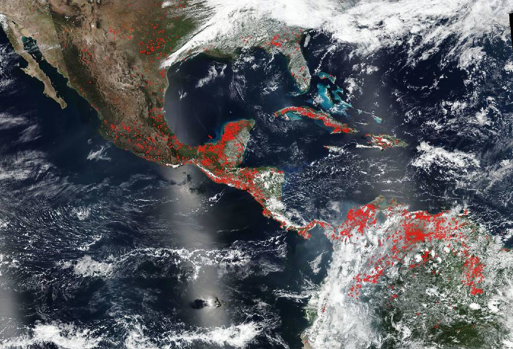
Fires burn across the Yucatan Peninsula of Mexico, Central America, and the upper part of South America as highlighted by the red marks (which detect and “mark” the area using the satellite’s thermal bands) that scatter across the landscape. This VIIRS (Visible Infrared Imaging Radiometer Suite) image was taken from NOAA/NASA’s Suomi NPP satellite on March 24, 2020. The cause of the fires may be agricultural in nature since farmers in this area use “slash and burn” agricultural methods to clear their fields. This type of farming does add nutrients to the soil, but it also contributes to soil erosion, possible ecosystem losses, and air pollution. Fires can also occur accidentally from human activities and from lightning strikes. In addition, landscapes that have been disturbed by logging, fragmentation, or previous accidental fire are more prone to catch fire accidentally. In these situations, agricultural fires can easily get out of control and invade other areas. It is unclear which type of fires these are from the number present in the image.
NASA’s satellite instruments are often the first to detect fires burning in remote regions, and the locations of new fires are sent directly to land managers worldwide within hours of the satellite overpass. Together, NASA instruments detect actively burning fires, track the transport of smoke from fires, provide information for fire management, and map the extent of changes to ecosystems, based on the extent and severity of burn scars. NASA has a fleet of Earth-observing instruments, many of which contribute to our understanding of fire in the Earth system. Satellites in orbit around the poles provide observations of the entire planet several times per day, whereas satellites in a geostationary orbit provide coarse-resolution imagery of fires, smoke and clouds every five to 15 minutes. For more information visit: https://www.nasa.gov/mission_pages/fires/main/missions/index.html
NASA’s Earth Observing System Data and Information System (EOSDIS) Worldview application provides the capability to interactively browse over 700 global, full-resolution satellite imagery layers and then download the underlying data. Many of the available imagery layers are updated within three hours of observation, essentially showing the entire Earth as it looks “right now.” Actively burning fires, detected by thermal bands, are shown as red points. Image Courtesy: NASA Worldview, Earth Observing System Data and Information System (EOSDIS). Caption: Lynn Jenner. Suomi NPP is managed by NASA and NOAA.