


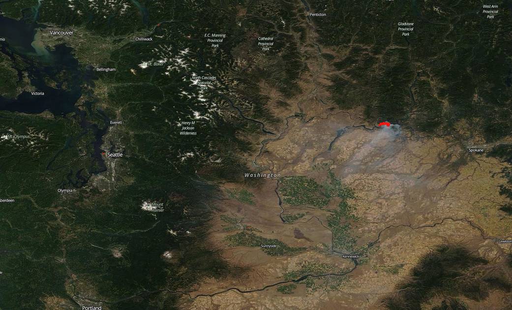
Washington state endured a band of early morning thunderstorms near the Colville Indian Reservation west of Spokane on August 02, 2019. The result of those storms were various lightning strikes and one of which caused the outbreak of the Williams Flats Fire. The 10,438 acre fire is burning south of Silver Creek Road, within the Colville Indian Reservation and is currently 20% contained. Firefighting efforts are being hampered by steep terrain, limited access and primitive road conditions near the fire. High pressure over the fire area is producing above normal temps and low humidity. Poor humidity recovery, in combination with the daytime wind pattern, resulted in fairly active fire behavior for the night shift. There are large amounts of fuel available to the fire that continue to feed the flames including short grass, timber and tall brush.
The Suomi NPP satellite collected this natural-color image using the VIIRS (Visible Infrared Imaging Radiometer Suite) instrument on Aug. 02, 2019. Suomi NPP is managed by NASA and NOAA. NASA’s Earth Observing System Data and Information System (EOSDIS) Worldview application provides the capability to interactively browse over 700 global, full-resolution satellite imagery layers and then download the underlying data. Many of the available imagery layers are updated within three hours of observation, essentially showing the entire Earth as it looks “right now.” Actively burning fires, detected by thermal bands, are shown as red points. Image Courtesy: NASA Worldview, Earth Observing System Data and Information System (EOSDIS). Caption: Lynn Jenner with information from Inciweb.