


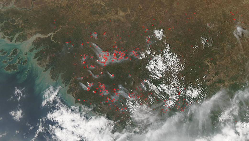
The African country of Guinea is experiencing a spate of fires across its landscape. This May 02, 2019 image captured by the Moderate Resolution Imaging Spectroradiometer (MODIS) aboard the Aqua satellite satellite shows red points which indicate the presence of hot spots. Combined with smoke as they are in this image these red points are almost certainly areas where ongoing fires are spreading across the country.
The origin of these fires is most likely one of two things. Either they are wildfires that occur during the dry season in Guinea or they could be agricultural in nature. In this part of the world farmers use the “slash and burn” method of clearing fields of old crops in order to bring nutrients to the soil for the upcoming planting season. It should also be noted that the rainy season typically starts in June which should extinguish most of these fires. The rainy season continues through November. The dry season for Guinea typically lasts from December through May.
NASA’s Earth Observing System Data and Information System (EOSDIS) Worldview application provides the capability to interactively browse over 700 global, full-resolution satellite imagery layers and then download the underlying data. Many of the available imagery layers are updated within three hours of observation, essentially showing the entire Earth as it looks “right now.”
Image Courtesy: NASA Worldview, Earth Observing System Data and Information System (EOSDIS). Caption: Lynn Jenner