


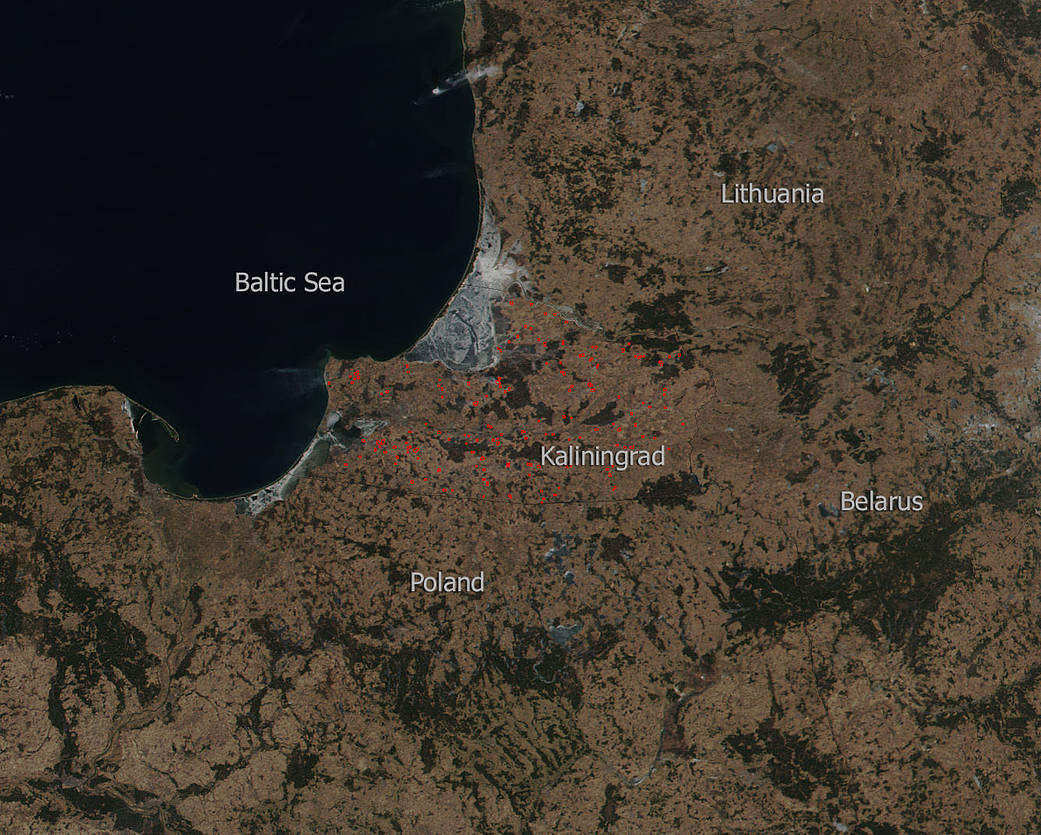
The Suomi NPP satellite captured this image of dozens of hot spots scattered throughout the Kaliningrad Oblast, Russia landscape which is the westernmost point of Russia. Each hot spot, which appears as a red mark, is an area where the thermal detectors on the VIIRS instrument recognized temperatures higher than background. It is unclear if these are wildfires that have broken out or if they are agricultural fires that are used by farmers to clear fields in anticipation of the upcoming planting season. What is clear is that the fires are contained within Kaliningrad as evidenced by this satellite image.
Surrounding these hotspots are large expanses of snow which cover parts of Poland, Belarus, and Lithuania.
NASA’s Suomi NPP satellite collected this natural-color image using the VIIRS (Visible Infrared Imaging Radiometer Suite) instrument on March 18, 2018. NASA image courtesy Jeff Schmaltz LANCE/EOSDIS MODIS Rapid Response Team, GSFC. Caption by Lynn Jenner
Suomi NPP is managed by NASA and NOAA.