


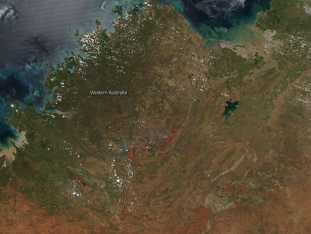
NASA’s Suomi NPP satellite collected this natural-color image of fires in Western Australia using the VIIRS (Visible Infrared Imaging Radiometer Suite) instrument on March 16, 2018. Each hot spot, which appears as a red mark, is an area where the thermal detectors on the MODIS instrument recognized temperatures higher than background. When accompanied by plumes of smoke, as in this image, such hot spots are diagnostic for fire.
The hotspots are most likely bushfires which plague this area of Western Australia. Summer in Australia coupled with high temperatures and dry conditions make for large outbreaks of bushfires, especially in this region of the country. It is interesting to note that the Department of Fire and Emergency Services (DFES) in Western Australia is not listing these fires on their daily hazards page. They may be too new and have not been recorded as yet. The closest fire noted on the DFES page is a fire that was prescribed that is burning above the lake in the image which is not showing up on this satellite pass.
NASA image courtesy Jeff Schmaltz LANCE/EOSDIS MODIS Rapid Response Team, GSFC. Caption by Lynn Jenner