


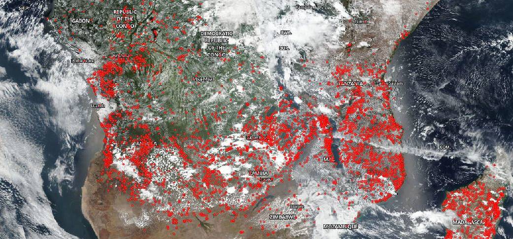
Naturally occurring fires are not uncommon in the drier forests and grasslands of Central Africa, but these fires, at this time of year, are most likely the product of human activities. Some fires are intentionally set by people to clear forest, savannas, and grasslands for ranching or farming. Other fires, of course, occur accidentally from human activities. In addition, landscapes that have been disturbed by farming, logging, fragmentation, or previous accidental fire are more prone to catch fire accidentally. In these situations, planned (or prescribed) fires (such as brush clearing fires on already cleared land) can easily get out of control and invade other areas. The fires in this satellite image cannot be definitively identified as just agricultural, but this explanation is most likely given the information present.
NASA’s Suomi NPP satellite collected this natural-color image using the VIIRS (Visible Infrared Imaging Radiometer Suite) instrument on October 19, 2018. NASA’s Earth Observing System Data and Information System (EOSDIS) Worldview application provides the capability to interactively browse over 700 global, full-resolution satellite imagery layers and then download the underlying data. Many of the available imagery layers are updated within three hours of observation, essentially showing the entire Earth as it looks “right now. Actively burning fires, detected by thermal bands, are shown as red points. Image Courtesy: NASA Worldview, Earth Observing System Data and Information System (EOSDIS). Caption: Lynn Jenner