


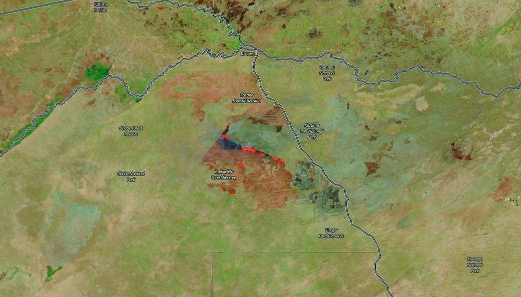
Patches of black and brown, scorched earth and pale gray wispy trailing lines of smoke surround the Maikaelelo Forest Reserve in Botswana in this false-color image from October 11, 2018. The use of false color imagery helps to show more clearly the areas of the image where the land has burned. Actively burning fires, detected by thermal bands, are shown as red points. Since unnaturally straight lines define the burned land, it is likely that at least some of the large fires were intentionally set to manage vegetation as is typically done in this area of the world.
NASA’s Earth Observing System Data and Information System (EOSDIS) Worldview application provides the capability to interactively browse over 700 global, full-resolution satellite imagery layers and then download the underlying data. Many of the available imagery layers are updated within three hours of observation, essentially showing the entire Earth as it looks “right now.” Image Courtesy: NASA Worldview, Earth Observing System Data and Information System (EOSDIS). Caption: Lynn Jenner with information from Earth Observatory