


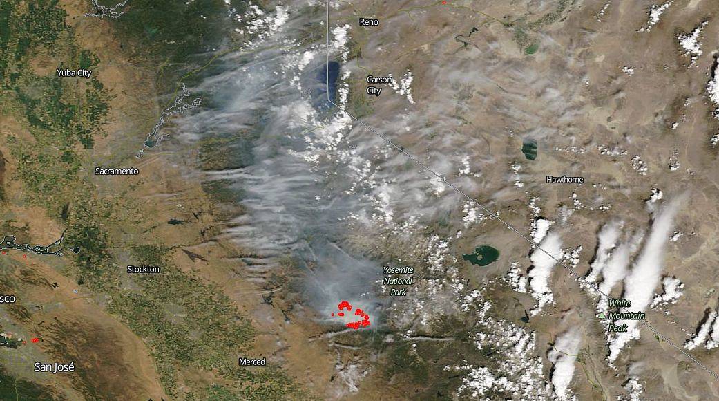
The difficult Ferguson Fire is now into its 11th day. The fire is under unified command between the United States Forest Service, California Interagency Incident Management Team 4, CALFIRE and the Mariposa County Sheriff’s Office. Much of the fire is burning in steep, rugged terrain with little to no access roads. The rough terrain is making firefighting especially difficult for crews. The hot, dry conditions are also complicating matters as well. Weather forecasts are calling for hotter and drier air throughout the week making for extreme fire weather and the possibility that the fire will grow even larger. Currently the fire is 33,743 acres with 13% containment. Over three thousand personnel are currently engaged on the fire. There has been 1 fatality and 6 injuries to date.
NASA’s EOSDIS provides the capability to interactively browse over 600 global, full-resolution satellite imagery layers and then download the underlying data. Many of the available imagery layers are updated within three hours of observation, essentially showing the entire Earth as it looks “right now”. This natural-color satellite image was collected on July 22, 2018. Actively burning areas, detected by thermal bands, are outlined in red. NASA image courtesy NASA/Goddard Space Flight Center Earth Science Data and Information System (ESDIS) project. Caption: Lynn Jenner with information from Inciweb.