


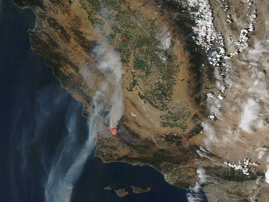
A large plume of smoke from the Alamo Fire raging just north of Santa Maria in Santa Barbara County, California, was seen from space by NASA’s Terra satellite on July 9.
This natural-color satellite image was collected by the Moderate Resolution Imaging Spectroradiometer (MODIS) aboard the Terra satellite at 4:40 p.m. EDT (20:40 UTC ) on July 9, 2017. Actively burning areas, detected by MODIS’s thermal bands appear in red. A large plume of smoke from several fires was blowing to the northeast and to the southwest over the Eastern Pacific Ocean.
According to the Santa Barbara County Sheriff’s Office at 7 a.m. PDT on July 9, an estimated 24,000 acres had burned in the Alamo Fire with 10 percent containment. There are more than 600 firefighters battling this fire. No residences or structures have been reported as being lost.
An evacuation order remains in effect for Tepusequet Canyon from Blazing Saddle Drive to Santa Maria Mesa Road, White Rock Lane and Colson Canyon, Pine Canyon and Buckhorn Ridge. For evacuation information assistance, contact the Santa Barbara County Sheriff’s Department at 805-683-2724.
The latest information will be on www.CountyofSB.org and on the county’s Twitter and Facebook pages.
NASA image courtesy NASA MODIS Rapid Response Team. Caption: NASA/Goddard, Rob Gutro