


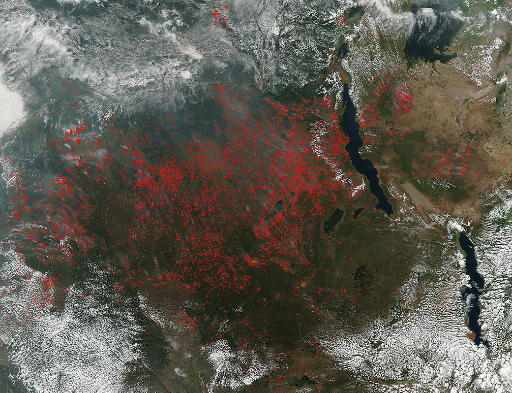
The Suomi NPP satellite’s Visible Infrared Imaging Radiometer Suite (VIIRS) instrument captured a look at hundreds of fires and smoke burning in central Africa on June 07, 2017.
Actively burning areas, detected by VIIRS are outlined in red. The fires stretch across the whole central area of Africa. Because of the huge number of fires, it is most likely that these are intentional agricultural fires set by people to prepare for the upcoming growing season, but it is not out of the question that some of these may also be fires caused by lightning strikes or could even be agricultural fires that have gotten out of control.
While fire helps enhance crops and grasses for pasture, the fires also produce smoke that degrades air quality. The smoke released by any type of fire (forest, brush, crop, structure, tires, waste or wood burning) is a mixture of particles and chemicals produced by incomplete burning of carbon-containing materials. All smoke contains carbon monoxide, carbon dioxide and particulate matter or soot and is hazardous to breathe. Smoke from fire releases carbons into the atmosphere which contributes adversely to climate change.
The Suomi NPP satellite is a joint mission between NASA, NOAA and the U.S. Department of Defense.
NASA image courtesy Jeff Schmaltz, MODIS Rapid Response Team. Caption: NASA/Goddard, Lynn Jenner