


![Request for Information – Potential [Placeholder for Prize]](https://assets.science.nasa.gov/dynamicimage/assets/science/psd/solar/2023/09/s/solarsystem_0.jpg?w=1024)


The Russian Aerial Forest Protection Service posted this information to its website on July 31. It has been translated with Google translate: “According to the situation on July 31, 418 fire interregional groupings of forces are working to extinguish fires in the Yamal-Nenets Autonomous District. Their share in the general grouping of quenching forces is almost 50%. Today, another 30 fire brigades of the SBU “Ural Base for Aviation Forest Protection” arrive in addition. According to the information of the regional dispatch service, the district is working on extinguishing 77 fires in an area of more than 27 thousand hectares. Involved 895 people. The use of ground-based equipment is extremely limited due to the inaccessibility and swampiness of the areas on which fires operate.
“Today, the wind has sharply increased in Yamal, which limits the use of aviation in extinguishing works. Over the past weekend, a total grouping of firefighting forces eliminated 32 fires and limited the spread of fire 16 fires on a total area of more than 8 thousand hectares. Also in extremely remote areas of the county there are still 19 fires on an area of 19,419 hectares, for which the regional Commission for ChSiPB decided not to extinguish. According to these fires there is no threat to settlements and economic objects and the predicted costs for their suppression exceed the predicted harm that may be caused by them. The regional dispatch service monitors the dynamics of fires with the help of space monitoring tools. Most of the district has a high and extreme fire danger in the forests according to the weather conditions. The air temperature reaches and exceeds + 30 ° C, there is no precipitation.”
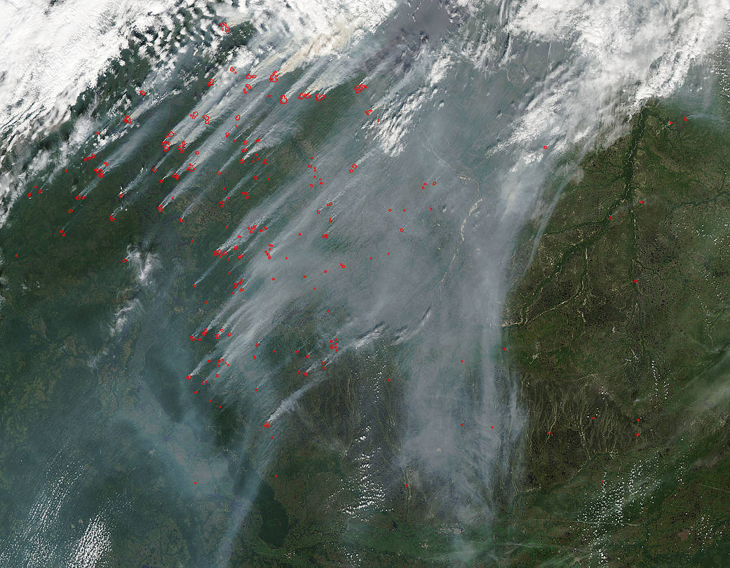
NASA’s Aqua satellite collected this natural-color image with the Moderate Resolution Imaging Spectroradiometer, MODIS, instrument on July 31, 2017. Actively burning areas, detected by MODIS’s thermal bands, are outlined in red. Each hot spot, red mark, is an area where the thermal detectors on the MODIS instrument recognized temperatures higher than background. When accompanied by plumes of smoke, as in this image, such hot spots are diagnostic for fire.
NASA image courtesy Jeff Schmaltz LANCE/EOSDIS MODIS Rapid Response Team, GSFC. Caption by Lynn Jenner with information from the Russian Aerial Forest Protection Service