


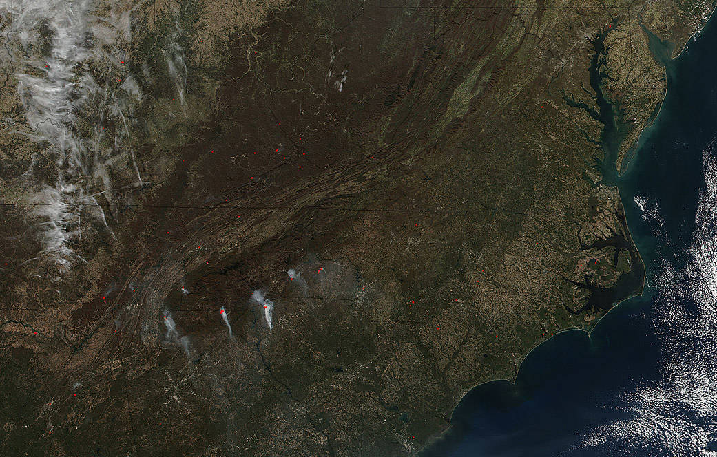
On November 14, 2016, the Aqua satellite captured a relatively close up image of fires in the Southeastern U.S. and a detailed description was given of the major fires. This image, taken by NOAA/NASA’s Suomi NPP satellite on November 17, 2016 shows a wider angle of these same fires. The fires all continue to grow due to the weather conditions in the area and terrain hampering firefighting efforts. Drought conditions are contributing to drier and larger forest fuels being available. These range from the undergrowth to sticks, leaves and logs. Even the smallest of sparks can ignite these very dry fuels. The major goal of firefighters is to try to have the fires burn inward as opposed to expanding, but weather conditions and available fuel is allowing these fires to expand leaving fire officials to try to combat incredibly difficult conditions. The U.S. Forest Service expects some fire activity during the fall with hunting season providing a chance of human caused fires and the annual leaves causing more dry tinder but this type of fire activity is unheard of in this part of the country.
This natural-color satellite image was collected by the VIIRS (Visible Infrared Imaging Radiometer Suite) instrument on the Suomi NPP satellite. Actively burning areas, detected by thermal bands, are outlined in red. NASA image courtesy Jeff Schmaltz, MODIS Rapid Response Team. Caption: NASA/Goddard, Lynn Jenner with information from Inciweb.