


![Request for Information – Potential [Placeholder for Prize]](https://assets.science.nasa.gov/dynamicimage/assets/science/psd/solar/2023/09/s/solarsystem_0.jpg?w=1024)


KSC-99pp1417
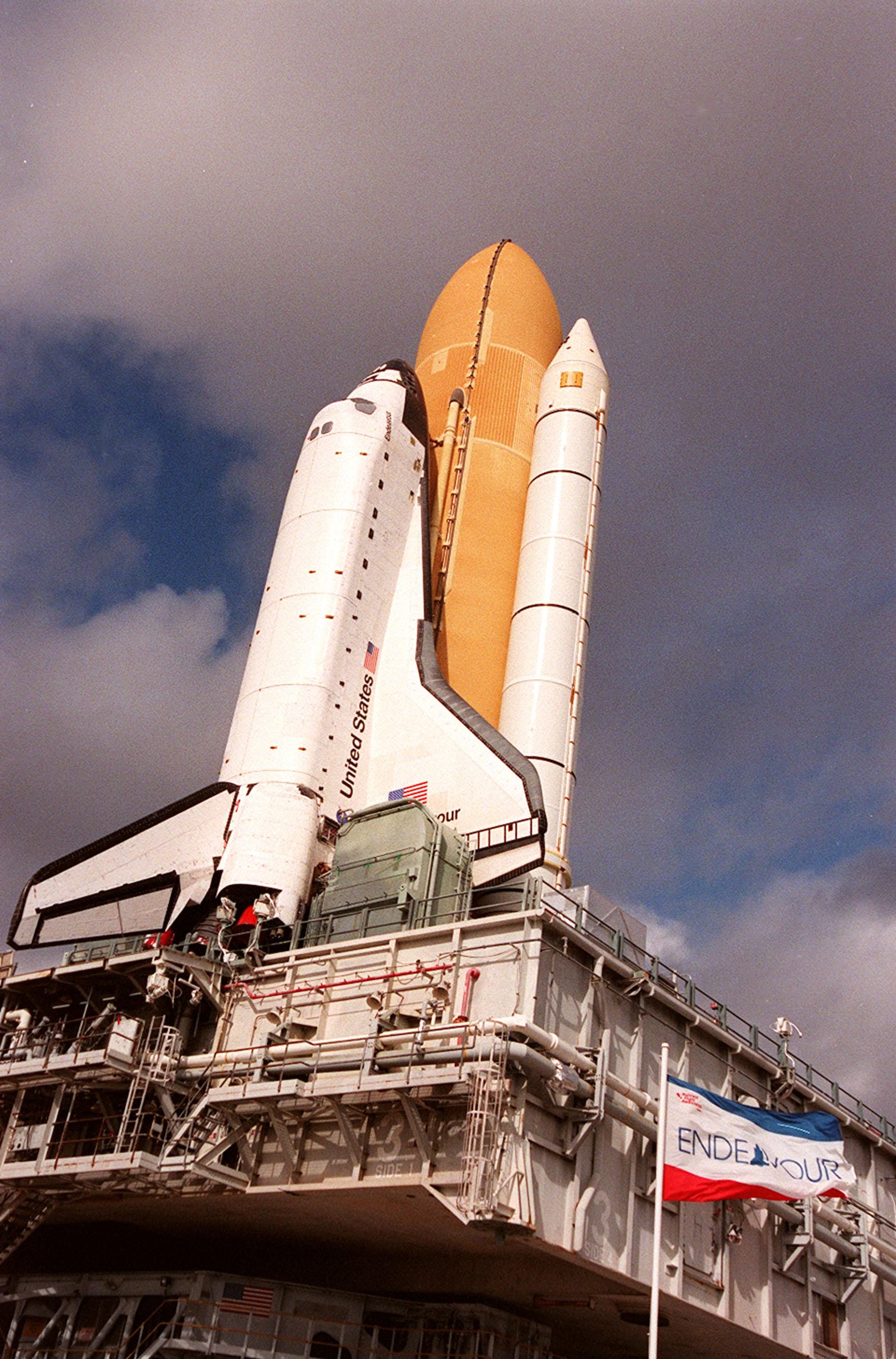
KENNEDY SPACE CENTER, Fla. -- Space Shuttle Endeavour is viewed atop the mobile launcher platform on its way to Launch Pad 39A for launch of mission STS-99. Named the Shuttle Radar Topography Mission (SRTM), STS-99 involves an international project spearheaded by the National Imagery and Mapping Agency and NASA, with participation of the German Aerospace Center DLR. SRTM will chart a new course, using two antennae and a 200-foot-long section of space station-derived mast protruding from its payload bay, to produce unrivaled 3-D images of the Earth's surface. The result of the Shuttle Radar Topography Mission could be close to 1 trillion measurements of the Earth's topography. Besides contributing to the production of better maps, these measurements could lead to improved water drainage modeling, more realistic flight simulators, better locations for cell phone towers, and enhanced navigation safety. STS-99 is scheduled for launch in January 2000
- X
https://www.nasa.gov/image-detail/amf-ksc-99pp1417/
TakenDecember 13, 1999
ProducerKSC
Size1760x2670px
PIA NumberKSC-99pp1417
