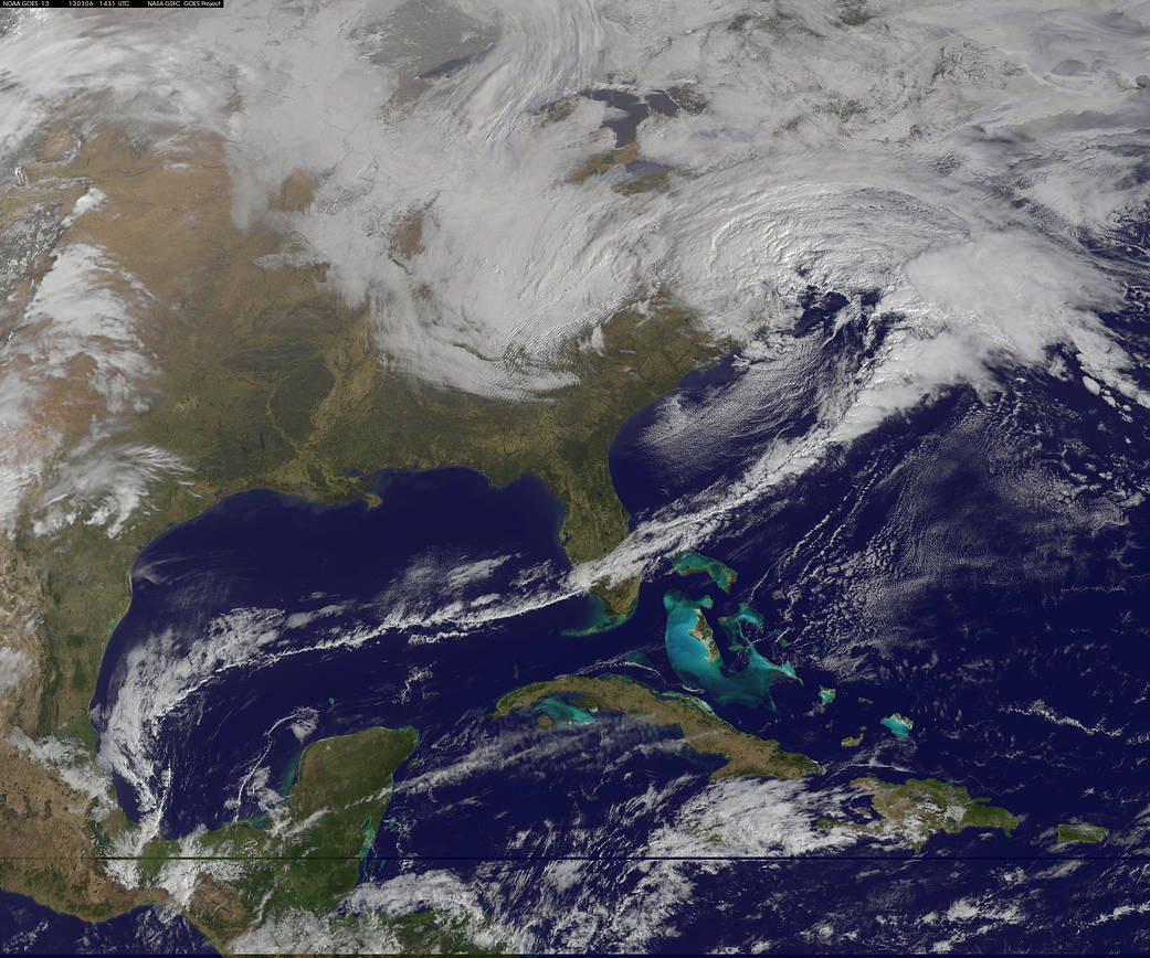
An image from NOAA’s GOES-13 satellite on March 6, 2013, shows a winter storm hitting the U.S. mid-Atlantic region. The Geostationary Operational Environmental Satellite Program (GOES) is a joint effort of NASA and the National Oceanic and Atmospheric Administration (NOAA).
1 min read


