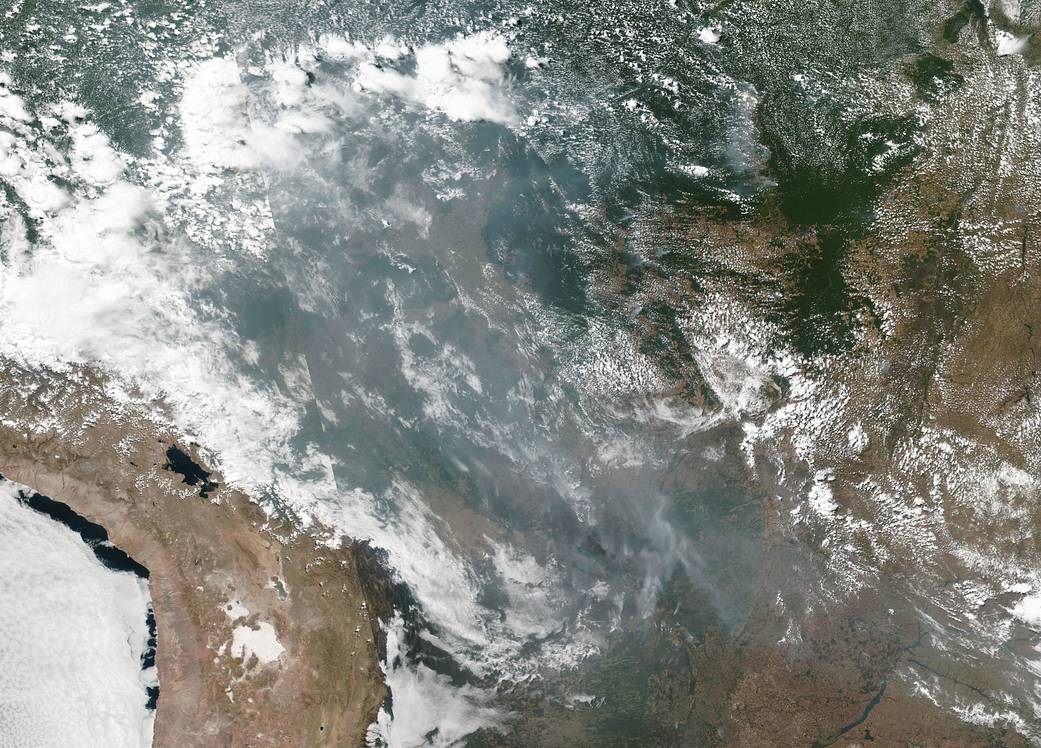
This natural-color image of smoke and fires in several states within Brazil including Amazonas, Mato Grosso, and Rondônia was collected by NOAA/NASA’s Suomi NPP using the VIIRS (Visible Infrared Imaging Radiometer Suite) instrument on August 20, 2019. It is not unusual to see fires in Brazil at this time of year due to high temperatures and low humidity. Time will tell if this year is a record breaking or just within normal limits.
NASA’s Earth Observing System Data and Information System (EOSDIS) Worldview application provides the capability to interactively browse over 700 global, full-resolution satellite imagery layers and then download the underlying data. Many of the available imagery layers are updated within three hours of observation, essentially showing the entire Earth as it looks “right now.” Suomi NPP is managed by NASA and NOAA. Image Courtesy: NASA Worldview, Earth Observing System Data and Information System (EOSDIS). Caption: Lynn Jenner


