


![Request for Information – Potential [Placeholder for Prize]](https://assets.science.nasa.gov/dynamicimage/assets/science/psd/solar/2023/09/s/solarsystem_0.jpg?w=1024)


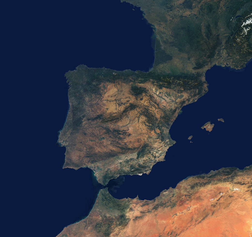
This natural-color satellite image shows the meeting place of Earth's second largest and second smallest continents: Africa and Europe. It's a mosaic of numerous images captured throughout 2000-02 by the Multi-angle Imaging SpectroRadiometer (MISR) on NASA's Terra satellite.
This natural-color satellite image shows the meeting place of Earth’s second largest and second smallest continents: Africa and Europe. It’s a mosaic of numerous images captured throughout 2000-02 by the Multi-angle Imaging SpectroRadiometer (MISR) on NASA’s Terra satellite. The image stretches from the snow-covered Swiss Alps in the northeast, through France and Spain across the Mediterranean to Morocco and Algeria.Image Credit: NASA