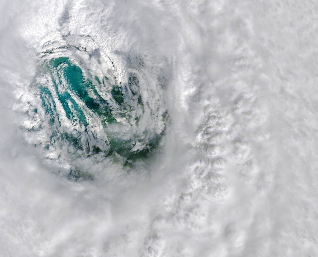
The Operational Land Imager aboard the Landsat 8 satellite captured this natural-color image of Hurricane Ian’s eye on Sept. 28, 2022 at 11:57 a.m. EDT (15:57 UTC), three hours before the storm crashed into the coast in Caya Costa, Fla.
When Ian’s eyewall made landfall, its maximum sustained winds were 150 miles (240 kilometers) per hour, according to the National Hurricane Center. That is the equivalent of a category 4 storm on the Saffir-Simpson wind scale and fast enough to tear the roofs off homes and snap power lines.
The eye of a hurricane is a circular zone of fair weather at the storm’s center. It is surrounded by a towering ring of extremely powerful thunderstorms called an eyewall, the part of the hurricane with the strongest winds. The swirling clouds along the edges of the eyewall are mesovortices—small-scale rotational features found in hurricanes with unusually strong winds.
Read more: Staring Into Ian’s Eye
Image credit: NASA Earth Observatory image by Joshua Stevens, using Landsat data from the U.S. Geological Survey.


