


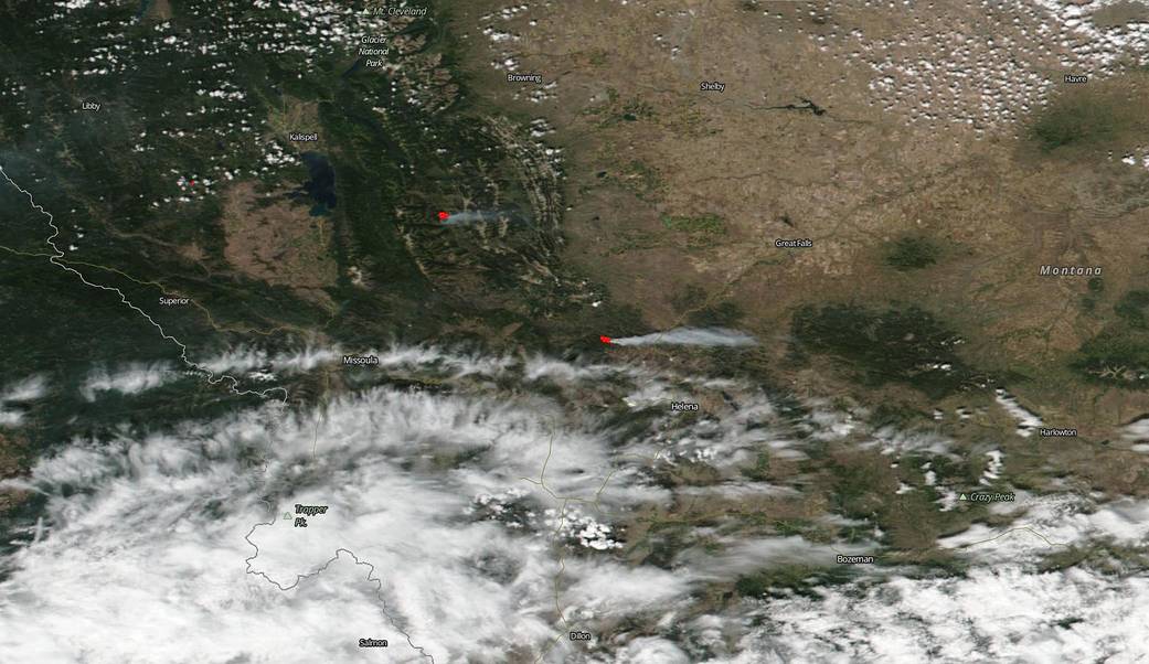
On August 06, 2019, NOAA-NASA’s Suomi NPP satellite captured this image of two fires in Montana that were caused by a lightning strike and an unknown cause. The fire to the far left is the Snow Creek Fire which began with a lightning strike on August 02, 2019. It’s located 19 miles NE of Condon, MT, and is currently 1,084 acres in size. Fire officials expect fire growth to the east and south, spreading towards high value targets. Hampering firefighting efforts is the weather forecast. The next two days call for dry, hot conditions with temperatures potentially being the hottest of the year. Cooler and wetter trends are in the forecast beginning Friday and are expected to last through the early part of next week.
The fire located just northwest of Helena is the Horsefly fire that began on August 05, 2019 under unknown causes. This blaze grew more quickly than the Snow Creek Fire growing to 1,294 acres in just two days. The Horsefly fire is moving in a southeast/east direction and is burning in gray sage, beetle killed lodgepole and subalpine fir with a high number of dead and down trees fueling the flames. There is concern that if fire activity becomes extreme, there is the potential for the fire to cross a highway moving it into difficult and inaccessible terrain. Increasing cloud cover trend continues with a slightly higher relative humidity and these conditions should help reduce fire spread. Although as the fire moves higher in elevation, it also becomes more exposed to stronger winds which can accelerate fire growth. Temperatures and humidity moderate slightly through Thursday with better chances for cloud-cover, cooler temperatures, showers and thunderstorms Friday into the weekend.
NOAA-NASA’s Suomi NPP satellite collected this natural-color image using the VIIRS (Visible Infrared Imaging Radiometer Suite) instrument on August 06, 2019. Actively burning areas, detected by MODIS’s thermal bands, are outlined in red. Suomi NPP is managed by NASA and NOAA.
NASA’s Earth Observing System Data and Information System (EOSDIS) Worldview application provides the capability to interactively browse over 700 global, full-resolution satellite imagery layers and then download the underlying data. Many of the available imagery layers are updated within three hours of observation, essentially showing the entire Earth as it looks “right now.” Image Courtesy: NASA Worldview, Earth Observing System Data and Information System (EOSDIS). Caption: Lynn Jenner with information from Inciweb.