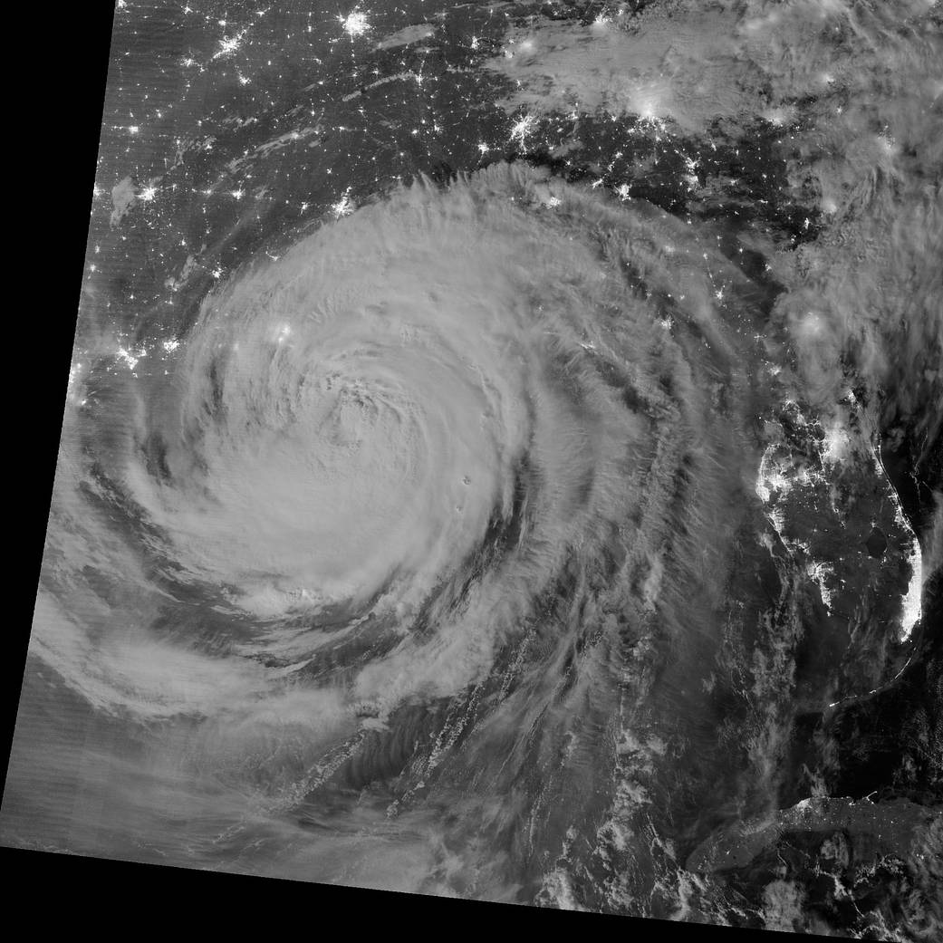
Early on August 29, 2012, the Visible Infrared Imaging Radiometer Suite on the Suomi-NPP satellite captured this nighttime view of Hurricane Isaac and the cities near the Gulf Coast of the United States. The image was acquired at 1:57 a.m. local time by the VIIRS “day-night band,” which detects light in a range of wavelengths from green to near-infrared and uses light intensification to enable the detection of dim signals. In this case, the clouds of Isaac were lit by moonlight.
Isaac, a slow-moving storm, made landfall as a category 1 hurricane near the mouth of the Mississippi River in southwestern Louisiana at about 6:45 p.m. local time on August 28, 2012.› More on IsaacCredit: NASA
1 min read


