


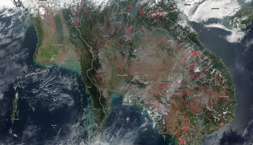
The monsoon season dominates the climate of Southeast Asia from mid-April to September. During this time, the climate is rainy and hot. From November to mid-March, it becomes much cooler and dry. Across Southeast Asia, NASA’s Suomi NPP satellite captured this image of hundreds of fires dotting the landscape. These fires are for the most part intentionally set for agricultural purposes for the coming growing season. Fires become widespread throughout the Indochina peninsula as people use burning to clear and maintain agricultural and residential landscapes. The Visible Infrared Imaging Radiometer Suite (VIIRS) sensor on NASA/NOAA’s Suomi NPP satellite captured this natural-color image showing large numbers of small fires burning throughout the Indochina peninsula on March 06, 2019.
NASA’s Earth Observing System Data and Information System (EOSDIS) Worldview application provides the capability to interactively browse over 700 global, full-resolution satellite imagery layers and then download the underlying data. Many of the available imagery layers are updated within three hours of observation, essentially showing the entire Earth as it looks “right now.” Actively burning fires, detected by thermal bands, are shown as red points. Image Courtesy: NASA Worldview, Earth Observing System Data and Information System (EOSDIS). Caption: Lynn Jenner with information from the Earth Observatory.