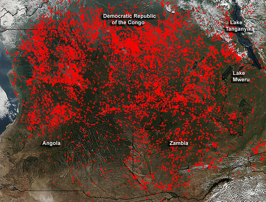
Widespread agricultural burning continues throughout central Africa, and smoke and fires were detected by the Suomi NPP satellite. Most of the fires were burning in the southern region of the Democratic Republic of the Congo, Zambia and Angola.
The Suomi NPP satellite’s Visible Infrared Imaging Radiometer Suite (VIIRS) instrument captured a look at multiple fires and smoke. Actively burning areas, detected by VIIRS are outlined in red. The instrument that flies onboard NASA’s Aqua satellite captured an image of smoke and fires burning in central Africa on June 3, 2016. Suomi NPP is a joint mission between NASA, the National Oceanic and Atmospheric Administration and the U.S. Department of Defense.
Image credit: NASA/Jeff Schmaltz, NASA Goddard Rapid Response Team
Text credit: Rob Gutro, NASA’s Goddard Space Flight Center, Greenbelt, Md.

