


A bushfire advisory has been issued by the Department of Fire and Emergency Services (DFES) of the Government of Western Australia. This advisory is for those traveling anywhere near the area 70 kilometers north of Broome in the Shire of Broome. This is a desolate area so there is no threat to lives or homes, but copious amounts of smoke are being produced by this blaze. The smoke released by any type of fire (forest, brush, crop, structure, tires, waste or wood burning) is a mixture of particles and chemicals produced by incomplete burning of carbon-containing materials. All smoke contains carbon monoxide, carbon dioxide and particulate matter (PM or soot). Smoke can contain many different chemicals, including aldehydes, acid gases, sulfur dioxide, nitrogen oxides, polycyclic aromatic hydrocarbons (PAHs), benzene, toluene, styrene, metals and dioxins. The type and amount of particles and chemicals in smoke varies depending on what is burning, how much oxygen is available, and the burn temperature.
Exposure to high levels of smoke should be avoided. Individuals are advised to limit their physical exertion if exposure to high levels of smoke cannot be avoided. Individuals with cardiovascular or respiratory conditions (e.g., asthma), fetuses, infants, young children, and the elderly may be more vulnerable to the health effects of smoke exposure.
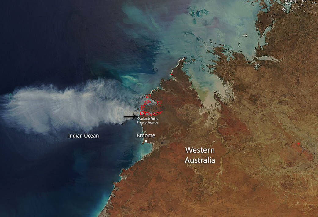
Conditions are expected to ease overnight, however fire conditions will be monitored and the alert level may be upgraded if the situation changes. The bushfire is moving fast in southerly and westerly directions. The bushfire is dangerous and out of control. Firefighters are actively fighting the fire, backburning and using machinery to strengthen containment lines.
According to the DFES, The incident was reported on September 29, 2015. Currently the fire has affected approximately 110,000 hectares (271,815 acres). Officials have deemed the cause of the fire suspicious at this point. No other information is available.
This natural-color satellite image was collected by the Moderate Resolution Imaging Spectroradiometer (MODIS) aboard the Aqua satellite on October 02, 2015. Actively burning areas, detected by MODIS’s thermal bands, are outlined in red. NASA image courtesy Jeff Schmaltz, MODIS Rapid Response Team. Caption: NASA/Goddard, Lynn Jenner