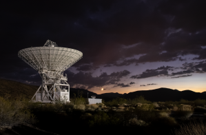
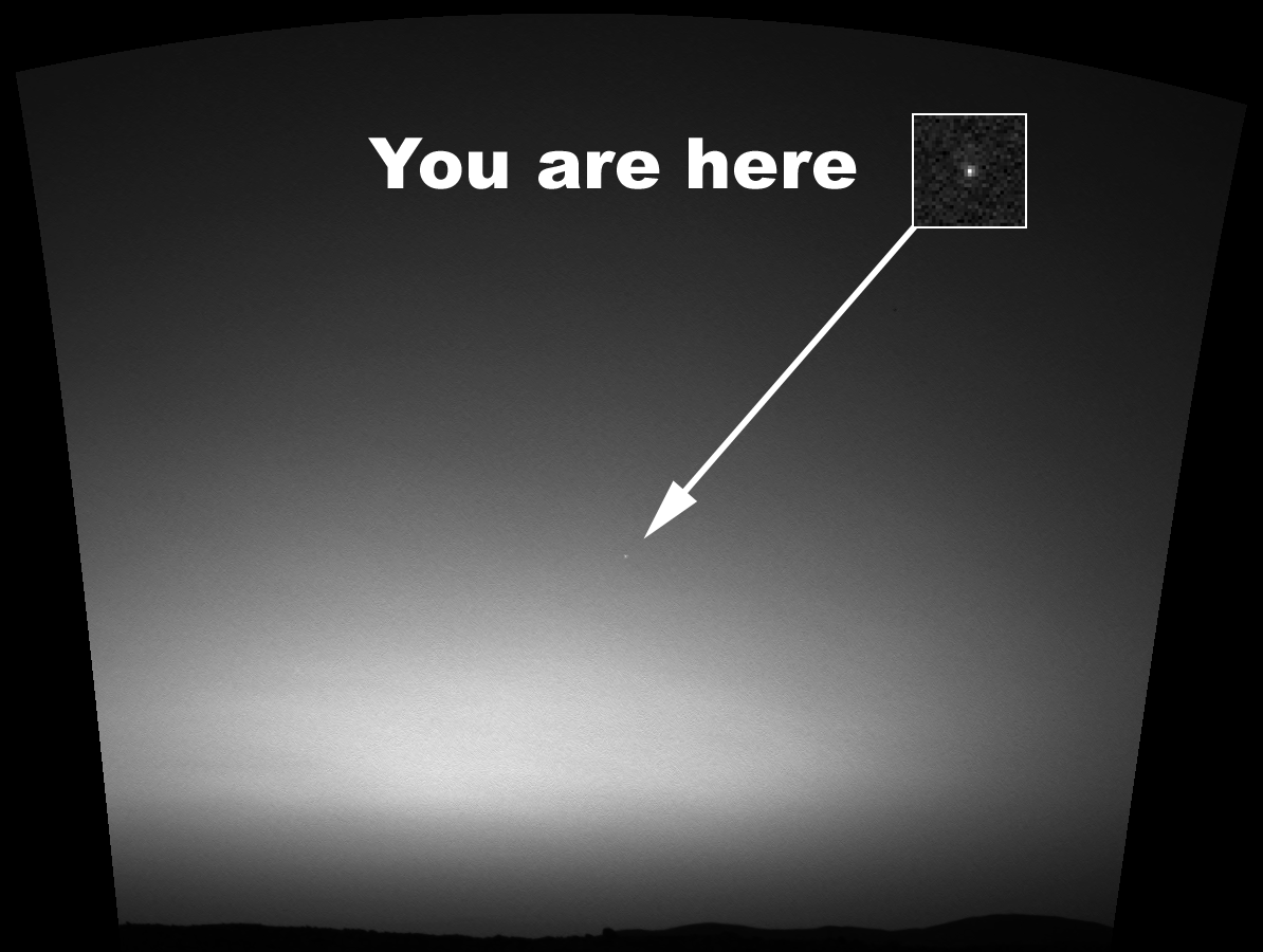
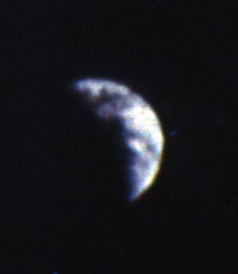
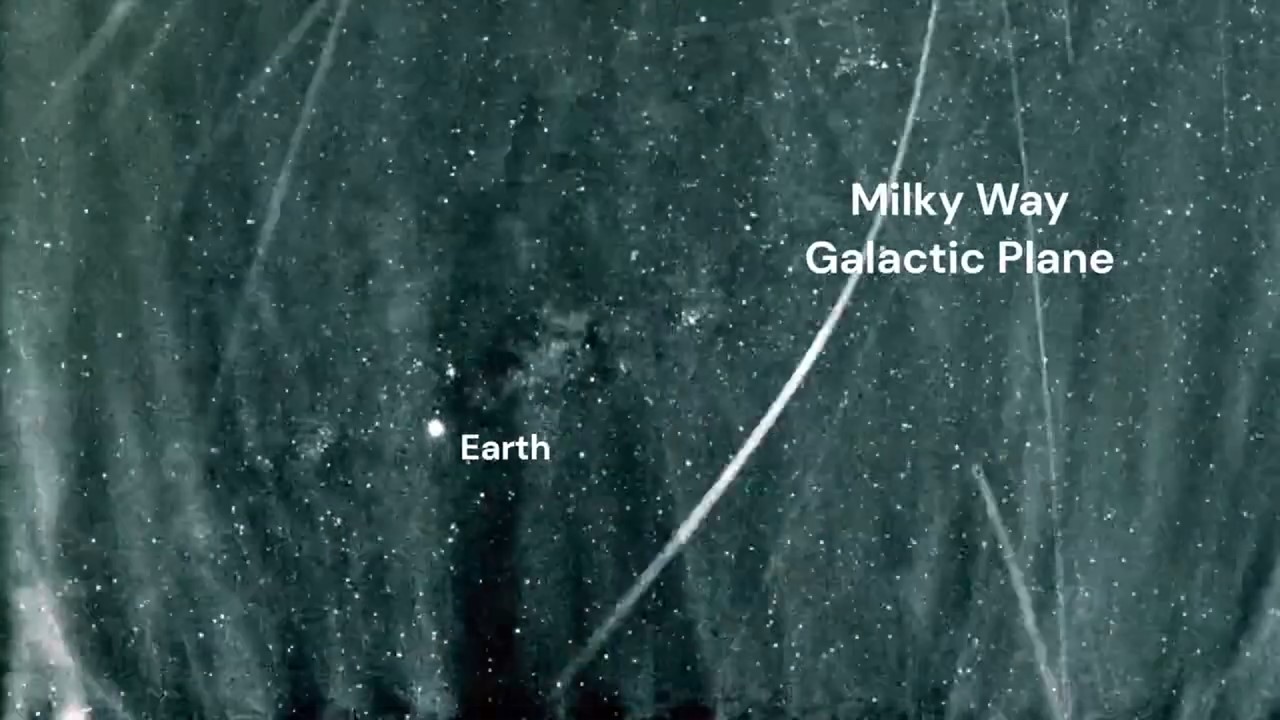
On March 8, 2004, the Mars Exploration Rover Spirit took the first image of Earth from the surface of another planet. The Earth appearing as nothing more than a bright star provided a new perspective on our home planet, a perspective reshaped over the past eight decades as cameras aboard rockets and spacecraft traveled farther and farther away. From sounding rockets in the 1940s and Earth orbiting satellites in the early 1960s to spacecraft and people traveling to the Moon in the late 1960s and early 1970s and since then to spacecraft exploring all reaches of our solar system, the images of Earth they sent back expanded our horizons while showing an ever-smaller pale blue dot in the vastness of space.
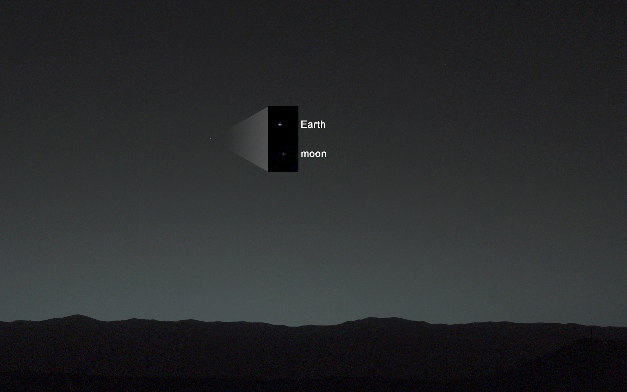
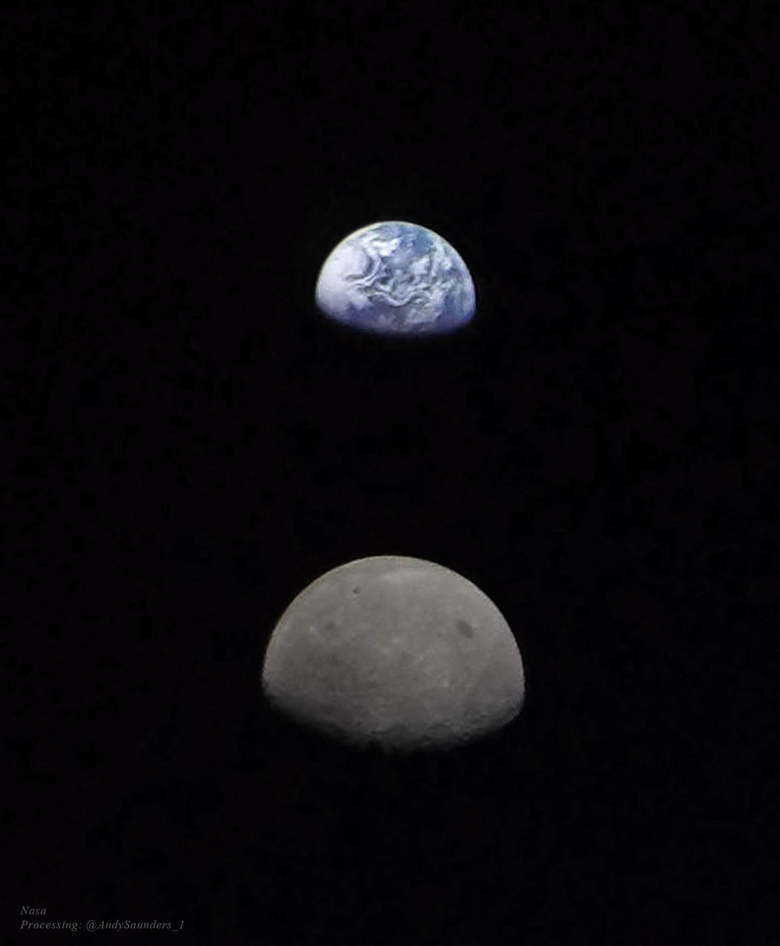
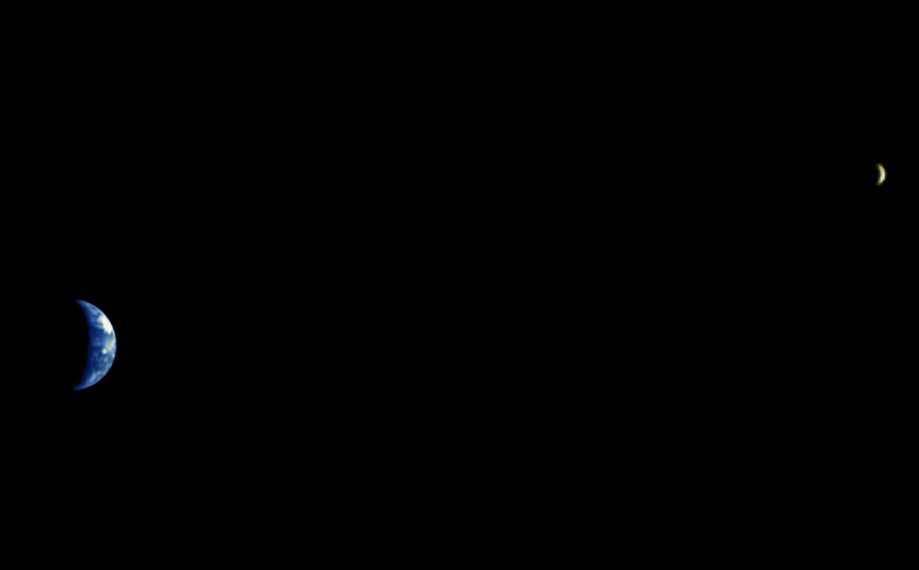
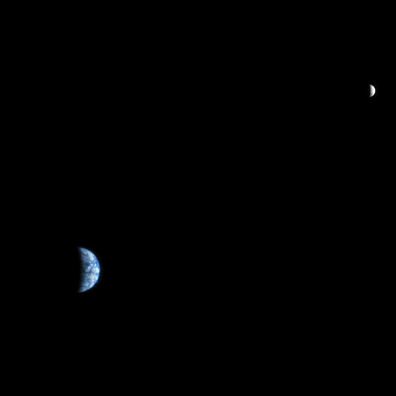
Left: The Mars Exploration Rover Spirit photographed Earth before sunrise in 2004. Right: The Mars Science Laboratory Curiosity rover photographed the Earth-Moon system in 2014.
Shortly after landing in Mars’ Gusev Crater on Jan. 4, 2004, Spirit began sending to Earth remarkable photos of its surroundings. On March 8, it turned its camera skyward in an attempt to photograph the Martian moon Deimos partially eclipsing the Sun as it transited across its disc. Shortly before sunrise, Spirit’s camera managed to capture Earth as a bright star, appearing much as Venus does to terrestrial observers. This marked the first photograph of Earth from another planetary surface. Nearly a decade passed before another rover, the Mars Science Laboratory Curiosity, took another photograph of Earth from its location in Mars’ Gale Crater. The image taken on Jan. 31, 2014, from 99 million miles away, also captured the Moon. These images, and others taken of Earth from ever-more distant vantage points over the past eight decades, provided a new perspective of our home planet’s place in our solar system. Enjoy the following postcards of Earth over the decades.
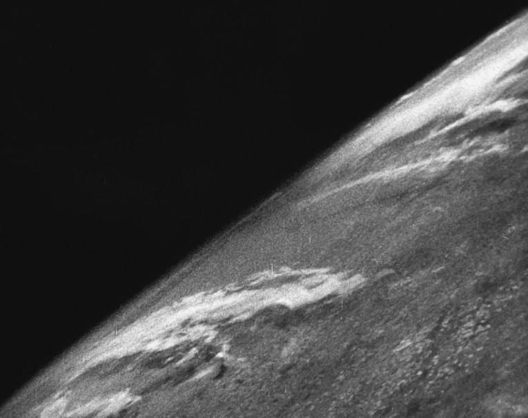
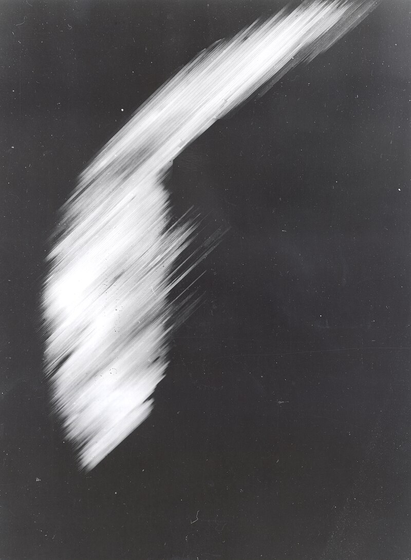
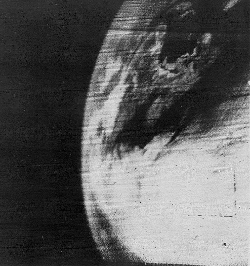
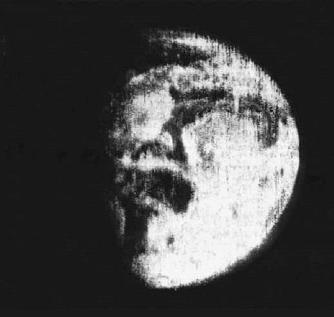
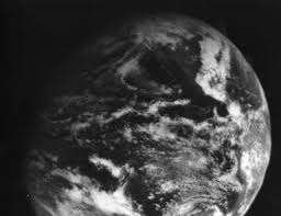
Left: The first image of Earth taken from space in 1946 by a suborbital rocket, from an altitude of 65 miles. Image credit: courtesy White Sands Missile Range/Applied Physics Laboratory. Middle: The first photograph of Earth taken from orbit, by the Explorer 6 satellite. Right: The first television image of Earth, transmitted by the TIROS-1 weather satellite in 1960.
On Oct. 24, 1946, more than 10 years before the launch of the first artificial satellite Sputnik, scientists at the White Sands Missile Range in New Mexico placed a camera on top of a captured German V-2 ballistic missile. As the rocket flew to an altitude of about 65 miles – just above the generally recognized border of outer space – the 35-mm motion picture camera snapped a frame every one and a half seconds. Minutes later, the missile came crashing back down and slammed into the ground at more than 340 miles per hour, but the film survived and gave us our first glimpse of Earth from space. On Aug. 14, 1959, the Explorer 6 satellite took the first photograph of Earth from orbit about 17,000 miles high, but the image lacked detail. On April 1, 1960, from an orbital altitude of about 450 miles, the TIROS-1 weather satellite returned the first of its 23,000 television images of the Earth, most of them of sufficient quality for the satellite’s main purpose, weather forecasting.
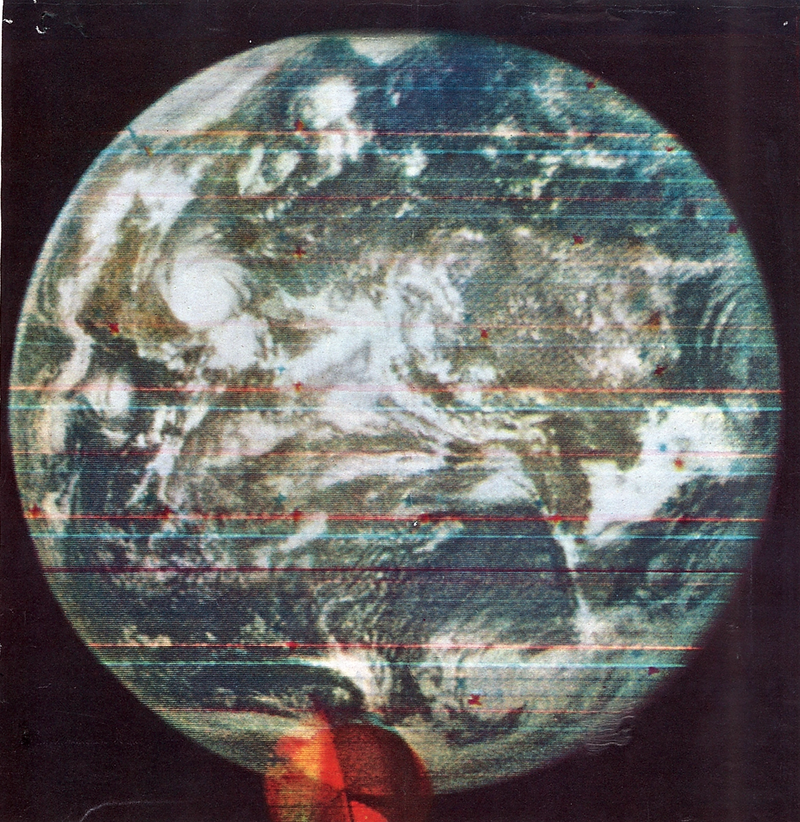
Left: The first full-disk photograph of Earth, taken by the Soviet Molniya 1-3 communications satellite in 1966. Middle: The first image of Earth taken from geostationary orbit, by the Advanced Technology Satellite-1 (ATS-1) satellite in 1966. Right: The first color image of the full Earth from the DODGE (Department of Defense Gravity Experiment) satellite in 1967.
The Soviet Molniya 1-3 communications satellite took the first photograph showing the Earth as a full disk on May 30, 1966, although the image quality was somewhat poor. On Dec. 11, 1966, the ATS-1 advanced technology satellite beamed back the first photograph of Earth from geostationary orbit 22,300 miles above Ecuador. The Department of Defense Gravity Experiment (DODGE) satellite returned the first color image of the full Earth in August 1967.
Left: The original photo, top, of Earth taken from lunar orbit by the Lunar Orbiter 1 spacecraft in 1966, and a 2008 digitized version by the Lunar Orbiter Image Recovery Project (LOIRP). Image credit: courtesy LOIRP. Right: The first color image of Earth taken from the surface of the Moon by Surveyor 3 in 1967.
The primary purpose of early robotic spacecraft to the Moon was to prepare for the crewed Apollo missions that followed, including extensive photography of the lunar terrain from orbit and from the surface. The first of five Lunar Orbiter spacecraft designed to map the Moon’s surface from orbit took the first photograph of Earth from lunar distances on Aug. 23, 1966. A digital reconstruction of the original frame in 2008 as part of the Lunar Orbiter Image Recovery Project removed the scan lines and other imperfections. The Surveyor 3 robotic lander, later visited by the Apollo 12 astronauts, took the first photograph of Earth from the lunar surface on April 30, 1967.
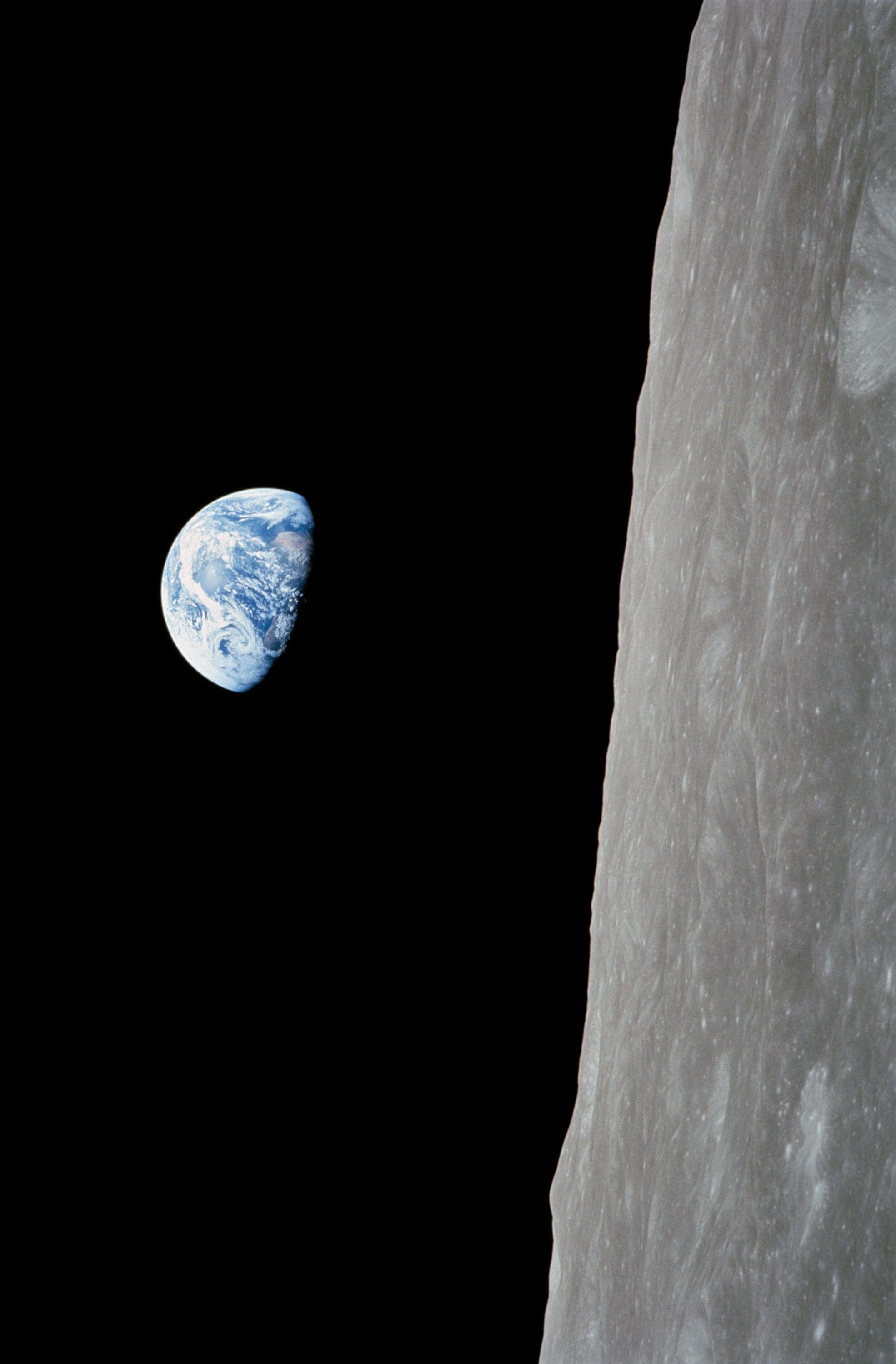
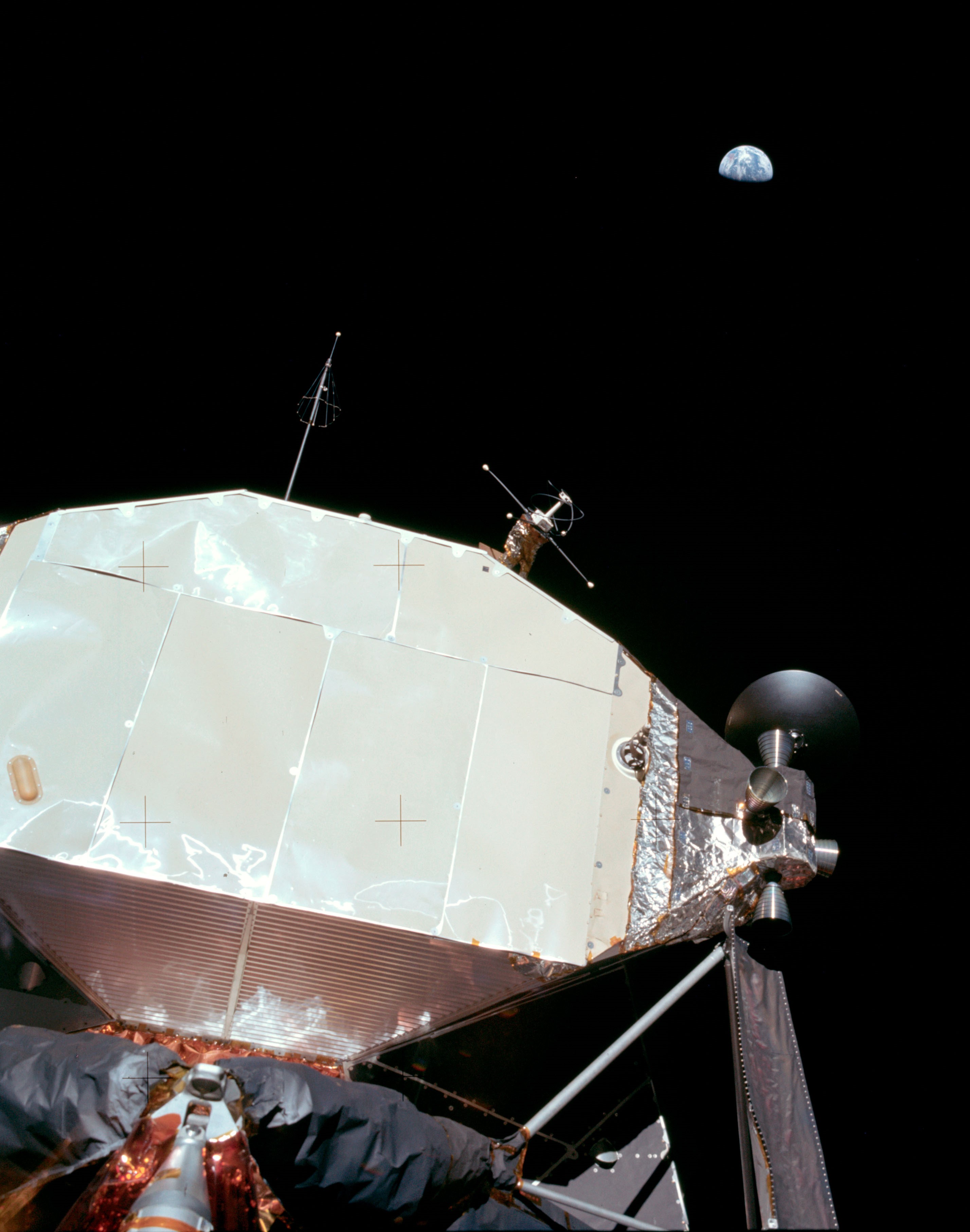
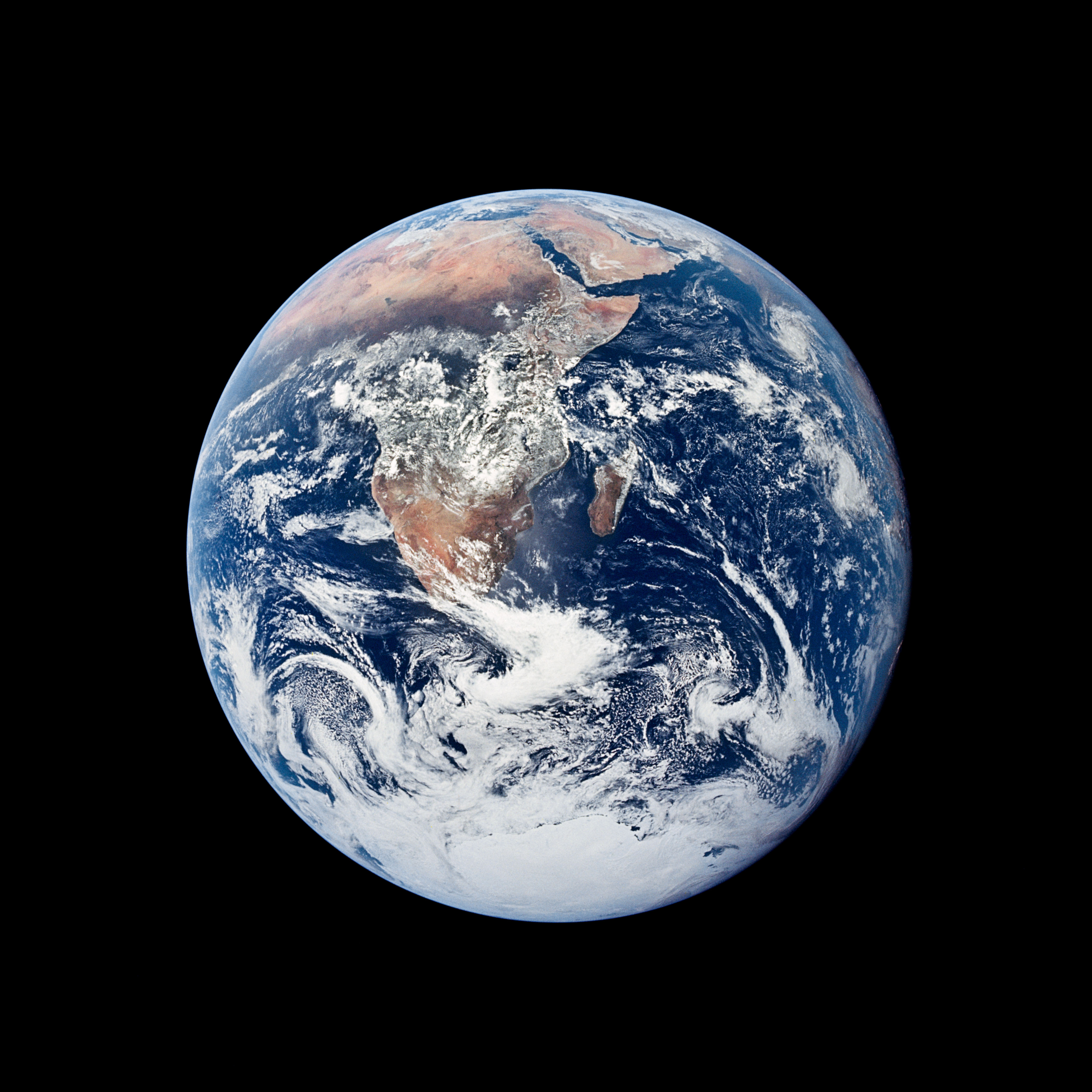
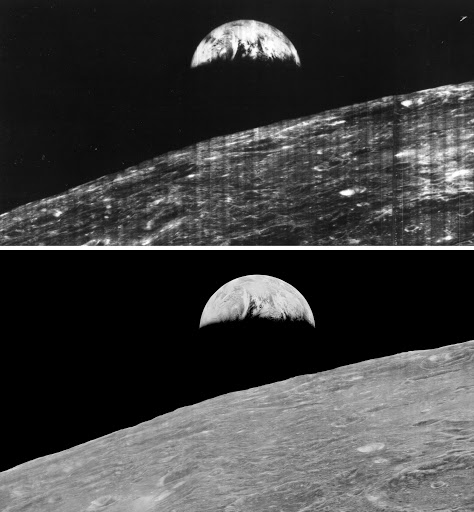
Left: The famous Earthrise photograph taken during the Apollo 8 crew’s first orbit around the Moon in 1968. Middle left: The first photograph of Earth taken by an astronaut standing on the lunar surface, taken during the Apollo 11 Moon landing in 1969. Middle right: The famous Blue Marble image taken by Apollo 17 astronauts on their way to the Moon in 1972. Right: Earth and Moon photographed during the Artemis I uncrewed mission in 2022.
The Apollo missions of the late 1960s and early 1970s returned thousands of stunning and memorable images of humanity’s first exploration of another world. Among them are photographs of the Earth taken by the astronauts that show how small and fragile our planet can appear against the blackness and vastness of space. Arguably, the most famous is the Earthrise photos taken during Apollo 8, the first crewed mission to orbit the Moon in December 1968. The image of the smooth blue ball of Earth appearing suspended over the battered gray lunar terrain provided inspiration for the ecology movement of the time. In July 1969, the first human lunar landing mission, Apollo 11, returned many iconic photographs of Neil A. Armstrong and Edwin E. “Buzz” Aldrin on the surface, and also included the first image of the Earth taken by an astronaut on the Moon. In December 1972, astronauts on the final Apollo lunar landing mission, Apollo 17, took the famous Blue Marble image of the Earth from 72,000 miles away on their way to the Moon. More recently, in November 2012, the uncrewed Artemis I mission imaged the Moon and Earth together, from a distance of 268,563 miles from Earth.
Left: A composite of two separate images of the Earth and Moon, taken by Mariner 10 in 1973 as it headed toward encounters with Venus and Mercury. Middle: The first image of the Earth-Moon system in a single photographic frame taken by Voyager 1 in 1977 as it departed on its journey to explore Jupiter, Saturn, and beyond. Right: The first image of Earth taken by a planetary spacecraft, Galileo, as it made a return encounter with its home planet for a gravity assist in 1990.
As planetary spacecraft carried increasingly sophisticated instruments in the 1970s, some turned their cameras toward the Earth as they departed on their long voyages of exploration. In November 1973, a few days after Mariner 10 launched on its mission to explore Venus and Mercury, it snapped separate photographs of the Earth and the Moon, that technicians combined into a composite photo. On Sept. 18, 1977, at a distance of 7.25 million miles, the Jupiter-bound Voyager 1 snapped the first photograph of the Earth-Moon system in a single frame, providing an impression of the view from a spacecraft approaching our home planet. The Galileo spacecraft did exactly that – on Dec. 8, 1990, more than two years after its launch, it passed within 600 miles of Earth, using the planet for a gravity assist to reach Jupiter. During the fly-by, Galileo used its sophisticated instruments and cameras to study Earth as an unexplored planet and detected chemical signatures in atmospheric trace elements associated with life-form activity.
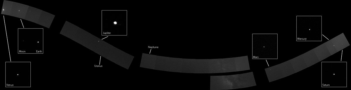
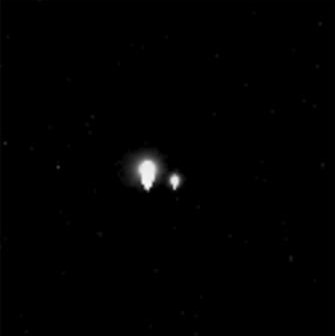
Voyager 1’s family portrait of six planets, when the spacecraft was 3.7 billion miles from Earth in 1990.
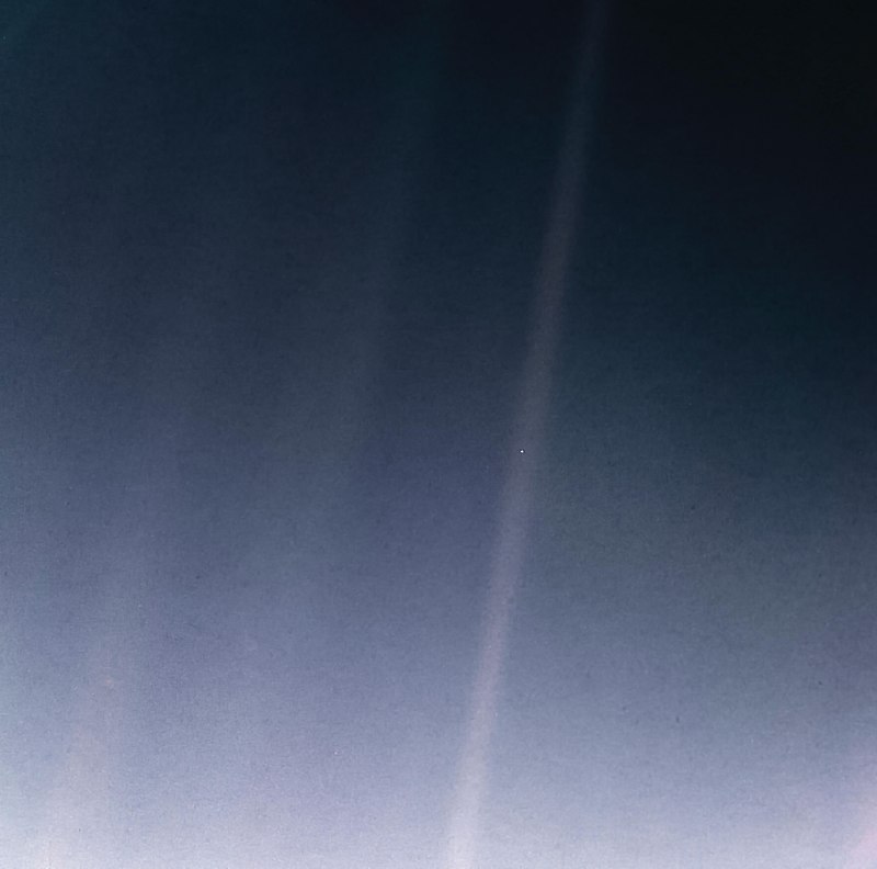
Pale Blue Dot Revisited, NASA’s 2020 remastered version of the Voyager 1 image of Earth.
On Feb. 14, 1990, more than 12 years after it began its journey from Earth and shortly before controller permanently turned off its cameras to conserve power, Voyager 1 spun around and pointed them back into the solar system. In a mosaic of 60 images, it captured a “family portrait” of six of the solar system’s planets, including a pale blue dot called Earth more than 3.7 billion miles away. In February 2020, to commemorate the photograph’s 30th anniversary, NASA released a remastered version of the image of Earth as Pale Blue Dot Revisited.
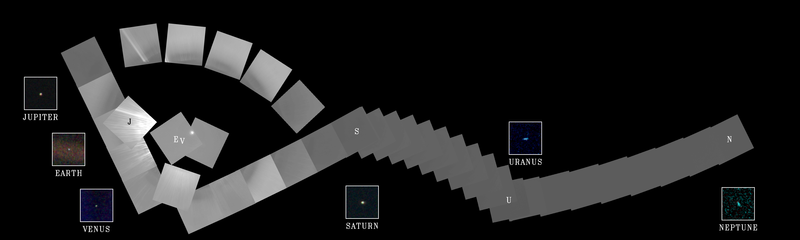
MESSENGER’s family portrait of the planets, taken from approximately the orbit of Mercury in 2010.
Twenty years later, and from a very different part of the solar system, came another family portrait of the planets. From near the orbit of Mercury, the MESSENGER spacecraft took 34 images on Nov. 3 and 16, 2010, that engineers stitched together. The composite shows six planets, Venus, Earth, Jupiter, Mars, Mercury, and Saturn, and even several planetary satellites including the Moon and Jupiter’s four Galilean moons Callisto, Ganymede, Europa, and Io.
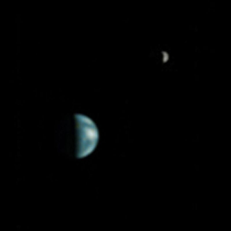
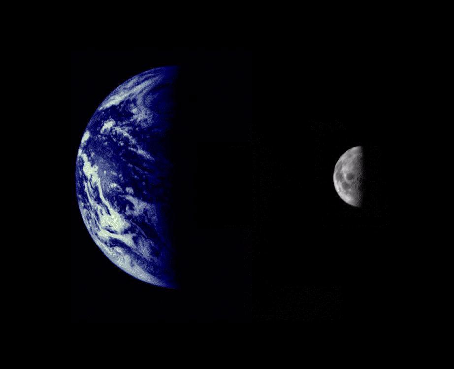
Left: Earth and Moon photographed by the Mars Global Surveyor spacecraft in orbit around Mars in 2003. Middle: Earth and Moon photographed by the European Space Agency’s Mars Express spacecraft in orbit around Mars in 2003. Right: Earth and Moon photographed by the Mars Reconnaissance Orbiter in orbit around Mars in 2007.
Even before Spirit returned the first photo of Earth from the surface of Mars, spacecraft in orbit around the Red Planet took amazing photos of the Earth-Moon system with their telescopic high-resolution cameras. Mars Global Surveyor took the first photograph of the Earth-Moon system from Mars orbit in May 2003, the two planets 86 million miles apart. Given the Moon’s position in its orbit around Earth, the two bodies appeared close together. Two months later, in July 2003, the European Space Agency’s (ESA) Mars Express spacecraft photographed them appearing much further apart, given the Moon’s orbital position. In October 2007, Mars Reconnaissance Orbiter used its HiRISE camera to take a more detailed shot of the Earth-Moon system. Because Earth orbits closer to the Sun than Mars, it goes through phases, much as Mercury and Venus do as viewed from Earth.
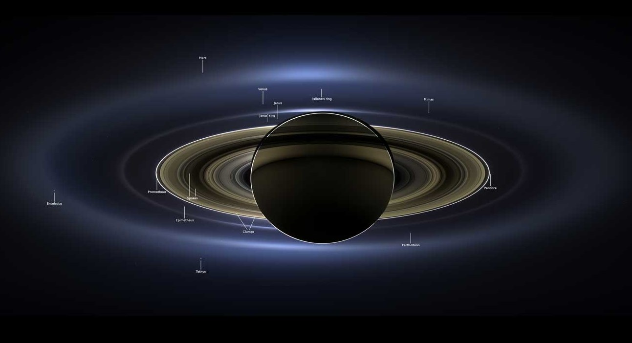
The Earth-Moon system as seen from the Cassini spacecraft in orbit around Saturn in 2013.
On July 19, 2013, the Cassini spacecraft in orbit around Saturn took a series of images from a distance of about 750,000 miles as the planet eclipsed the Sun. In the event dubbed The Day the Earth Smiled, people on Earth received notification in advance that Cassini would be taking their picture from 900 million miles away, and were encouraged to smile at its camera. In addition to the Earth and Moon, Cassini captured Venus, Mars, and seven of Saturn’s satellites in the photograph.
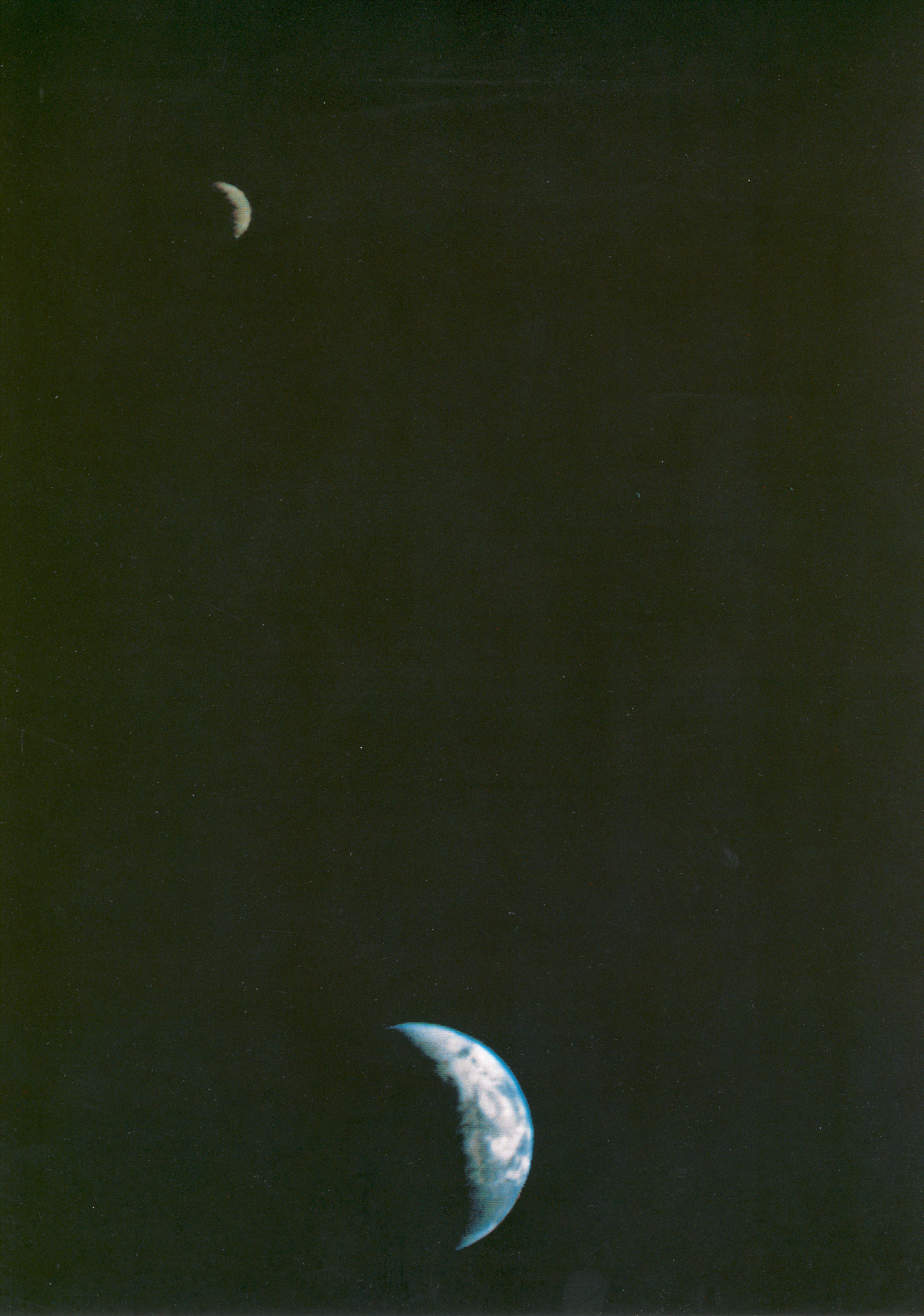
Left: The MESSENGER spacecraft in orbit around Mercury took this photograph of Earth and Moon in 2013. Right: The Parker Solar Probe photographed Earth through the solar corona from well inside the orbit of Mercury in 2023.
On the same day that Cassini imaged Earth and other planets from Saturn, the MESSENGER spacecraft in orbit around Mercury, during a search for possible moons orbiting the small planet, took a photograph of the Earth-Moon system from 61 million miles away. The Parker Solar Probe, during its 16th close pass of the Sun in June 2023, took a series of photographs through the Sun’s corona, imaging several planets including Earth in the process. Engineers stitched the images together to create an amazing video of the solar corona and a coronal mass ejection. The view is from well inside Mercury’s orbit.
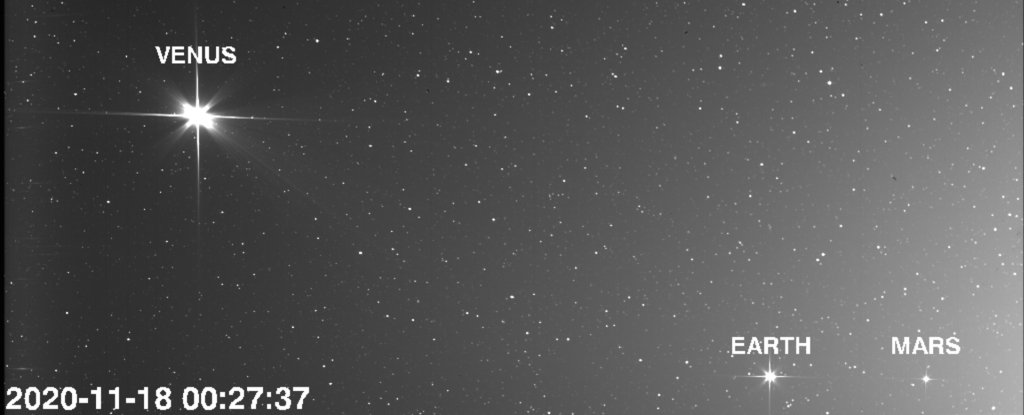
The European Space Agency’s Solar Orbiter took this mini-family portrait in November 2020.
The ESA Solar Orbiter spacecraft’s primary objectives focus on studying the Sun from close distances. These orbits enable it to photograph several planets at once. On Nov. 18, 2020, Solar Orbiter imaged Venus, Earth, and Mars in one frame.
We hope you enjoyed this review of how photographs of Earth over the past 80 years have changed our perspectives of our home planet, and also of our own place in the universe. Future human space explorers, whatever their destinations, will always look back and try to find their home planet in whatever sky it may shine, and hopefully share their experiences with us through photographs we can only dream about today.