


![Request for Information – Potential [Placeholder for Prize]](https://assets.science.nasa.gov/dynamicimage/assets/science/psd/solar/2023/09/s/solarsystem_0.jpg?w=1024)


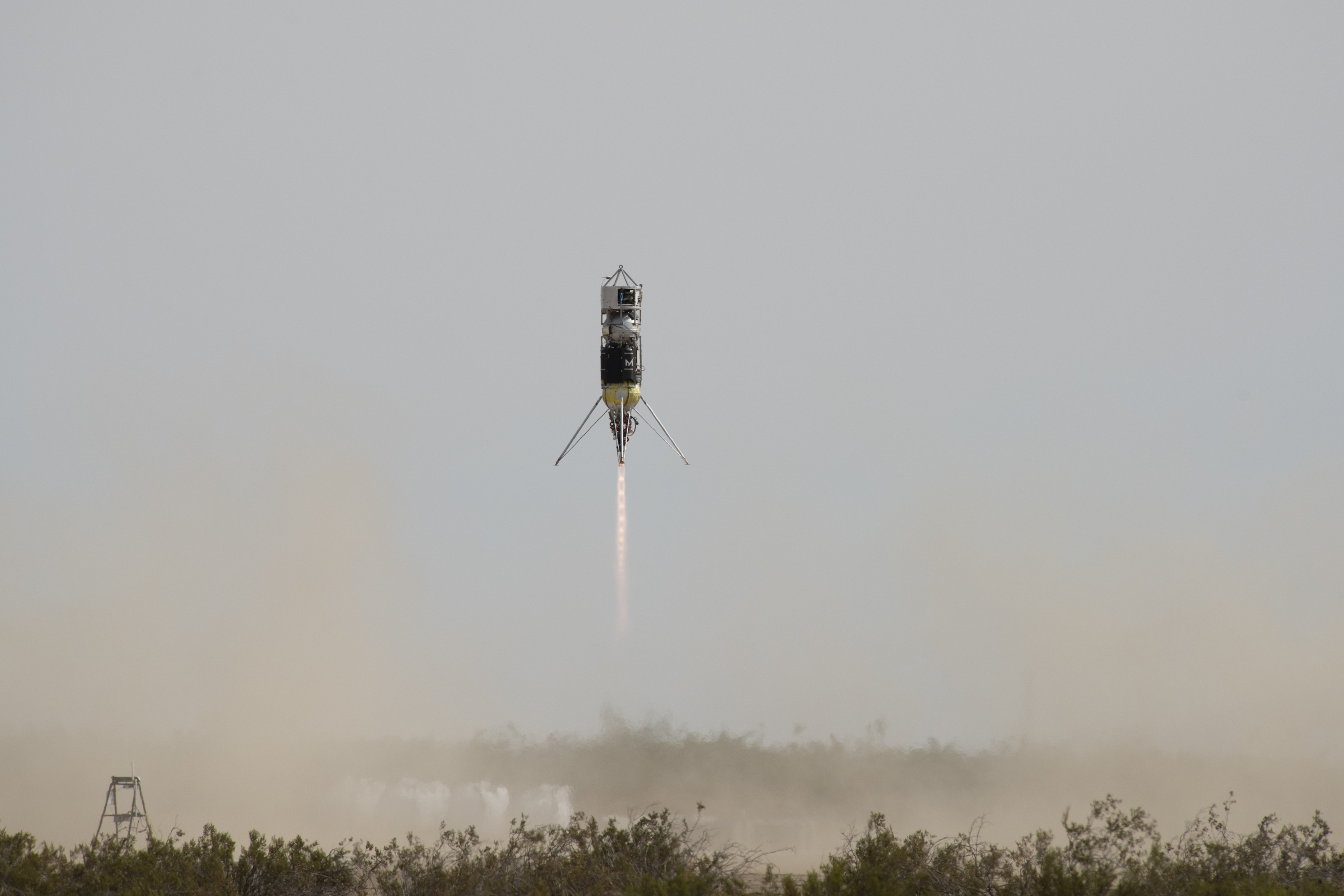
NASA is advancing a laser-based technology designed to help spacecraft land on a proverbial dime for missions to the Moon and Mars. The technology will undergo testing on upcoming suborbital rocket launches with Blue Origin on its New Shepard rocket and ride to the Moon on several commercial landers as part of the Artemis program. Simultaneously, companies are using the technology to help self-driving cars navigate rush hour traffic on this planet.
NASA engineers are designing an approach to safely manage multiple trips to the Moon and Mars that could include delivering tons of scientific and life-support equipment in advance of crewed missions.
It helps to compare the proposed challenge to previous landings: the Curiosity rover, NASA’s most precise Mars landing to date, had a target landing area 12 miles long and 4 miles wide. Future missions will require multiple supply deliveries as well as people to land within a few hundred yards of each other. Only a precision landing and hazard avoidance system can make that possible.
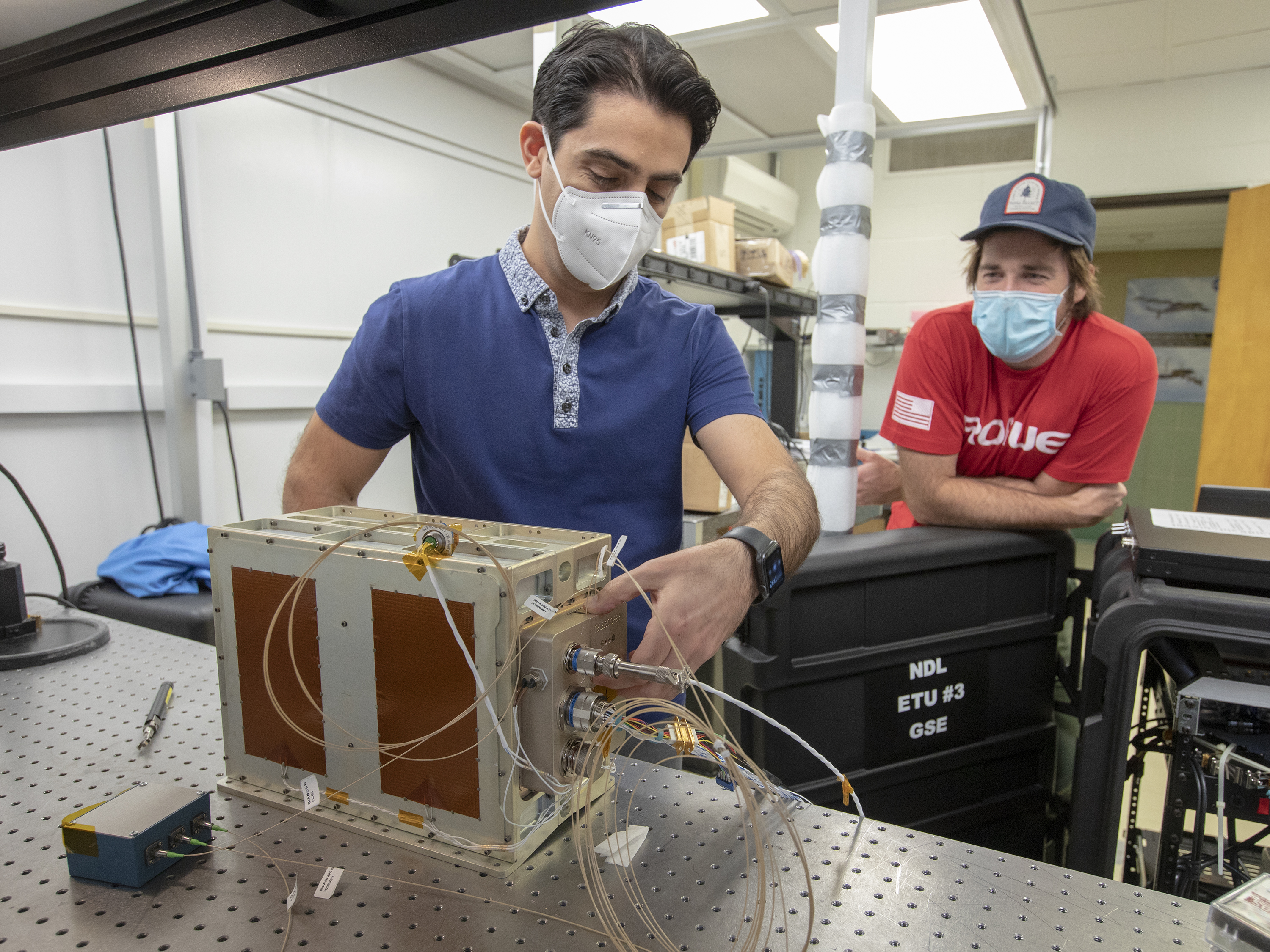
Future landers may use a full suite of technology, including next-generation sensors, cameras, specialized algorithms, and a high-performance spaceflight computer that all work in concert. NASA organized the development of these capabilities under the Safe and Precise Landing – Integrated Capabilities Evolution project, or SPLICE. The technology development effort is under the Space Technology Mission Directorate’s Game Changing Development program. And even as SPLICE prepares for its first suborbital test flight on an upcoming partnership flight with Blue Origin, some of the technologies used on it and fostered along the way are spinning off into the commercial sector.
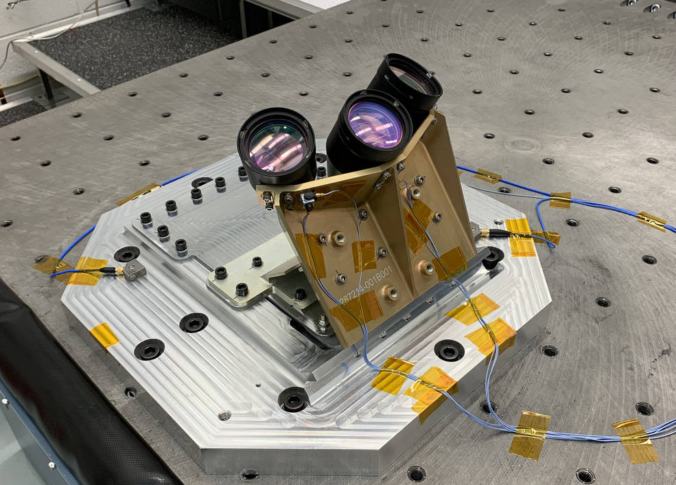
Lidar is a detection system similar to radar that uses light waves instead of radio waves to detect objects, characterize their shape, and calculate their distance. SPLICE uses a new variation called navigation Doppler lidar, or NDL, which goes even further: it detects the movement and velocity of distant objects, as well as the spacecraft’s own motion relative to the ground (such as speed, pitch, roll and altitude).
NDL co-inventor Farzin Amzajerdian, who is the technology’s principal investigator at NASA’s Langley Research Center in Hampton, Virginia, explained that the frequency of the system’s laser is at least three orders of magnitude higher than radars.
“Higher frequency translates to higher-precision data and potentially more efficient and compact sensors,” he said, and “the velocity or speed is obtained by using the Doppler effect.” That is, the frequency of the returned laser light will shift when bouncing off the ground as the spacecraft approaches. So, a spacecraft will have precise data to verify exactly how quickly it’s moving toward the ground and at what angle.
“Navigation Doppler Lidar is expected to become a standard sensor for most NASA landing vehicles” according to Glenn Hines, NDL chief engineer. “NDL demonstration units will be tested on a suborbital vehicle later this month and on two lunar landing missions next year.”
Terrestrial Applications
Steve Sandford, former engineering director at Langley, also believed the technology had valuable terrestrial applications. He supported development of Doppler lidar during his tenure at NASA, seeing initial results first-hand. After retiring, he formed Psionic LLC, based in Hampton, Virginia.
In 2016, the company licensed Doppler lidar technology from Langley. It also entered into a Space Act Agreement with the center to leverage NASA facilities and expertise while developing its commercial version of the technology for uses on this planet as well as maturing it for space applications such as lunar landings.
Psionic is reengineering the hardware, an effort led by Diego Pierrottet, a lidar co-inventor when he worked at NASA and now chief engineer at Psionic. Sandford said the work invested by NASA for decades makes it possible for Psionic to develop a viable manufacturing process to enter the market.
Psionic has defense customers using the adapted technology to reduce the impact on landing aircraft, improve the safety of in-air refueling, and detect drones, according to Sanford. Space companies are exploring applications of the technology in rendezvous and proximity operations and precision landing on the Moon and Mars.
And in the automotive industry, customers are developing self-driving systems for cars that will use the technology in both navigation and collision avoidance.
“Doppler lidar’s high resolution can distinguish between objects that are only several inches apart and even at a distance of several hundred feet,” explained Sandford.
This matters when a pedestrian is crossing a road, or a truck is passing in front of a building. Algorithms need accurate data to determine what the object is – person, building, or truck – and if it’s in the path of the car, avoiding the potentially fatal mistake of not slowing down or stopping in time.
In addition, a game-changing characteristic of this lidar is that it only sees the laser light it generates, ignoring the laser light transmitted from other lidars.
Precision Vision
SPLICE is the product of many years of development. In earlier stages, NASA tested a different kind of 3D imager lidar called a global shutter flash lidar that is also finding use for self-driving cars.
Unlike the single stream of laser pulses in traditional lidar, global shutter flash lidar acquires data across a pixel array, using a single laser pulse to generate the entire map, Amzajerdian said. This allows for much faster results. “You can have tens of thousands of pixels in one single shot of the laser,” he explained.
It also significantly reduces the computational load, because all the data is received at the same moment and in the same physical location – no velocity calculations are necessary.
In 2014, NASA demonstrated an autonomous landing using the technology in a precursor project to SPLICE.
Global shutter flash lidar was invented by Santa Barbara, California-based Advanced Scientific Concepts Inc. (ASC). Although it had already begun, several years of funding from NASA’s Small Business Innovation Research (SBIR) program and other project funds were instrumental to its completion.
“Through all this process we were working with them,” said Amzajerdian. “When we saw problems or areas needing improvement, we tried to understand them and communicate to the company what we saw, and sometimes we’d also suggest solutions to them.”
Today, ASC’s flash lidar is a space pioneer. NASA’s Origins, Spectral Interpretation, Resource Identification, Security-Regolith Explorer (OSIRIS-REx) asteroid sample return mission has one of the cameras to help guide the final approach to Bennu, its target asteroid.
The camera technology, a power efficient version shrunk from its space-bound version, has also been bought by a major automotive parts manufacturer, with an eye to use it in autonomous, self-driving cars.
Editor’s Note: A previous version of these features were originally published in the 2020 Spinoff publication and online. To read the original stories, visit spinoff.nasa.gov.