


![Request for Information – Potential [Placeholder for Prize]](https://assets.science.nasa.gov/dynamicimage/assets/science/psd/solar/2023/09/s/solarsystem_0.jpg?w=1024)


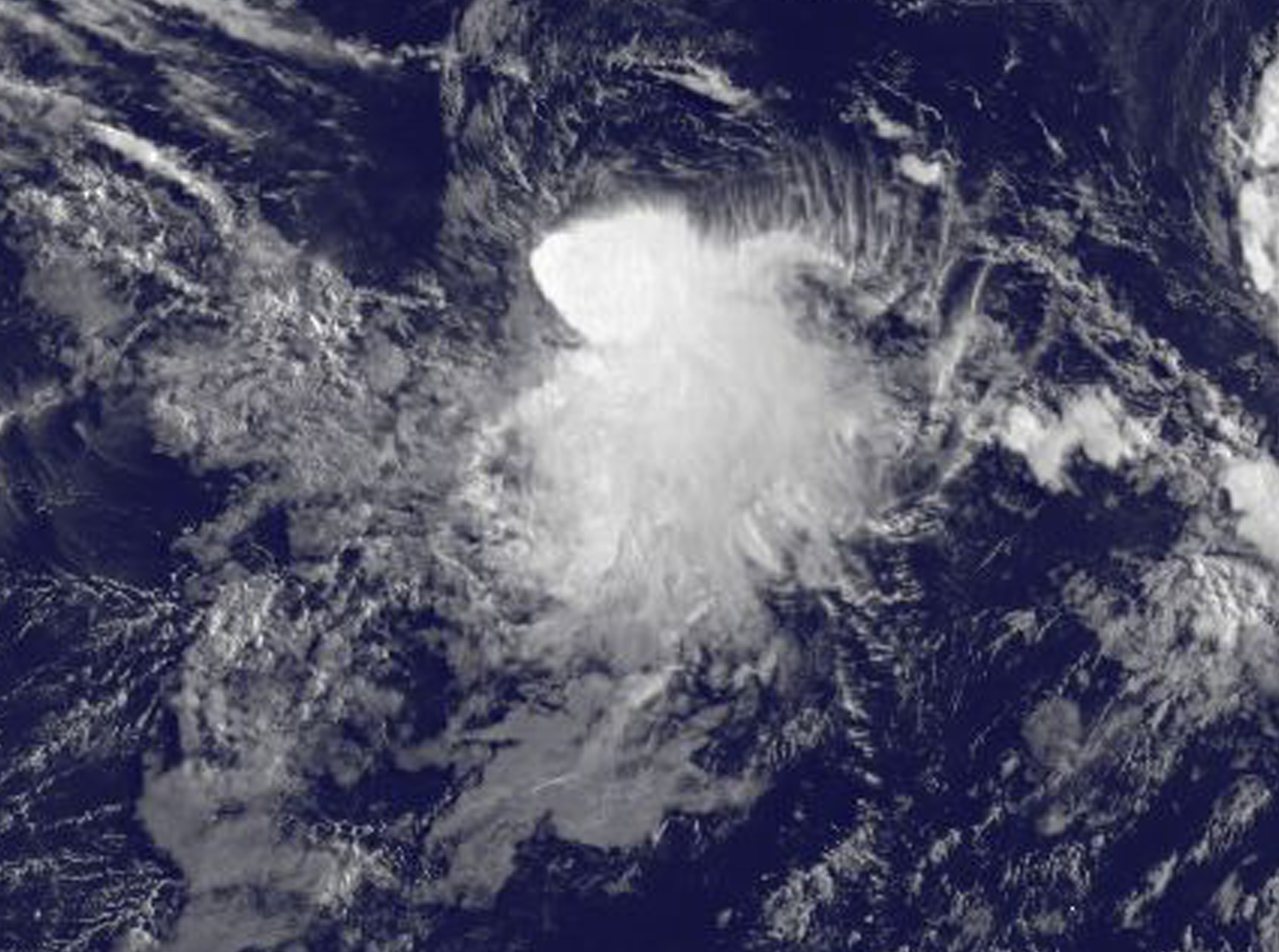
NASA Imagery Shows Disorganized Tropical Depression 8E
Infrared imagery from NASA’s Aqua satellite revealed a lack of organized circulation in Tropical Depression 8E. The storm is sandwiched between Tropical Storm Fernanda to the west and Tropical Storm Greg to the east.
As reported by the National Oceanic and Atmospheric Administration’s National Hurricane Center, at 5 a.m EDT (0900 UTC) on July 20 the center of Tropical Depression 8E was located near 13.7 degrees north latitude and 122.6 degrees west longitude. The depression is moving toward the west-southwest near 6 mph (9 kph). A turn toward the southwest or south-southwest with a decrease in forward speed is expected by Friday. Maximum sustained winds are near 30 mph (45 kph) with higher gusts. The depression is forecast to become a remnant low by this weekend.
For updated forecasts visit: www.nhc.noaa.gov
By Rob Gutro
NASA’s Goddard Space Flight Center, Greenbelt, Md.
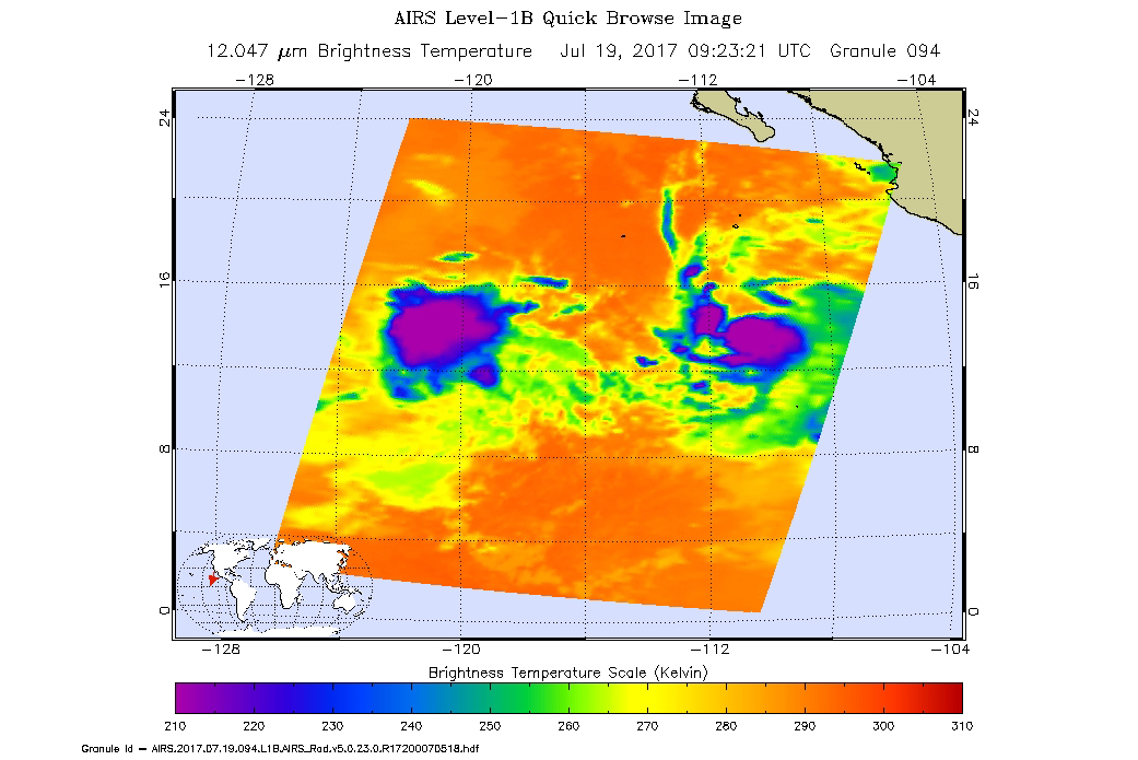
July 19, 2017 – Tropical Storm Depression 8E Depressed by Two Other Storms
Two other tropical cyclones appear to be depressing or inhibiting Tropical Depression 8E’s development. NOAA’s GOES-West satellite imagery on July 19 revealed that Tropical Depression 8E is struggling in the Eastern Pacific Ocean because it’s close to Tropical Storm Greg and Hurricane Fernanda.
NOAA’s GOES-West satellite captured an infrared image of Tropical Depression 8E (TD8E) on July 19 at 8 a.m. EDT (1200 UTC). The National Hurricane Center noted because the depression is close to Tropical Storm Greg, TD8E is not able to strengthen. Forecaster Steward at the National Hurricane Center noted that “the depression engaging in some weak binary interaction with the larger circulation of Tropical Storm Greg as the latter cyclone passes about 200 nautical miles to the north over the next few days.
In the image, created by the NASA/NOAA GOES Project at NASA’s Goddard Space Flight Center in Greenbelt, Maryland, the strongest thunderstorms associated with the depression were south of the center of circulation. Infrared imagery revealed that some of those cloud top temperatures were as cold as minus 70 degrees Fahrenheit.
The National Hurricane Center (NHC) noted at 5 a.m. EDT (0900 UTC), the center of Tropical Depression 8E was located near 14.6 degrees north latitude and 120.8 degrees west longitude. That’s about 915 miles (1,470 km) southwest of the southern tip of Baja California, Mexico. The depression was moving toward the west-southwest near 6 mph (9 kph) and this general motion is forecast to continue today. A turn toward the southwest at a similar forward speed is expected on Thursday, July 20. Maximum sustained winds are near 35 mph (55 kph) with higher gusts. Little change in strength is forecast during the next 48 hours.
It’s not only Tropical Storm Greg that’s preventing Tropical Depression 8E from getting better organized. Hurricane Fernanda, located on the other side of the depression, to the storm’s west, is also having an effect.
NHC’s discussion noted that the upper-level westerly outflow on the east of Hurricane Fernanda is expected to keep the depression in a moderate to strong vertical wind shear regime for the next couple of days. After that, northerly outflow from Tropical Storm Greg should act to maintain unfavorable shear conditions across the depression, preventing any significant strengthening until the system dissipates by 96 hours.
For updated forecasts, visit: www.nhc.noaa.gov.
By Rob Gutro
NASA’s Goddard Space Flight Center, Greenbelt, Md.
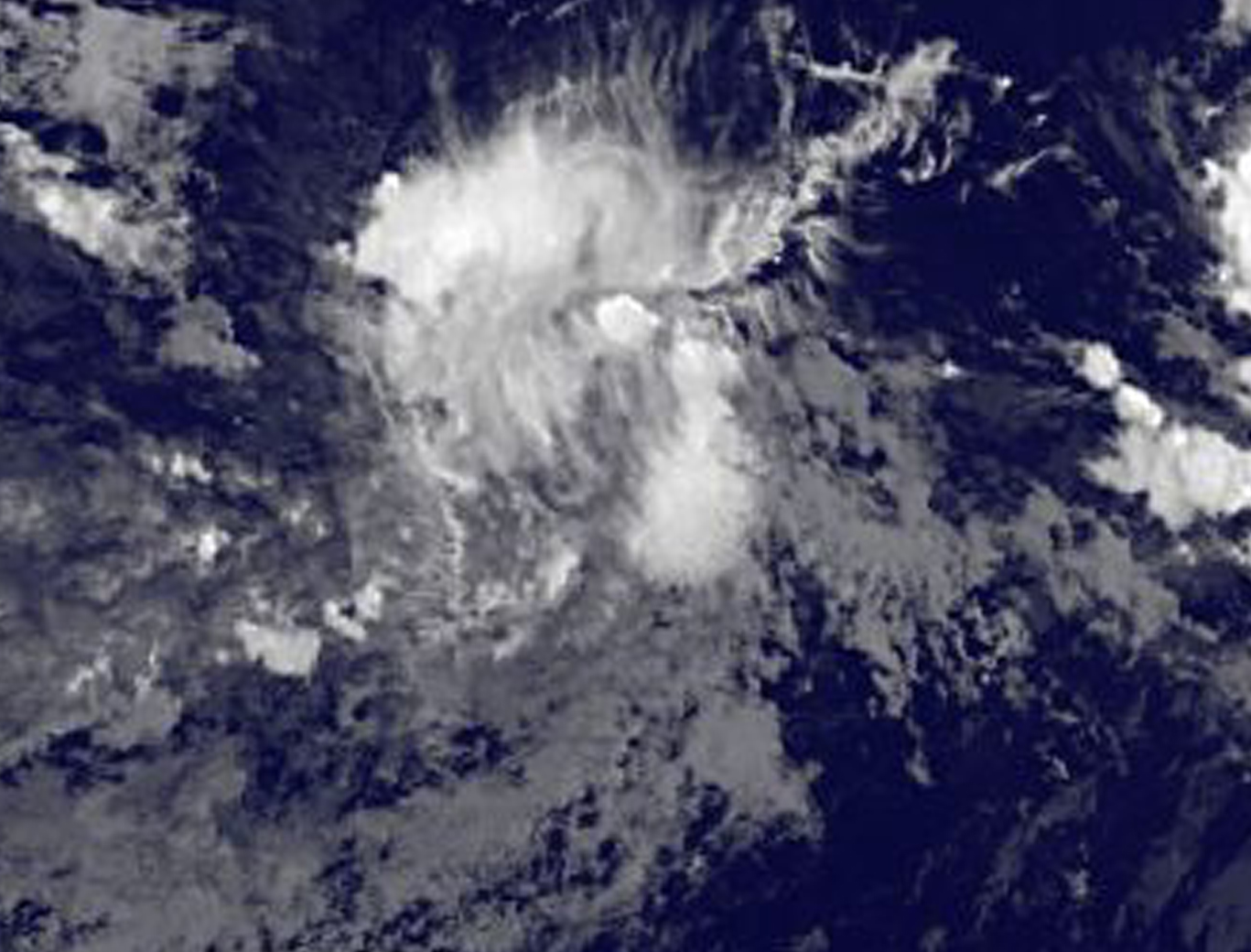
July 18 – Satellite Image Captures Development of Tropical Storm Depression 8E
As Hurricane Fernanda moves toward the Central Pacific, and Tropical Storm Greg moves away from the Mexican coast, a new tropical depression formed in between the two tropical cyclones. NOAA’s GOES-West satellite saw the development of Tropical Depression 8E in the Eastern Pacific Ocean on July 18.
NOAA’s GOES-West satellite captured an infrared image of Tropical Depression 8E on July 18 at 8 a.m. EDT (1200 UTC). The National Hurricane Center noted that deep convection developed closer to the system’s center overnight and it has also produced convection for more than 24 hours despite strong northwesterly shear. The image, created by the NASA/NOAA GOES Project at NASA’s Goddard Space Flight Center in Greenbelt, Maryland, showed that the bulk of clouds associated with the depression were being pushed southeast of the center from the northwesterly vertical wind shear.
The National Hurricane Center (NHC) noted at 11 a.m. EDT (1500 UTC) the center of Tropical Depression 8E was located near 14.6 degrees north latitude and 118.8 degrees west longitude, about 815 miles (1,315 km) southwest of the southern tip of Baja California, Mexico. The depression was moving toward the west near 5 mph (7 kph). A turn toward the southwest is expected later today, and a slow southwestward motion is expected to continue through early Thursday. The estimated minimum central pressure is 1,007 millibars.
Maximum sustained winds are near 35 mph (55 kph) with higher gusts.
Slight strengthening is possible and the depression could become a tropical storm during the next day or so.
For updated forecasts, visit: www.nhc.noaa.gov.
By Rob Gutro
NASA’s Goddard Space Flight Center, Greenbelt, Md.