


Operation IceBridge, NASA’s airborne survey of polar ice, completed its first Greenland research flight of 2016 on April 19, kicking off its eighth spring Arctic campaign. This year’s science flights over Arctic sea and land ice will continue until May 21.
During its seven years of operations in the Arctic, IceBridge has gathered large volumes of data on changes in the elevation of the ice sheet and its internal structure. Measurements from IceBridge have revealed a 460-mile-long (740 kilometers) canyon hiding under a mile of ice and mapped the extent of a vast liquid water aquifer beneath the snow in southern Greenland. IceBridge’s readings of the thickness of sea ice and its snow cover have helped scientists improve forecasts for the summer melt season and have enhanced the understanding of variations in ice thickness distribution from year to year.
This campaign’s flights will be conducted aboard one of the National Oceanic and Atmospheric Administration’s (NOAA) hurricane hunter planes, a P-3 Orion. NOAA is also providing a full crew and collecting atmospheric data during the IceBridge flights. Despite being the same type of aircraft than the one IceBridge often uses in the Arctic, the NOAA P-3 has been modified to allow it to fly into hurricanes, which made the installation of IceBridge’s instruments challenging.
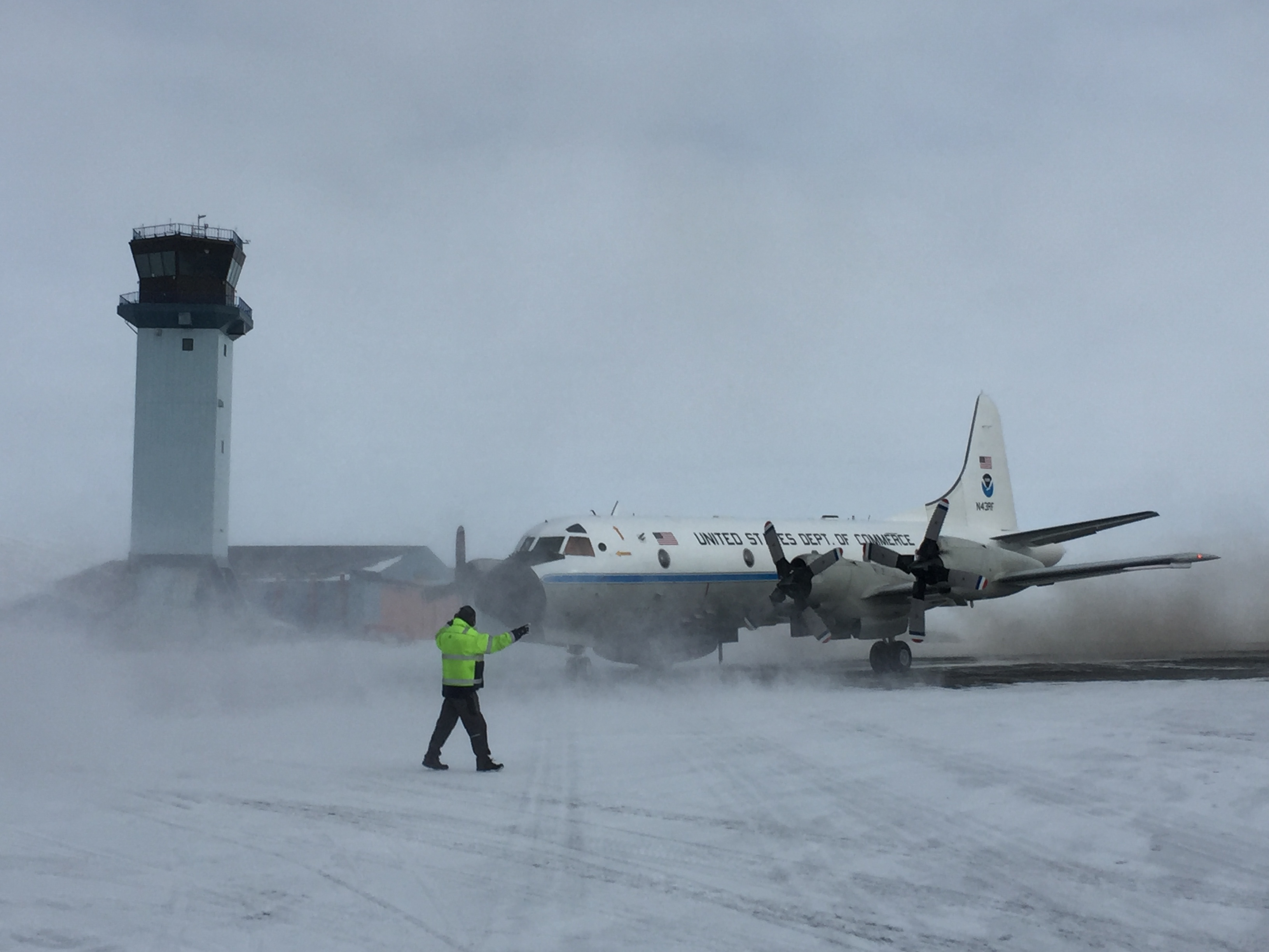
“We had to adapt all of our instruments to work on the aircraft, because under the floor there’s a fair amount of additional structure that we’re not used to in our own P-3, and it affects what can be placed under the deck and at the ports in the belly of the plane,” said John Sonntag, mission scientist for IceBridge. “It all worked out, but it required some compromises.”
The plane will carry a laser altimeter to measure the elevation of sea and land ice, three types of radar instruments to study the ice layers and the bedrock underneath the ice sheet, and a high-resolution camera technology to create color maps of polar ice. Furthermore, during this campaign IceBridge scientists are running two types of infrared cameras to measure surface temperatures, which will allow the accurate detection of open water and young ice thickness between sea ice floes even in flights flown during nighttime.
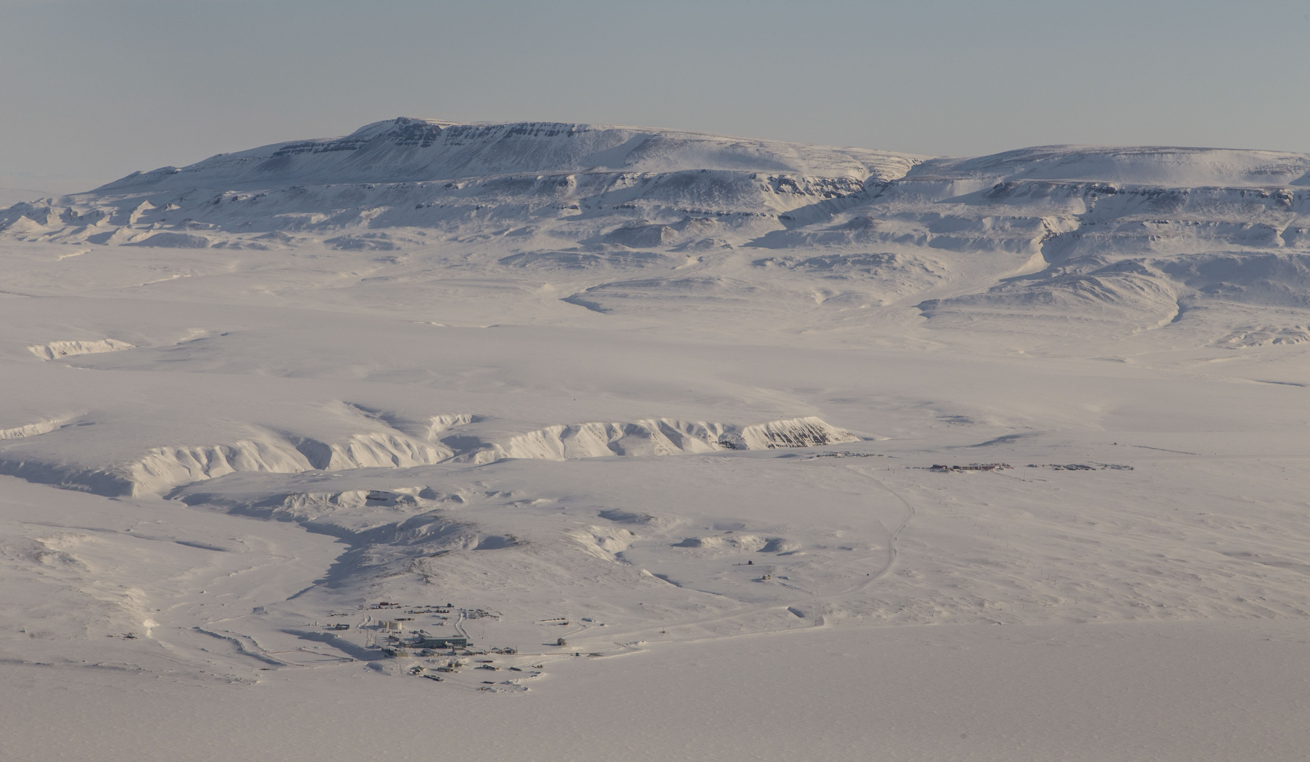
The first leg of the mission will be based out of Thule Air Base in northwest Greenland and out of Fairbanks, Alaska. Ten high-priority sea ice flights and three land flights are planned from these two sites. The sea ice flights will collect sufficient data to give scientists a good sense of how the sea ice thickness is distributed in the west Arctic basin, said Jackie Richter-Menge, IceBridge science team co-lead and sea ice researcher with the U.S. Army Corps of Engineers Cold Regions Research and Engineering Laboratory in Hanover, New Hampshire.
“This winter has been especially warm up in the Arctic, so there’s a lot of speculation about how the summer melt is going to unfold,” Richter-Menge said. “We know from the data IceBridge has been providing us that the sea ice thickness distribution in the Beaufort Sea is very important for anticipating how the summer melt is going to go, so we want to make sure we get adequate coverage in this region to give the modelers good data to initiate their seasonal forecasts.”
The second part of the Arctic campaign will be based in Kangerlussuaq, Greenland and will focus on gauging surface elevation changes in land ice.
“Our main priority is to look at the changes that have taken place since our previous campaigns, especially to look at fast-retreating glaciers like Jakobshavn and see how far inland they’re melting away,” said Eric Rignot, IceBridge science team co-lead and glaciologist at the University of California, Irvine and NASA’s Jet Propulsion Laboratory in Pasadena, California.
There will be seven high-priority land flights for this phase of the campaign, all of them repeats of lines that IceBridge flew during last year’s post-melt campaign.
“By replicating most of the lines we flew in the spring and fall last year, we will look at not only yearly changes but also at seasonal changes, and this will help evaluate regional atmospheric climate models that reconstruct melt and snowfall on the ice sheet,” Rignot said.
As in previous years, Operation IceBridge will cooperate with several international research initiatives. Some of the collaborations are ongoing, such as an overfly of a field site in Eureka Sound, where scientists from Environment and Climate Change Canada are collecting measurements of the depth of the snow cover over sea ice, and at least one flight under one of the lines followed by the European Space Agency’s CryoSat-2 satellite. But there are also two new collaborations this year: the first is with the University of Alaska, Fairbanks. For this joint project, IceBridge will fly in a racetrack formation off the coast of Alaska to study the transition between shore-fast ice (sea ice attached to the coastline) and drifting ice. The second collaboration is with the recently launched European satellite Sentinel-3; weather permitting, IceBridge will fly under one or more sections of the spacecraft’s orbit.
“These collaborations are important to tie our data to the big picture,” said Nathan Kurtz, IceBridge’s project scientist. “When we fly over a group taking measurements from the ground, we can determine the accuracy of our larger, regional airborne data. Then we can extrapolate even further by combining our more detailed regional data with the large-scale coverage of the satellites.”
The mission of Operation IceBridge is to collect data on changing polar land and sea ice and maintain continuity of measurements between ICESat missions. The original ICESat mission ended in 2009, and its successor, ICESat-2, is scheduled for launch in 2018. Operation IceBridge is currently funded until 2019. The planned overlap with ICESat-2 will help scientists validate the satellite’s measurements. NASA’s Wallops Flight Facility in Virginia provided the laser altimeter and one of the infrared cameras that are being used during IceBridge’s 2016 Arctic spring campaign. IceBridge’s tree radar instruments come from the Center for Remote Sensing of Ice Sheets at the University of Kansas, while NASA’s Ames Research Center at Moffett Field, California, provided the Digital Mapping System, and the University of Colorado loaned the second infrared camera.
For more about Operation IceBridge and to follow this year’s campaign, visit: https://www.nasa.gov/icebridge