![Request for Information – Potential [Placeholder for Prize]](https://assets.science.nasa.gov/dynamicimage/assets/science/missions/a-step/FFR_Earth_Background_20251120%20.png?w=1024)


Article by: Milan Loiacono
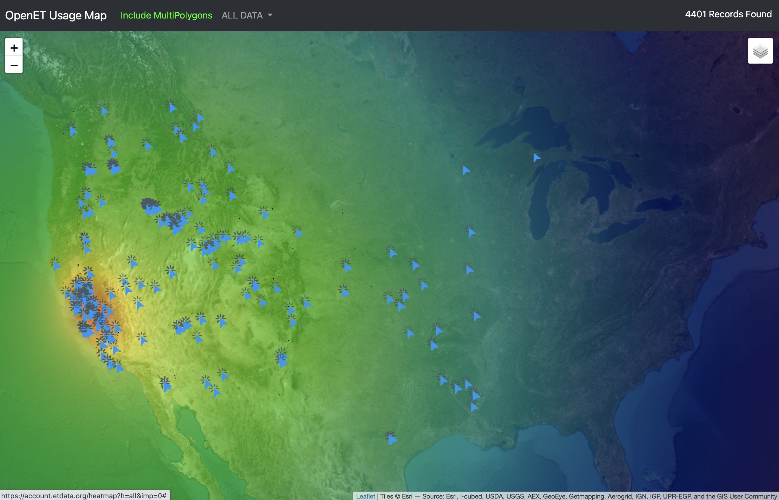
On Tuesday, October 3, the OpenET consortium launched an application programming interface (API) and open data service for the satellite-based datasets available through its widely-used Data Explorer tool.
OpenET provides satellite-based information on evapotranspiration (ET) and agricultural water use, and is currently deployed across the 23 westernmost continental states. The program provides water use data at the scale of a quarter acre per pixel – roughly the size of two basketball courts – and is available at daily, monthly, and annual time scales.
Evapotranspiration refers to the process by which water is transferred from land surface to the atmosphere, primarily through evaporation (from soil) and transpiration (from plants). ET fluctuates in response to a number of environmental influences, and is therefore an impactful, but historically difficult, factor for any water management system to account for. The ability to monitor ET creates a more accurate understanding of water usage and consumption, in order to inform decisions related to agricultural water management, water conservation, and drought response and mitigation.
The OpenET Data Explorer is freely available online, and allows anyone with an internet connection to easily access, download, retrieve and review data on the amount of water consumed through evapotranspiration, for any location in the Western United States.
The October 3 launch of the API comes as the second piece of a three-part initiative to achieve this goal: stage one was the creation of the Data Explorer itself. Stage two, the new API, is designed to allow data to be more easily retrieved and integrated with a variety of water management applications at local, state, or federal levels. Stage three, currently projected to launch next year, will be focused on delivering data to individual farmers and ranchers and will provide additional tools designed to support on-farm water management and irrigation scheduling.
The NASA Project Scientist for OpenET, Forrest Melton, notes that there are many applications of the new API, including, “on-farm water management and irrigation planning and scheduling, the development of water balances for an individual irrigation district or watershed, and the design and implementation of incentive-based water conservation programs. The API is the piece that will allow partners in the water resources management and agricultural sectors to begin to automatically integrate data from OpenET into other applications and tools.”
The API is the piece that will allow partners in the water resources management and agricultural sectors to begin to automatically integrate data from OpenET into other applications and tools."

Forrest melton
NASA Project Scientist for OpenET
There are currently 10 states retrieving and incorporating information from OpenET into various state water data information systems; the API will now make it easier to formalize and automate the data retrievals, and hopefully enable more states to integrate satellite data into their water management platforms in the future.
According to Will Carrara, lead software engineer for the API, NASA’s commitment to open science has also played a key role in the design of the OpenET data services. “We designed OpenET to bring transparency and accessibility to water data. By leveraging cloud technology and satellite imagery, we’re empowering farmers, water managers, and policy-makers with the high-resolution information they need to make informed decisions. The API represents a commitment to this belief.”
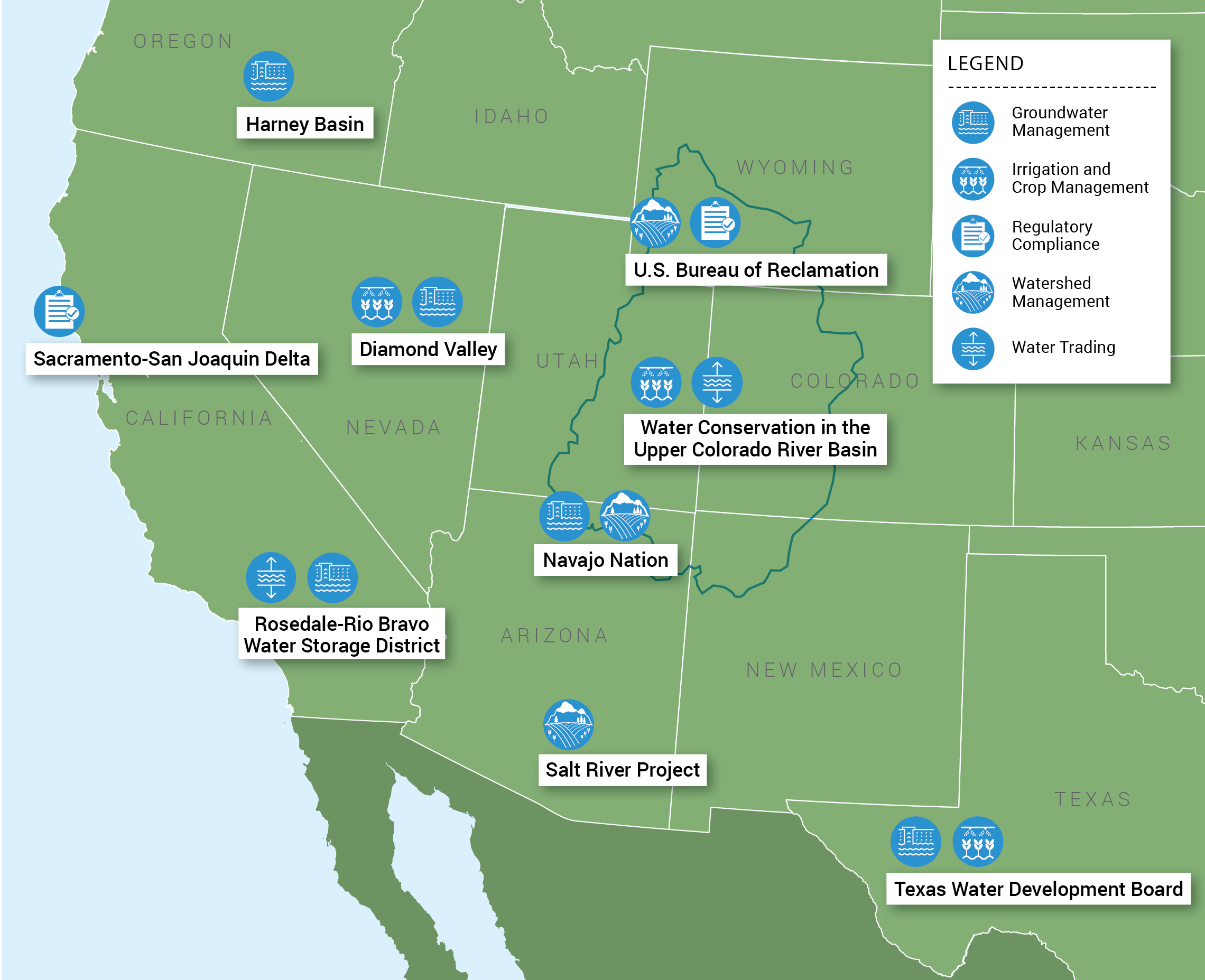
In an example of the need and efficacy of OpenET’s data systems, the new API is already being used as part of the Delta Alternative Compliance Plan. California passed a law in 2015 requiring the monitoring and reporting of all water diversions of more than 10 acre-feet per year, affecting thousands of farms in the San Francisco Bay-Delta where measuring water diversions and return flows is an expensive, complex, and time-consuming ask. Farmers worked with the Delta Watermaster’s Office to propose the use of OpenET in water use reporting, and were successful: the API now facilitates the automatic integration of data from OpenET with California State Water Resources Control Board’s Report Management System. Maurice Hall, OpenET Director and Senior Advisor for Climate Resilient Water Systems at Environmental Defense Fund, remarked on the significant impact the integration had on the farmers’ workloads for regulatory compliance:
“The process for reporting water use in the Delta that used to take farmers half a day to a day, can now be completed in as little as ten minutes. [It also] saves them thousands of dollars per year in costs for deploying and maintaining flow meters.”
“The process for reporting water use in the Delta that used to take farmers half a day to a day, can now be completed in as little as ten minutes.”
MAURICE Hall
OpenET Director and Senior Advisor, Climate Resilient Water Systems, Environmental Defense Fund
Water resource management has historically been a contentious subject for California, and Melton said it is gratifying to help create a “win-win” opportunity that is mutually beneficial for both parties;
“They’ve had record levels of reporting this last year. We know it’s saved farmers money and time, and given the state more consistent data across the Delta, which is a critical nexus for water management in the state. For folks that work in water and understand how challenging these types of problems have been in the past, it’s an important advance and a huge win.”

The OpenET team is also working with water resources managers in other regions in the West to begin integrating satellite data into a range of other applications, and Melton sees important benefits for supporting water conservation programs in places like the Upper Colorado River Basin. Unlike the Delta, these applications would focus less on water use reporting and more on supporting the development of incentive-based water conservation programs, as well as quantifying reductions in consumptive use of water. Such a program would allow farmers, ranchers, and other agricultural water rights holders to apply for funding to conserve water in the Colorado River Basin. OpenET would allow both water users and program administrators to access and review the same information at the same time to verify the program was working well.
Using OpenET to support incentive-based water conservation programs, however, is just one of the intended outcomes of the new API. Other goals stretch across the West, and include:
- Supporting implementation of the Sustainable Groundwater Management Act in California and automating data delivery for the engineering firms and consultants that are supporting groundwater sustainability agencies across California
- Supporting automated retrieval into state-run water data systems, such as the Columbia River Basin Evapotranspiration Mapping Tool; a multi-state initiative co- developed by the Oregon Water Resources Department, Idaho Department of Water Resources, Washington Department of Ecology, and the Desert Research Institute
- Integrating data into the Utah Colorado River Accounting and Forecasting system, to provide water managers in Utah with consistent and accurate information on consumptive water use across Upper Colorado River Basin in Utah
- Providing near real-time and forecasted evapotranspiration information to support irrigation scheduling, thereby aiding individual farmers and ranchers in implementing data-driven approaches to irrigation scheduling
The programming work to build the API was a collaborative effort led by OpenET team members at NASA Ames Research Center, the Desert Research Institute and Habitat Seven. Additional partners at Google Earth Engine host petabytes of imagery and provide substantial computational resources.
The team also worked closely with more than one hundred end-user agencies and agricultural organizations to test and refine the platform before its official release. The initial launch went out to the roughly 10,000 registered users of OpenET, with the intent for wider promotion once the initial wave of usage is passed and the platform is performing smoothly.
Looking at what is next for OpenET, Melton stated that the third stage of the open data architecture will be geared towards individual farmers and ranchers, creating custom reporting tools for farm and ranch management support. This final iteration will focus on providing a user-friendly interface to engage with those users that may be interested in the technology but may not have the programming background to automatically retrieve the data via the API. The graphical user interface, formally titled the OpenET Farm and Ranch Management Support (FARMS) tool, will sit on top of the API and guide users through the basics of setting up queries and running recurring reports.
The ultimate goal is to ensure that anyone can easily access and use information from OpenET, and that the information is being used on a day-by-day basis to inform water management decisions for both individual farms and ranches, as well as entire river basins.
To learn more about OpenET or to check out the free Data Explorer tool, visit https://openetdata.org/.
The OpenET API launch was only possible because of the collaborative efforts of individuals across organizations. On the software side: Will Carrara and Alberto Guzman (CSUMB / NASA ARC), Britta Daudert and Matt Bromley (Desert Research Institute), and Jordan Harding (Habitat Seven). On the data applications side: AJ Purdy and Lee Johnson (CSUMB / NASA ARC), and Maurice Hall, Robyn Grimm, Rachel O’Connor and Garshaw Amidi-Abraham (OpenET, Inc.).
OpenET is a public-private collaboration led by NASA, Desert Research Institute, Environmental Defense Fund, and HabitatSeven. Additional team members include Google Earth Engine, U.S. Geological Survey, U.S. Department of Agriculture, California State University Monterey Bay, University of Idaho, University of Maryland, University of Nebraska-Lincoln, University of Wisconsin-Madison, UCLA, and Universidade Federal do Rio Grande do Sul in Brazil.