


NASA’s Aqua satellite passed over a developing low pressure area in the southwestern Gulf of Mexico and captured infrared data on what is now the latest destination for NASA’s Hurricane and Severe Storms Sentinel mission. On Sept. 19, NASA’s HS3 mission sent an unmanned Global Hawk aircraft to investigate and gather data from low pressure System 95L, located in the Bay of Campeche.
On Sept. 19 at 07:35 UTC/3:35 a.m. EDT, NASA’s Aqua satellite passed over System 95L and the Atmospheric Infrared Sounder instrument or AIRS instrument that flies aboard it captured infrared data on the developing low. AIRS infrared imagery showed cold cloud top temperatures, indicating strong convection (rising air that cause thunderstorm development). Some of the strongest cloud top temperatures were near -63F/-52C. Those coldest cloud tops and strongest thunderstorms were scattered over the Yucatan Peninsula, the southern Bay of Campeche, the extreme northwestern Caribbean Sea and over the coast of Belize.
On Thursday, Sept. 19 at 8:10 a.m. EDT, NASA’s Global Hawk 872 departed from Runway 10 at NASA’s Wallops Flight Facility, Wallops Island, Va. NASA’s Global Hawk 872 carries the environmental payload of instruments that include the CPL or Cloud Physics Lidar, S-HIS or Scanning High-Resolution Interferometer Sounder Instrument, and NOAA’s AVAPS dropsonde system.
System 95L was producing disorganized shower and thunderstorm activity during the morning of Sept. 19. The National Hurricane Center noted that conditions still appear conducive for the formation of a tropical depression during the next day or two. System 95L has a high chance of becoming a tropical depression in the next day as it moves west-northwestward to northwestward at 5 to 10 mph. The low pressure area is expected to spread heavy rain over portions of eastern and southern Mexico drenching areas already soaked by Hurricane Ingrid.
Text Credit: Rob Gutro
NASA’s Goddard Space Flight Center in Greenbelt, Md.
August 24, 2013 – Mission Update: Getting the Global Hawk in shape
The Global Hawk (tailnumber NASA872) is back in the air right now, flying towards the Canary Islands off of the coast of Africa. The plane took off this morning, and will return on Sunday morning. The “lawn-mower” pattern will look at some more Saharan dust, compare the “dry” conditions in the subtropics with a very “wet” region to the south, look at a jet that is only a few thousand feet off the surface of the ocean, and look at a system that did NOT develop into a tropical storm.
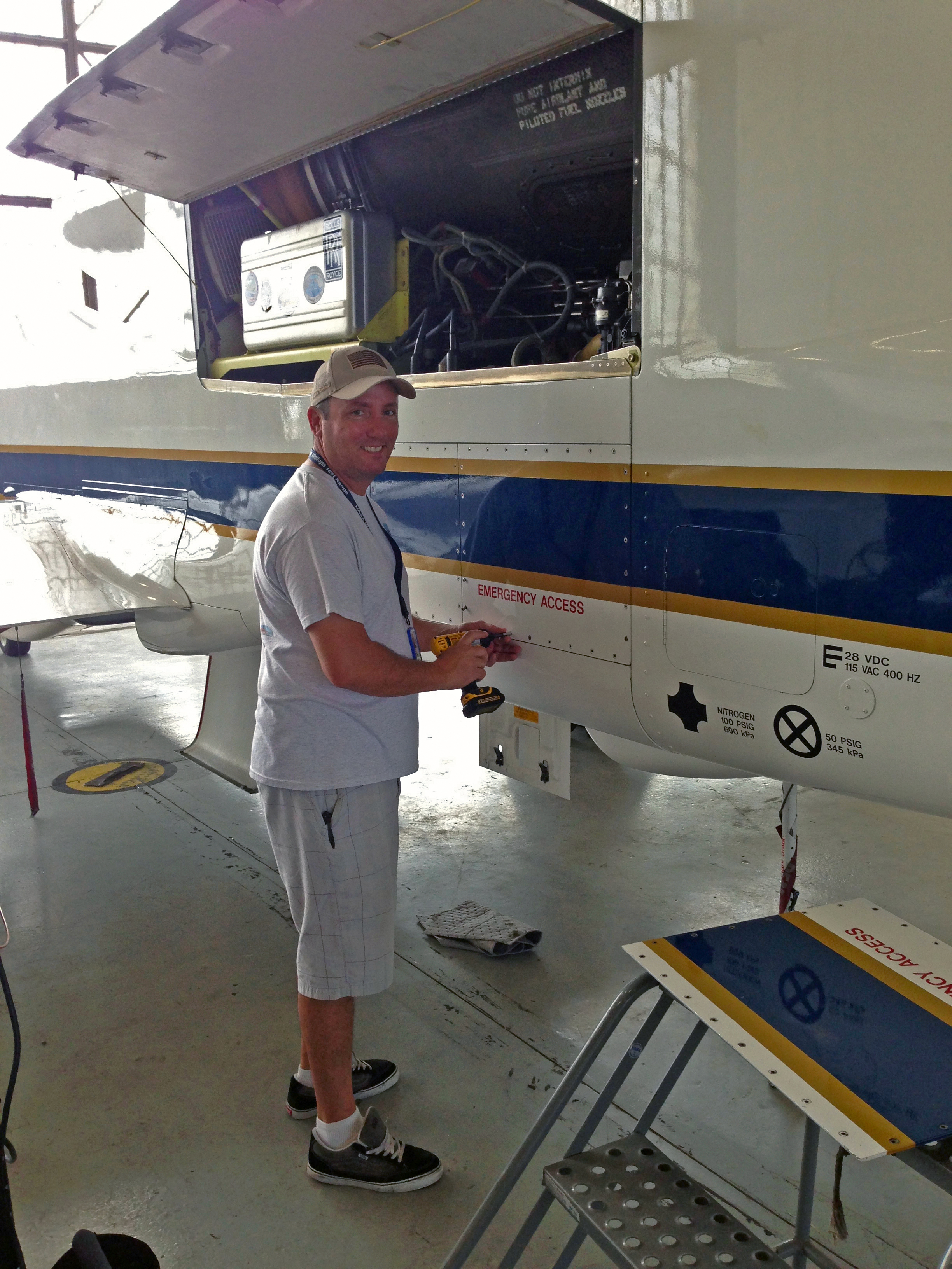
Watching the care and detail that goes into the preparation of the Global Hawk for flight is very interesting. First, after the last flight’s completion, the crew will refuel the plane. This refueling takes a long time, since the Global Hawk uses a lot of fuel – more that 12,000 lbs! The crew then does a full inspection of the plane to make sure that nothing happened to the aircraft systems during the flight. Keep in mind that this plane takes off with a surface temperature of about 80˚F and will fly into the tropical tropopause region with temperatures of about -107˚F at 54,000 feet. A temperature change of about 190˚F! Would your laptop work after such a temperature change?
Mike Bereda and Kenny Wilson are the crew chiefs for our Global Hawks. While the pilot is “in command” when the airplane is flying, the crew chief are “in command” on the ground. Mike, Kenny and the crew spent the time since our Wednesday (Aug. 21) landing doing maintenance on the Global Hawk and repairing some components on the plane. When you have a really complex piece of hardware, there are always little things and gadgets to fix. Of course, you also need to track and document all of the fixes and changes you make. That means that the crew also does lots of paperwork!
On a winning NASCAR team, the driver always gets to hoist the trophy after a victory, but the pit-crew is the vital part of the team that makes sure the car runs fast and safely. The HS3 science team stands on the shoulders of our excellent maintenance crew!
Text Credit: Paul A. Newman
NASA’s Goddard Space Flight Center in Greenbelt, Md.
August 23, 2013 – Mission Update: The flight is done, but has the dust settled?
The Hurricane and Severe Storm Sentinel, or HS3, mission completed its first science flight on Wednesday morning, Aug. 21! As I mentioned, HS3 uses the Global Hawk unmanned aircraft, and this plane took off on Tuesday morning from NASA’s Wallops Flight Facility near Chincoteague, Va., and landed 25 hours later. While the plane is unmanned, our ground station “mission control” (the Global Hawk Operations Center or GHOC) is always staffed with pilots, scientists and computer experts. This staffing is difficult, because the plane flies a lot longer than the people can maintain their focus. Hence, we do a series of “shifts,” where the scientists and pilots will swap after doing a regular work day – including a graveyard shift.
The objective of our flight was to look for dust that had come from the Sahara Desert out over the Atlantic. Why look at dust? Currently, there are competing theories on the impact of this dust. Some scientists say that dust makes hurricanes worse, while others say that the dust kills off hurricanes. How do we determine who’s correct? The first thing to do is make measurements!
We start with a prediction of where the dust might be in the broad Atlantic. This prediction comes from a model that both kicks up the Sahara dust, and then carries the dust on the wind into the Atlantic. The model is run at NASA’s Goddard Space Flight Center in Greenbelt, Md. During hurricane season from June to November, we see lots of dust from the Sahara out over the Atlantic. Not only is this air dusty, but it is also very dry. Keep in mind that hurricanes need hot and moist air to develop and thrive. A gulp of this dusty and dry air tends to asphyxiate a hurricane.
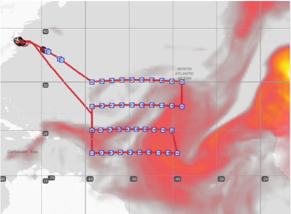
The image shows the dust prediction over the Atlantic. The “yellow” colors show thicker dust, while the red colors show thinner dust. On the top left, you can see the Atlantic Coast, and the “gray” image of the Global Hawk on the ground. The flight path that we were attempting to fly is shown as the red line. We call this a lawn-mower pattern, since we were flying east, then south, then west, etc. Each of the E-W lines is about 680 miles (1,100 km) in length. The area of the big “box” is close to 700,000 square miles. The Global Hawk can cover a lot of territory!
So what did we see? We have an instrument on the plane called the Cloud Physics Lidar or CPL. Dr. Matt McGill at NASA Goddard is the principal investigator for CPL. CPL did indeed see lots of that dust up to altitudes of about 2 miles. Hence, we got a nice dusty flight.
What’s the current plan? Right now we don’t have a lot of hurricanes to look at. Our speculation is that the dry and dusty conditions of the Atlantic are causing this lack of targets. Hence, we plan to do another dust flight this weekend.
Text Credit: Paul A. Newman
NASA’s Goddard Space Flight Center in Greenbelt, Md.
August 14, 2013 – Mission Update: HS3 is Spinning up for Science
The Hurricane and Severe Storm Sentinel or HS3 mission is almost underway. HS3 will be using two Global Hawk aircraft. These Global Hawks are unmanned aircraft systems (UASs) that can remain aloft for more than 26 hours and fly half-way around the globe in a single flight. HS3 will be flying our Global Hawks over hurricanes in the Atlantic, Gulf of Mexico, and Caribbean over the next month.
The Global Hawks are based at the NASA Dryden Flight Research Center just outside of Los Angeles, California. However, in order to be closer to hurricanes, we will be flying from the Wallops Flight Facility near Chincoteague, Virginia. We plan to fly the planes from Dryden to Wallops over the next few days, weather permitting.
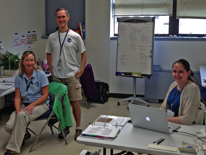
Getting Wallops ready for the mission is a very large task. We have crews and pilots coming in from Dryden. We have about 30 scientists coming to Wallops from Maryland, Wisconsin, California, Alabama, and Colorado. Everyone needs office space, tables, chairs, etc. The aircraft crews need to worry about fuel storage, work benches, tools, spare parts, electronics and a host of other maintenance and operational issues. We’re all located in large hangar at Wallops that is well equipped with office furniture, copiers, printers, WIFI, and all the other amenities of home.
Fortunately, we have a dedicated group of people from here at Wallops and the NASA Ames Research Center to help set-up all of the tents of our traveling science circus. Ron Walsh is our NASA point man here at Wallops. Ron is constantly on the prowl to solve problems and smooth the waters. Ron is ably assisted by Barbara Justis.
The Earth Science Project Office (ESPO) from NASA Ames manages the entire mission. Marilyn Vasques is the Project Manager, and her deputy is Bernadette (Bernie) Luna. While we scientists are pretty good at figuring where to fly our planes, the backbone of the missions comes from the organization, attention to detail, and pure sweat of folks like Marilyn and Bernie.
Text Credit: Paul A. Newman
NASA’s Goddard Space Flight Center in Greenbelt, Md.