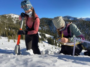


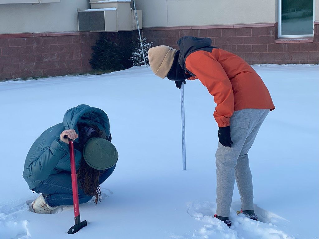


NASA scientists are testing a technology that from orbit could more accurately measure water stored in snow.
NASA scientists are testing a technology that could more accurately measure water stored in snow as seen from a satellite in orbit.
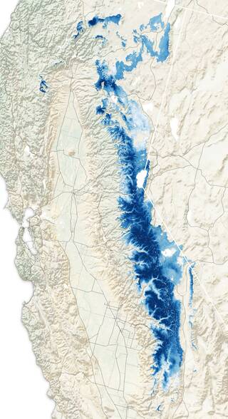
Melting snow provides much of the water that the western United States depend on for agriculture and power. But warming winters due to climate change led to decreased seasonal snowpacks high up in the Rockies and Sierra Nevada mountains. That in turn affects the volume of water that travels downriver to irrigate crops and turn hydroelectric turbines.
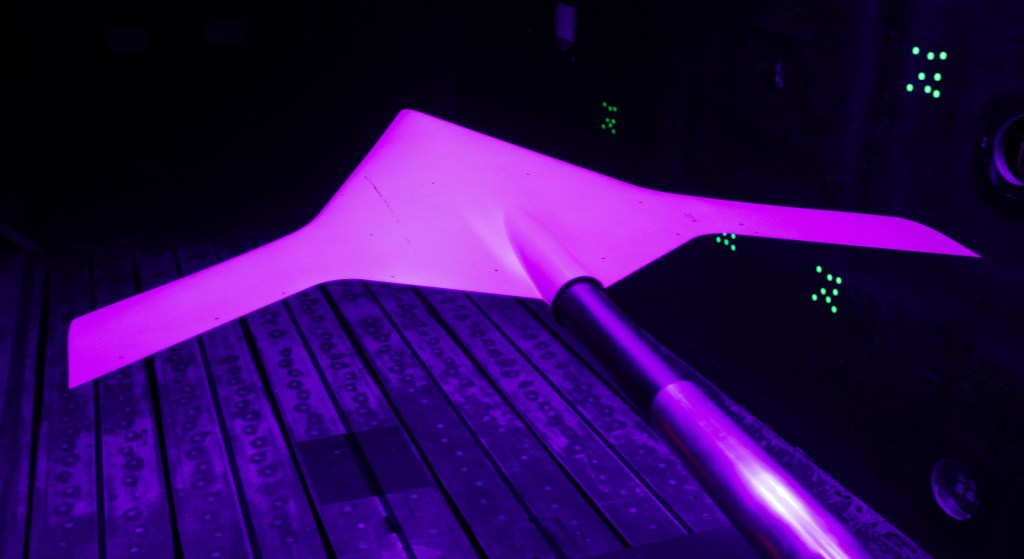
“If you take out the seasonal snowpack, you can essentially forget about all the agricultural products that we grow in California, which feed a large portion of this country,” said Batuhan Osmanoglu, a research physical scientist at NASA’s Goddard Space Flight Center in Greenbelt, Maryland. Osmanoglu is the principal investigator on the Snow Water Equivalent Synthetic Aperture Radar and Radiometer, or SWESARR, instrument, built to track the amount of water in those seasonal snowpacks from above.
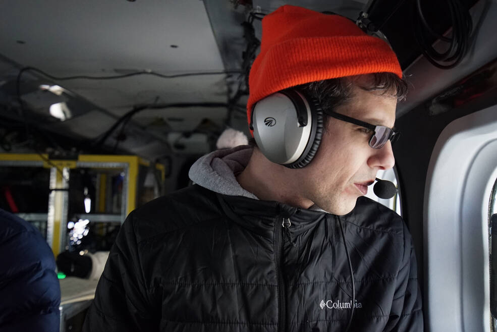
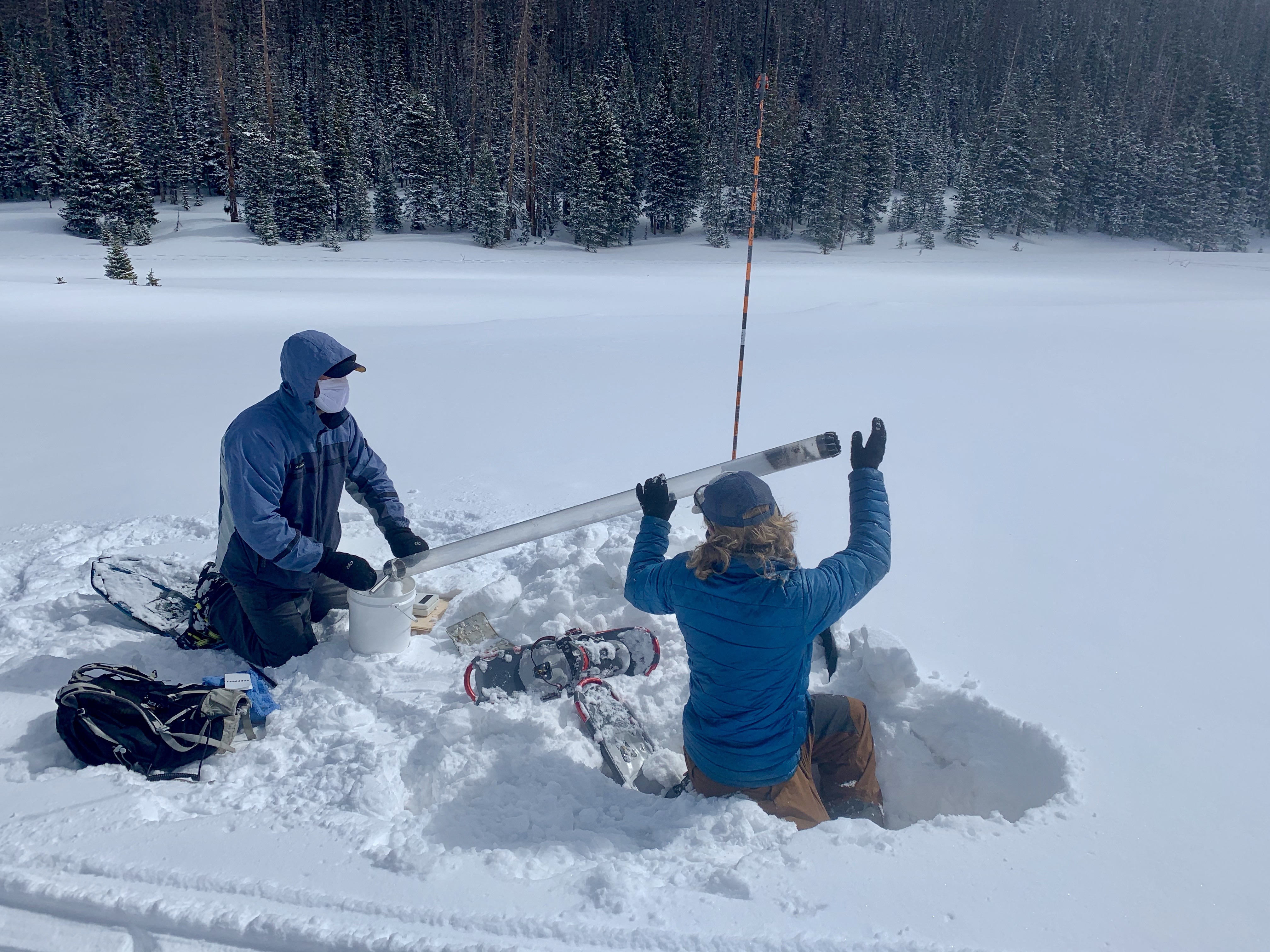
Originally funded by Goddard’s Internal Research and Development, or IRAD program, his team flew their instrument on a Twin Otter aircraft in 2020 and earlier this year while colleagues measured the snowpack on the ground. They plan to fly over the same areas when the snowpack reaches its lowest levels in October. “We saw the maximum signal from the snow,” Osmanoglu said. “Now we are interested in the minimum. Observing both conditions will allow us to improve our algorithms.”
Measuring the terrain when there is little to no snow on the ground will help further refine their ability to measure the water in snow.
Figuring out how much water is contained in a given volume of snow isn’t straightforward, Osmanoglu said, as snow can vary in density from mostly air to mostly water.
“If you have snow in your backyard, and you take a cup and fill it up with snow, is the cup full or half-full when it’s melted?” Osmanoglu said. The melt test works well enough after one backyard snowfall where the snow’s density is uniform. But over an entire mountain range for a full winter, density varies a great deal. To make those measurements, scientists need a different method and a higher vantage point.
The SWESARR instrument combines two techniques to offer improved sensitivity over earlier technology: SWESARR bounces its own radar pulses off the ground, measuring their return signal, as well as capturing naturally occurring microwave signals emitted from the snow.
Snow absorbs some of SWESARR’s radar signals. Scientists measure how much of the signal returns versus how much is absorbed by the snow to calculate the amount of water it contains.
Snow is cold, but still warm enough to emit microwaves that a radiometer can detect. Scientists measure the “brightness temperature” of energy emitted by the snow and compare it with that from snowless ground to calculate the water in the snowpack.
With the combination of the two measuring techniques, “You basically get a bigger range of snow water equivalent values that you can measure,” Osmanoglusaid . “And also, there is the benefit of these measurements confirming each other using two different physics.”
Both technologies have tradeoffs. Radiometers have been used for this kind of analysis for a long time and are good at measuring shallow to medium snow depths, while radar provides higher resolution and can penetrate deeper into the snowpack. But radiometers can struggle when the mountainous terrain is also heavily forested. “It’s difficult to say what part of the signal is actually coming from the snow versus which part is coming from the vegetation, because that also emits signals,” Osmanoglu said.
Radar is a little better at discerning smaller features like trees, but the measurements are not perfect. The radar wavelengths are about the length of evergreen branches, which means the signals bounce off instead of penetrating through trees to the ground where the snow is.
To address those challenges, Osmanoglu’s team combines four computer models to generate simulated landscapes of forests and snow and show what SWESARR would see in those environments. Using the simulation, he hopes to improve methods for detecting snow through small gaps in forest canopies before conducting further test flights.
“We have the trees, we have the snow, and we have the simulators, so we can actually see what type of signals we should be getting,” Osmanoglu said. “You’re trying to see, what is the canopy opening? Can we make a snow observation under the canopy?”
The SWESARR instrument is in good shape and has performed well on its aircraft flights. Improving the measurement algorithms is the next step, Osmanoglu said, toward the eventual dream of putting something like SWESARR on a satellite – a vantage point from which it could estimate the amount of water in snowpacks across the globe.
By Christian Elliott
NASA’s Goddard Space Flight Center, Greenbelt, Md.