NASA’s Curiosity Rover Finds Patches of Rock Record Erased, Revealing Clues
by Rachel Hoover
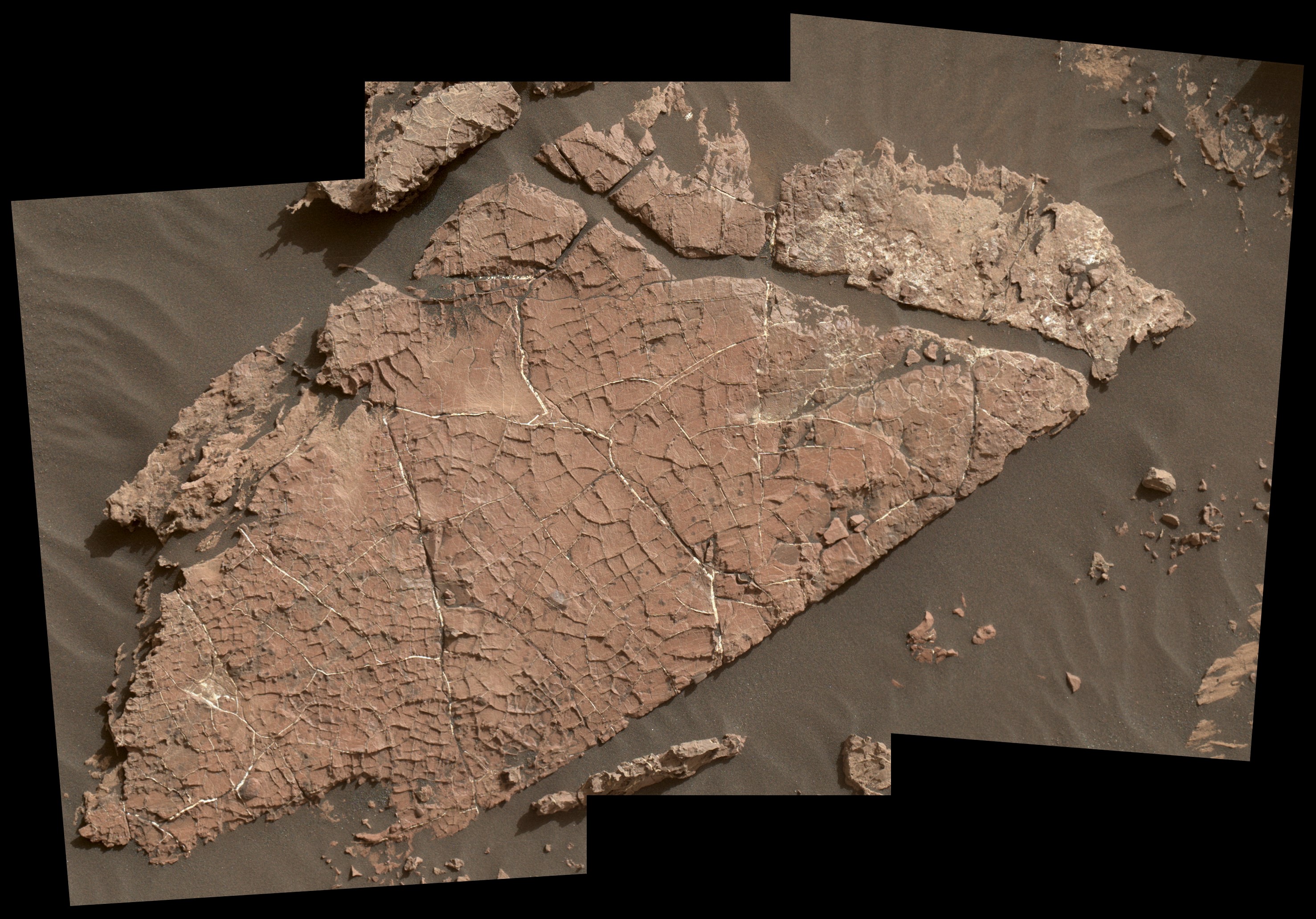
Today, Mars is a planet of extremes – it’s bitterly cold, has high radiation, and is bone-dry. But billions of years ago, Mars was home to lake systems that could have sustained microbial life. As the planet’s climate changed, one such lake – in Mars’ Gale Crater – slowly dried out. Scientists have new evidence that super salty water, or brines, seeped deep through the cracks, between grains of soil in the parched lake bottom and altered the clay mineral-rich layers beneath.
The findings published in the July 9 edition of the journal Science and led by the team in charge of the Chemistry and Mineralogy, or CheMin, instrument – aboard NASA’s Mars Science Laboratory Curiosity rover – help add to the understanding of where the rock record preserved or destroyed evidence of Mars’ past and possible signs of ancient life.
“We used to think that once these layers of clay minerals formed at the bottom of the lake in Gale Crater, they stayed that way, preserving the moment in time they formed for billions of years,” said Tom Bristow, CheMin principal investigator and lead author of the paper at NASA’s Ames Research Center in California’s Silicon Valley. “But later brines broke down these clay minerals in some places – essentially re-setting the rock record.”
Mars: It Goes On Your Permanent Record
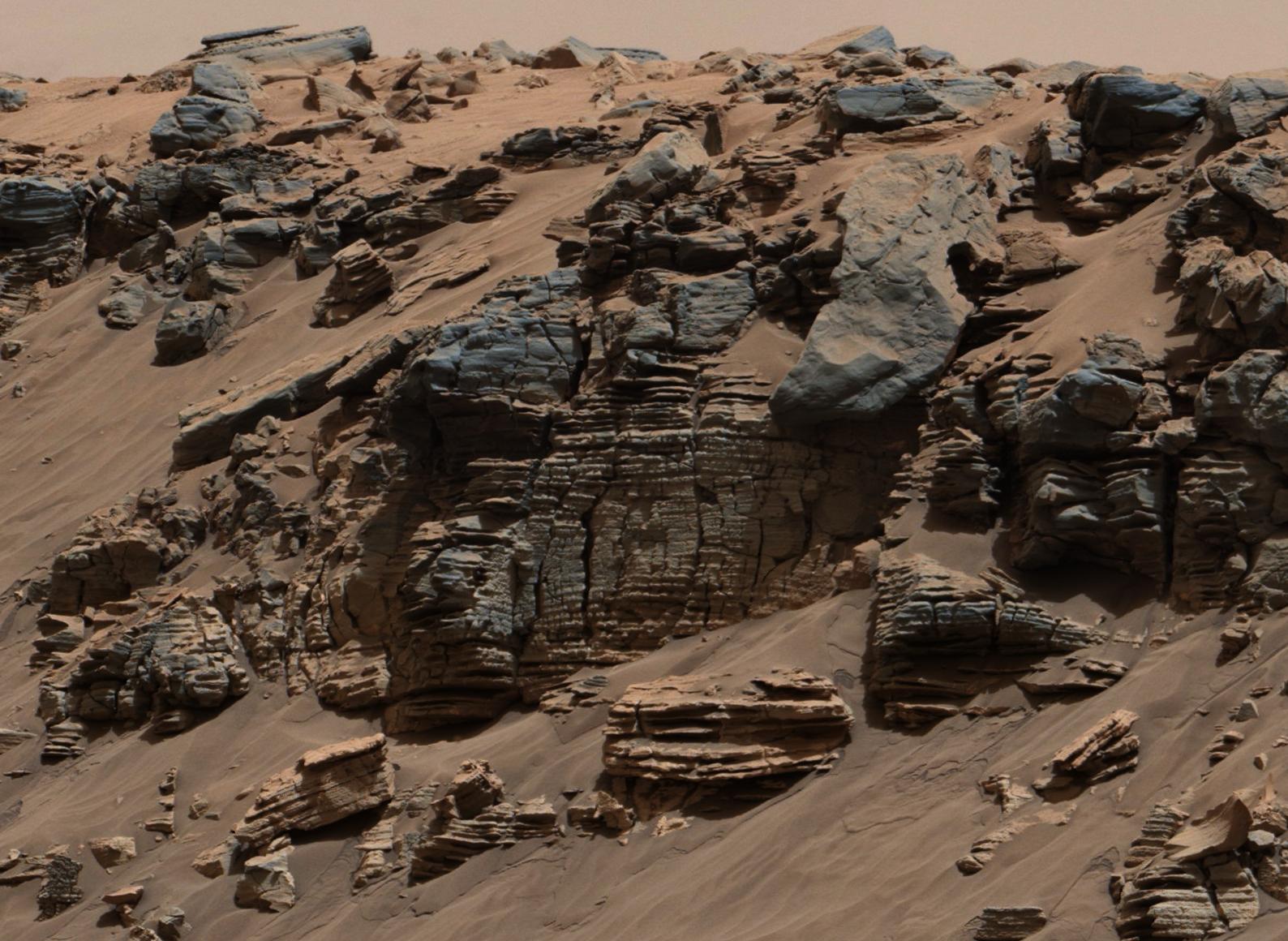
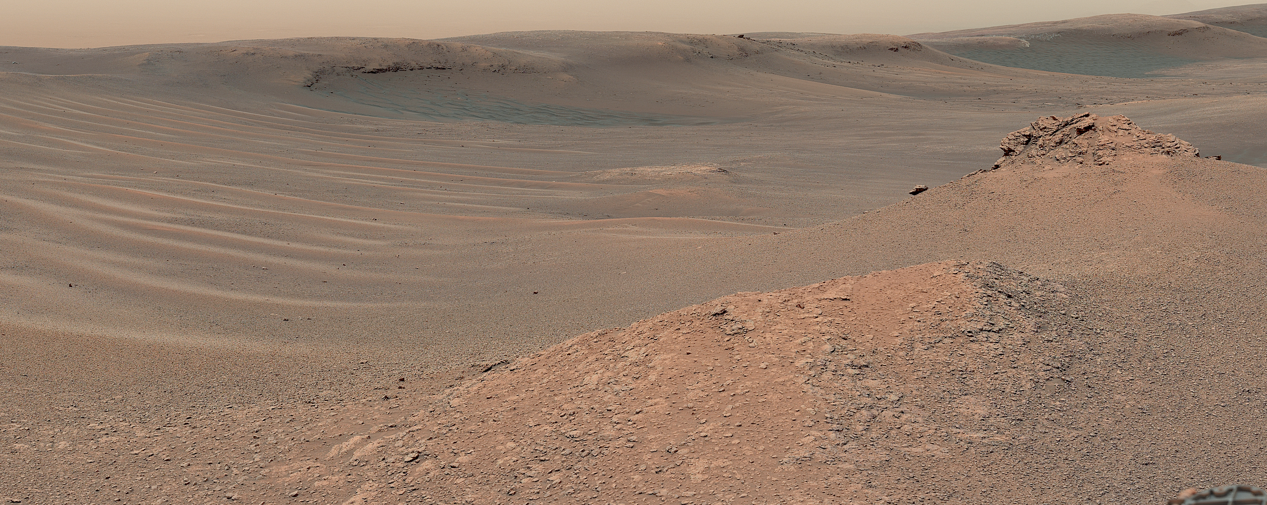
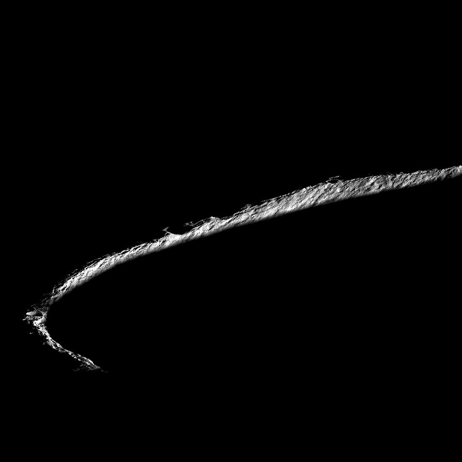
Mars has a treasure trove of incredibly ancient rocks and minerals compared with Earth. And with Gale Crater’s undisturbed layers of rocks, scientists knew it would be an excellent site to search for evidence of the planet’s history, and possibly life.
Using CheMin, scientists compared samples taken from two areas about a quarter-mile apart from a layer of mudstone deposited billions of years ago at the bottom of the lake at Gale Crater. Surprisingly, in one area, about half the clay minerals they expected to find were missing. Instead, they found mudstones rich with iron oxides – minerals that give Mars its characteristic rusty red color.
Scientists knew the mudstones sampled were about the same age and started out the same – loaded with clays – in both areas studied. So why then, as Curiosity explored the sedimentary clay deposits along Gale Crater did patches of clay minerals – and the evidence they preserve – “disappear”?
Clays Hold Clues
Minerals are like a time capsule; they provide a record of what the environment was like at the time they formed. Clay minerals have water in their structure and are evidence that the soils and rocks that contain them came into contact with water at some point.
“Since the minerals we find on Mars also form in some locations on Earth, we can use what we know about how they form on Earth to tell us about how salty or acidic the waters on ancient Mars were,” said Liz Rampe, CheMin deputy principal investigator and co-author at NASA’s Johnson Space Center in Houston.
Previous work revealed that, while Gale Crater’s lakes were present and even after they dried out, groundwater moved below the surface, dissolving and transporting chemicals. After they were deposited and buried, some mudstone pockets experienced different conditions and processes due to interactions with these waters that changed the mineralogy. This process, known as “diagenesis,” often complicates or erases the soil’s previous history and writes a new one.
Diagenesis creates an underground environment that can support microbial life. In fact, some very unique habitats on Earth – in which microbes thrive – are known as “deep biospheres.”
“These are excellent places to look for evidence of ancient life and gauge habitability,” said John Grotzinger, CheMin co-investigator and co-author at Caltech in Pasadena, California. “Even though diagenesis may erase the signs of life in the original lake, it creates the chemical gradients necessary to support subsurface life, so we are really excited to have discovered this.”
By comparing the details of minerals from both samples, the team concluded that briny water filtering down through overlying sediment layers was responsible for the changes. Unlike the relatively freshwater lake present when the mudstones formed, the salty water is suspected to have come from later lakes that existed within an overall drier environment. Scientists believe these results offer further evidence of the impacts of Mars’s climate change billions of years ago. They also provide more detailed information that is then used to guide the Curiosity rover’s investigations into the history of the Red Planet. This information also will be utilized by NASA’s Mars 2020 Perseverance rover team as they evaluate and select rock samples for eventual return to Earth.
“We’ve learned something very important: there are some parts of the Martian rock record that aren’t so good at preserving evidence of the planet’s past and possible life,” said Ashwin Vasavada, Curiosity project scientist and co-author at NASA’s Jet Propulsion Laboratory in Southern California. “The fortunate thing is we find both close together in Gale Crater, and can use mineralogy to tell which is which.”
Curiosity is in the initial phase of investigating the transition to a “sulfate-bearing unit,” or rocks thought to have formed while Mars’s climate dried out.
The mission is managed by JPL, a division of Caltech, for NASA’s Science Mission Directorate, Washington. Colleagues in NASA’s Astromaterials Research and Exploration Science Division at Johnson and NASA’s Goddard Space Flight Center in Greenbelt, Maryland also are authors on the paper, as well as other institutions working on Curiosity.
New Maps Help Developers Plan Lunar Road Trip for VIPER’s Artemis Mission
by Rachel Hoover
As any seasoned road-tripper knows, to get the most out of an adventure, a good map helps. It’s no different for NASA’s first lunar robotic rover planned for delivery to the Moon in late 2023 to search for ice and other resources on and below the lunar surface. The Volatiles Investigating Polar Exploration Rover, or VIPER, is part of the agency’s Artemis program. Without a Moon travel guide, VIPER’s mission planners are creating new high resolution, digital elevation maps of the lunar surface.
When equipped with these maps, the rover will be in a better position to safely and efficiently traverse the Moon while looking for resources at the lunar South Pole. Ice is a resource of particular scientific interest as it may have applications if found in space and converted to other resources to further our exploration into the solar system such as oxygen and rocket fuel.
At about three-foot (one-meter) scale, these maps provide a 3D model of large swaths of the terrain at the lunar South Pole and show the ever-changing lighting and temperature conditions caused by long shadows that sweep across the landscape.
Besides preventing the rover from tipping down the edges of steep-sided craters, this up-close view of the Moon’s surface provides mission planners vital information to ensure the rover’s solar-powered batteries stay charged and guide the rover toward safe spots to hibernate during communication blackouts with mission operations on Earth.
“We are sending VIPER to one of the Moon’s most dynamic environments, and the rover needs to be able to take what the Moon gives,” said Anthony Colaprete, VIPER’s project scientist at NASA’s Ames Research Center in California’s Silicon Valley. “That’s why we are creating these unique maps – at human scale – to help us carefully plan routes for the rover while operating safely and collecting the best science possible.”
Already, the maps are revealing new features of scientific interest on the Moon’s surface, including numerous “mini cold traps” – which are shadowed pockets on the lunar surface 6 to 16 feet (2 to 5 meters) across – that could be cold enough for ice to potentially collect. These micro cold traps offer areas to explore in addition to the much deeper and older craters that are a focus of the VIPER mission.
“We used to think of water ice collecting only in deep, dark craters on the Moon,” said Colaprete. “But we now believe that even small, shadowed craters can be cold enough to retain water molecules. These small cold traps are much more common than their larger counterparts, so understanding how they may store water is important to answering the broader question of how water behaves on the Moon.”
To create the elevation maps, a team at Ames is using NASA’s open source Stereo Pipeline software tool as well as the processing power of Ames’ Pleiades supercomputer to layer thousands of satellite images taken by cameras aboard the Lunar Reconnaissance Orbiter.
Engineers are pairing these powerful tools and expertise with a photo processing capability called photoclinometry. This technique, also known as “shape from shading,” combines the known angles of sunlight with the greyscale levels of many two-dimensional images to infer the three-dimensional shapes of the lunar surface. The resulting model of the lunar terrain allows engineers to calculate how light and shadows play across the surface at any time in the past or future. For example, using the model they can predict the lighting at the time and place the rover will land, and plan the rover’s movements to keep it in sunlight and avoid the shadows.
With the lighting conditions known, the team can create detailed temperature maps across the varied terrain, at the surface, and up to a little more than 8 feet (2.5 meters) below. Temperatures can swing widely between 400 degrees below zero and 170 degrees Fahrenheit, making the Moon’s surface a checkerboard of potentially promising and very unlikely locations to detect ice. Equipped with these new maps, the team can pick spots where ice could be and send VIPER to sample and verify whether ice appears, and if so, how stable it is in various lunar conditions.
“These high-resolution maps have entirely changed our thinking,” said Kimberly Ennico Smith, a deputy project scientist for VIPER at Ames. “We’re beginning to see how extremely varied the soil conditions on the Moon are, even within areas we once thought as fairly uniform. This will allow us to pinpoint the rover’s drill sites much more carefully and lead us to collect even better science data.”
The VIPER team members responsible for keeping the rover humming along have a keen interest in seeing what the rover will face day-to-day – or rather minute-to-minute.
“Shadows move around the South Pole of the Moon at about the same speed the rover drives,” said Mark Shirley, mission operations planning lead at Ames. “We have to plan ahead to avoid VIPER being overtaken by darkness – there’s not much room for error.”
NASA Interns Connect Aviation Nonprofits, Food Banks, and Farmers Bringing Meals to Those in Need
by Rachel Hoover
NASA interns are known for going above and beyond. A team of interns at the NASA Aeronautics Research Institute at NASA’s Ames Research Center in California’s Silicon Valley is a prime example. In summer 2020 and at the height of the coronavirus pandemic, they found a way to help people in need.
Interns developed a project called “Match Supply and Demand of Goods Deliverable by Aviation.” Using a new website they created, they helped connect nonprofits with California farmers to deliver boxes of produce to food banks.
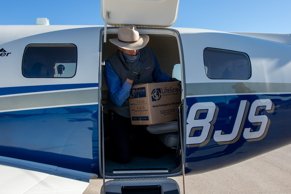
The website provided nonprofit organizations a way to submit forms and select the types of produce they were interested in, while giving farmers an option to submit what they were selling. Ultimately, the project connected Angel Flight West, a nonprofit organization that specializes in aviation in Santa Monica, California, with The Farmlink Project, a nationwide nonprofit organization that focuses on solutions to food insecurity.
Angel Flight West was able to provide flights to transport produce during the summer of 2020 and up until January 2021 – successfully delivering hundreds of boxes of produce.
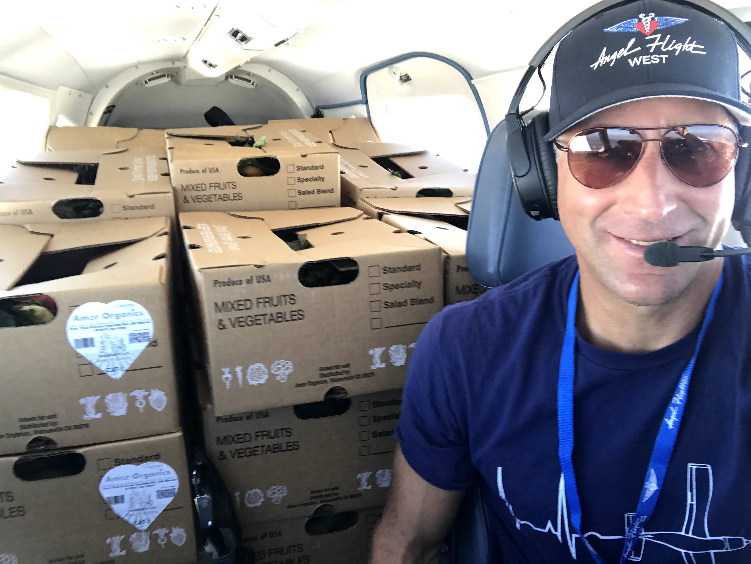
“The shipments included 320-produce boxes delivered in 22 volunteered personal planes that departed from Salinas, California,” said Pedro Jose Salazar Garcia, an Aerospace Engineering student at Iowa State University in Ames, Iowa, and a contributor to the project and continuing NASA intern. “Angel Flight West and The Farmlink Project were contacted by us about the partnership and they decided to help us with this mission.”
Two California food banks benefited from the project – Tehama Together, located in the city of Red Bluff, and Clearlake Gleaners, located in the city of Finely. The Farmlink Project selected the food banks based on their already existing network.
“We also secured another shipment of 200,000 meals and cases of bottled water for distribution to those that need it in Winslow, Arizona and the Pueblo of Zuni, New Mexico,” said Garcia. “My favorite part of this project is that our team was able to help the community during [such] tough times.”
A total of eight interns with various majors contributed to this project during summer 2020, including AJ Singh, Kiran Gomatam, Sarah Tesfaye, Bjorn Johnson, D’Leela Saiyed, Christos Vasilarakis, Pedro Salazar, and Aneesh Galgali.
NASA offers dozens of internships in a variety of projects across all 10 NASA centers. If you are interested, visit the NASA Internships website today to get started on your application!
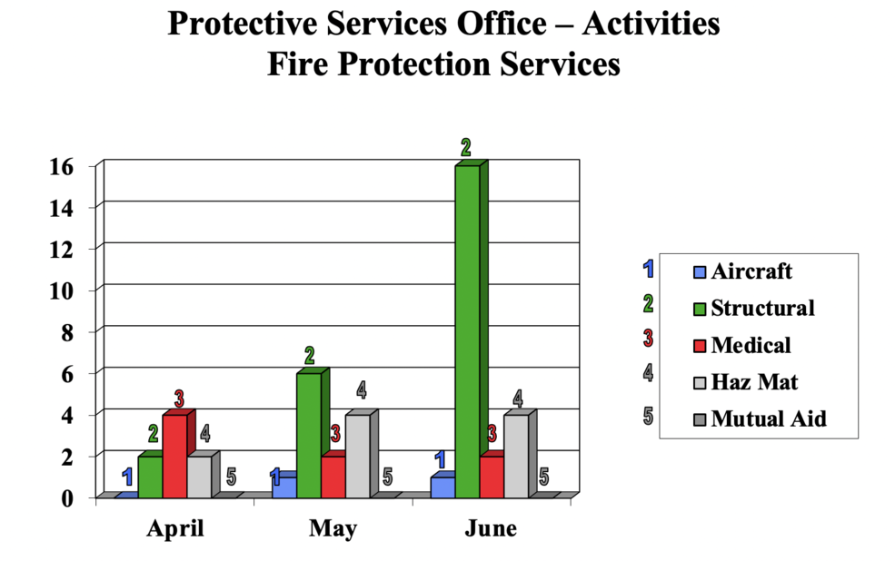
Statistical Summary of Activities of the Protective Service Division’s Security/Law Enforcement and Fire Protection Services Units for Period Ending June 2021