


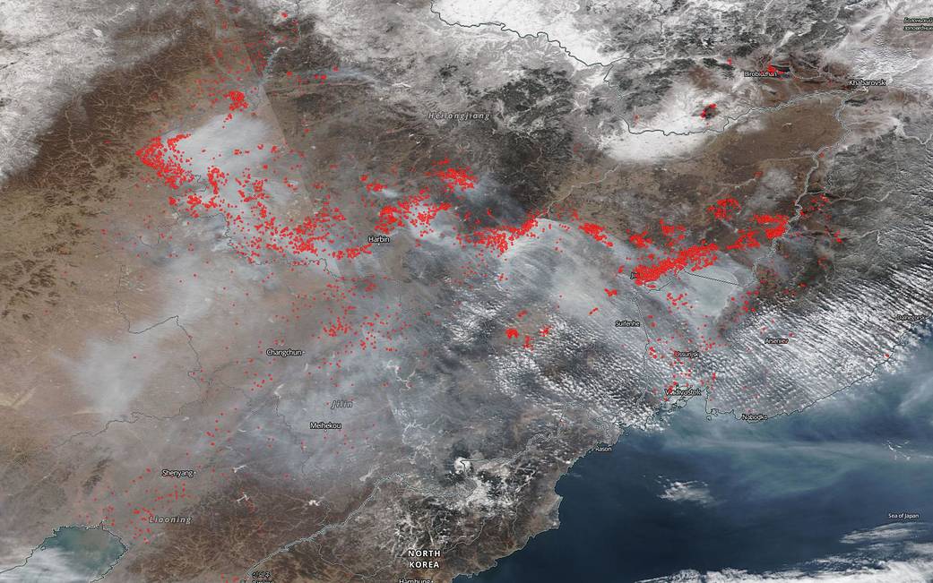
When NOAA/NASA’s Suomi NPP satellite captured this image of wildfires and smoke in eastern Russia on February 26, 2019 it was obvious that the number of wildfires had dramatically increased from the image taken just days before on February 21, 2019. At first glance it appears that the wildfires have doubled or tripled in number from just days ago. This seems to confirm the findings of the U.S. Global Change Research Program released in late 2018 referencing the fact that twice the number of wildfires have been breaking out due to climate change and the hotter/drier atmosphere in areas such as eastern Russia. This report estimated that twice as many acres have burned worldwide due to climate change over the past thirty years than would have if climate change were not a factor.
A slider has been provided below to show the difference in the number of wildfires. On the left is eastern Russia on Feb. 21, 2019 and on the right is the image of that same region taken on Feb. 26, 2019.
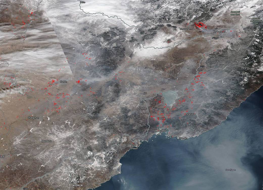
NASA’s Earth Observing System Data and Information System (EOSDIS) Worldview application provides the capability to interactively browse over 700 global, full-resolution satellite imagery layers and then download the underlying data. Many of the available imagery layers are updated within three hours of observation, essentially showing the entire Earth as it looks “right now.” Actively burning fires, detected by thermal bands, are shown as red points. Image Courtesy: NASA Worldview, Earth Observing System Data and Information System (EOSDIS). Caption: Lynn Jenner with information from the U.S. Global Change Research Program