


Since the spring of 2005, the U.S. Geological Survey’s Alaska Volcano Observatory has detected increasing volcanic unrest at Augustine Volcano in Cook Inlet, Alaska, near Anchorage. Based on all available monitoring data, an eruption similar to 1976 and 1986 is the most probable outcome. During January 2006, activity has been episodic, and characterized by emission of steam and ash plumes, rising to altitudes in excess of 30,000 feet, and posing hazards to aircraft in the vicinity.
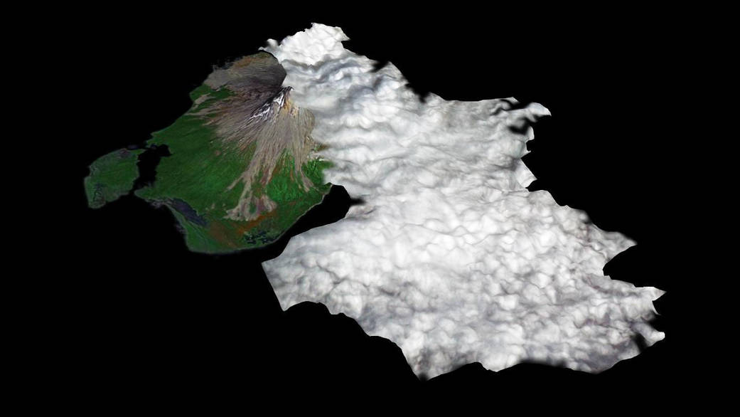
This image was captured by the Advanced Spaceborne Thermal Emission and Reflection Radiometer (ASTER) on Jan. 12, 2006, during an eruptive phase of Augustine. The perspective rendition shows the eruption plume derived from the ASTER image data. ASTER’s stereo viewing capability was used to calculate the 3-dimensional topography of the eruption cloud as it was blown to the south by prevailing winds. From a maximum height of 9,950 feet, the plume cooled and its top descended to 6,175 feet.
The topographic relief has been increased 1.5 times for this illustration. Comparison of the ASTER plume topography data with ash dispersal models and weather radar data will allow the National Weather Service to validate and improve such models. These models are used to forecast volcanic ash plume trajectories and provide hazard alerts and warnings to aircraft in the Alaska region.Image Credit: NASA/GSFC/METI/ERSDAC/JAROS, and U.S./Japan ASTER Science Team