


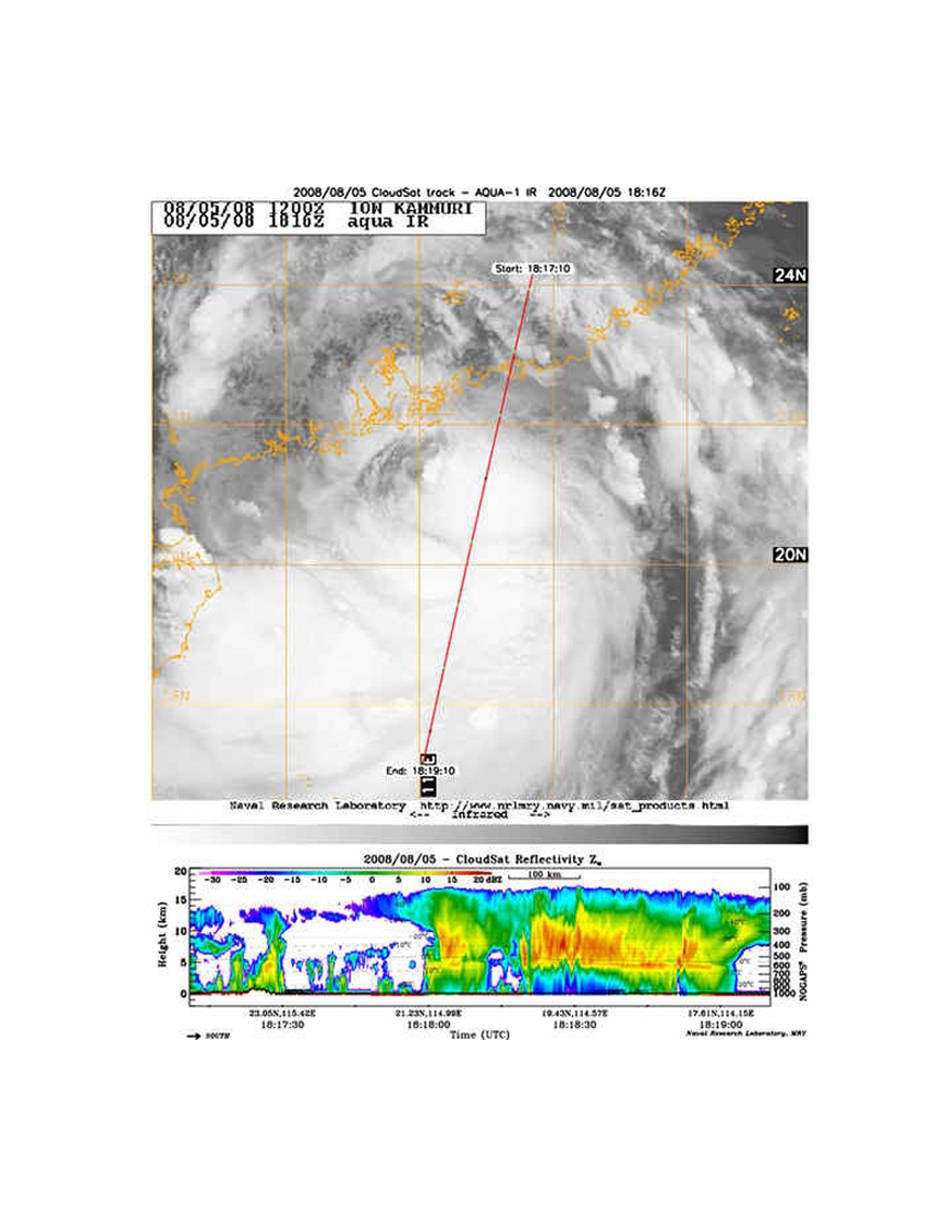
NASA’s CloudSat satellite Cloud Profiling Radar captured this sideways view through the deep clouds of Severe Tropical Storm Kammuri on August 5. Kammuri made landfall along the south coast of China about 161 miles (259 kilometers) west of Hong Kong. The weakening storm is now moving westward into Guangxi and the northern Vietnam border, but not before raking the region with winds between 55 and 63 miles per hour (86 and 101 kilometers per hour).
The top image is from the NASA Aqua satellite, supplied through the U.S. Naval Research Laboratory. It shows the top of Kammuri at the same time that the CloudSat image, below, shows a sideways, curtain-view of what the clouds along the red line looked like.
The colors in the CloudSat image indicate the intensity of the reflected radar energy, red colors indicating the most intense reflected energy. This is a indication of large amounts of water and heavy rainfall. The top of Kammuri’s clouds reach more than 11 miles (17 kilometers).
The blue areas along the top of the clouds indicate cloud ice, while the wavy blue lines on the bottom center of the image indicate intense rainfall reaching the surface. It is likely that in the area of intense rainfall the precipitation rate exceeds 1.18 inches per hour (30 millimeters per hour), based on previous studies.