


![Request for Information – Potential [Placeholder for Prize]](https://assets.science.nasa.gov/dynamicimage/assets/science/psd/solar/2023/09/s/solarsystem_0.jpg?w=1024)


The 2015 wildfire season in the Arctic has been very intense – and very smoky. As of July 15, over 3,190,000 acres had burned across Canada, according to Natural Resources Canada. According to the National Oceanic and Atmospheric Administration (NOAA), more than 600 fires had burned millions of acres in Alaska as of July 7, making this worst wildfire season so far in state’s history. In much of Russia the 2015 fire season also started early and intensely, with highly destructive fires as early as April in the northern regions.
As the wildfires consume vegetation they emit large quantities of smoke. This is especially intense in peat soils, which is a common soil in many boreal regions, especially in boggy areas or in permafrost. Peat is a soil made up of partially decayed vegetable matter, is readily ignited, and tends to burn with smoldering, smoky combustion rather than open flames. When small fires burn locally, the smoke tends to stay closer to the ground, but when large quantities of smoke are present there is an increased chance of a large quantity of smoke rising into the upper levels of the atmosphere and traveling long distances.
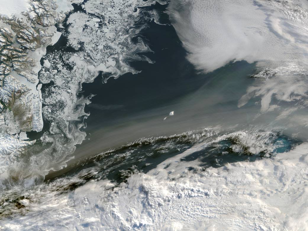
On July 3, 2015, the Moderate Resolution Imaging Spectroradiometer (MODIS) aboard NASA’s Aqua satellite captured this true-color image of a river of smoke passing over the Greenland Sea. The smoke most likely arose from fires in Canada and Alaska. Smoke was also reported to have cross the North Pole by July 12.
Image Credit: NASA/Jeff Schmaltz, LANCE/EOSDIS MODIS Rapid Response Team, NASA GSFC