


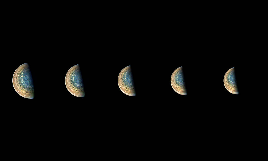
This series of images captures cloud patterns near Jupiter’s south pole, looking up towards the planet’s equator.
NASA’s Juno spacecraft took the color-enhanced time-lapse sequence of images during its eleventh close flyby of the gas giant planet on Feb. 7 between 7:21 a.m. and 8:01 a.m. PST (10:21 a.m. and 11:01 a.m. EST). At the time, the spacecraft was between 85,292 to 124,856 miles (137,264 to 200,937 kilometers) from the tops of the clouds of the planet with the images centered on latitudes from 84.1 to 75.5 degrees south.
At first glance, the series might appear to be the same image repeated. But closer inspection reveals slight changes, which are most easily noticed by comparing the far left image with the far right image.
Directly, the images show Jupiter. But, through slight variations in the images, they indirectly capture the motion of the Juno spacecraft itself, once again swinging around a giant planet hundreds of millions of miles from Earth.
Citizen scientist Gerald Eichstädt processed this image using data from the JunoCam imager.
JunoCam’s raw images are available for the public to peruse and process into image products at:
www.missionjuno.swri.edu/junocam
More information about Juno is at:
https://www.nasa.gov/juno and http://missionjuno.swri.edu
Image credits: NASA/JPL-Caltech/SwRI/MSSS/Gerald Eichstädt