


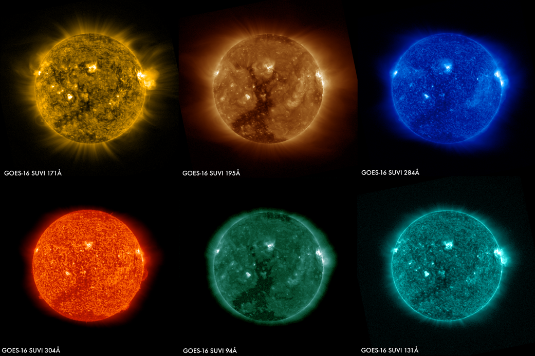
These images of the sun were captured at the same time on January 29, 2017 by the six channels on the Solar Ultraviolet Imager or SUVI instrument aboard NOAA’s GOES-16 satellite. They show a large coronal hole in the sun’s southern hemisphere. Data from SUVI will provide an estimation of coronal plasma temperatures and emission measurements which are important to space weather forecasting.
SUVI is essential to understanding active areas on the sun, solar flares and eruptions that may lead to coronal mass ejections which may impact Earth. Depending on the magnitude of a particular eruption, a geomagnetic storm can result that is powerful enough to disturb Earth’s magnetic field. Such an event may impact power grids by tripping circuit breakers, disrupt communication and satellite data collection by causing short-wave radio interference and damage orbiting satellites and their electronics. SUVI will allow the NOAA Space Weather Prediction Center to provide early space weather warnings to electric power companies, telecommunication providers and satellite operators.
NASA successfully launched GOES-R at 6:42 p.m. EST on November 19, 2016 from Cape Canaveral Air Force Station in Florida. It was renamed GOES-16 when it achieved orbit. GOES-16 is now observing the planet from an equatorial view approximately 22,300 miles above the surface of the Earth.