


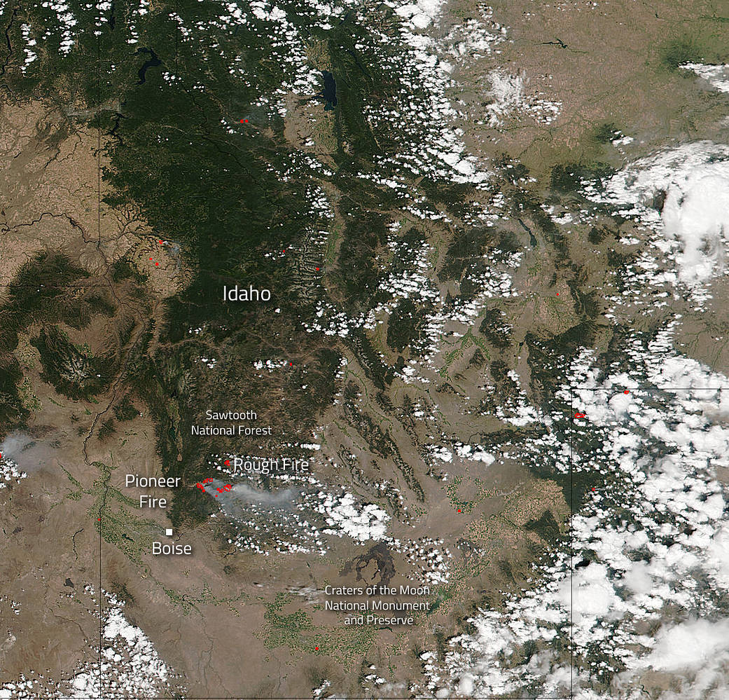
The Suomi NPP satellite’s Visible Infrared Imaging Radiometer Suite (VIIRS) instrument captured a look at multiple fires and smoke burning in Idaho’s Sawtooth National Forest on August 15, 2016. The Pioneer Fire is now 76,980 acres in size, an increase of 3622 acres, and 50% contained with 1790 personnel assigned. The cause of the blaze is under investigation now, but it began on July 18, 2016 at approximately 5:00 pm local time, 8 miles north of Idaho City. Weather forecast outlooks do not appear to bring any effective precipitation events. In addition, any weather events also bring gusty winds which serve to spread the fire.
The Rough Fire located 14 miles northeast of Lowman has been blazing since August 7, 2016 at 7:30 am. The cause of this blaze was a lightning strike. This fire is currently 2,332 acres in size and is currently 15% contained with 227 personnel actively working the scene. High temperatures and gusty winds are predicted which will hamper firefighting efforts. There is an area closure in effect around this blaze.
In this satellite image hot spots which are detected by VIIRS are outlined in red. Each red mark is an area where the thermal detectors recognized temperatures higher than background. When accompanied by plumes of smoke, as in this image, such hot spots are diagnostic for fire.
The Suomi NPP satellite is a joint mission between NASA, NOAA and the U.S. Department of Defense.
NASA image courtesy Jeff Schmaltz, MODIS Rapid Response Team. Caption: NASA/Goddard, Lynn Jenner with information from Inciweb.