


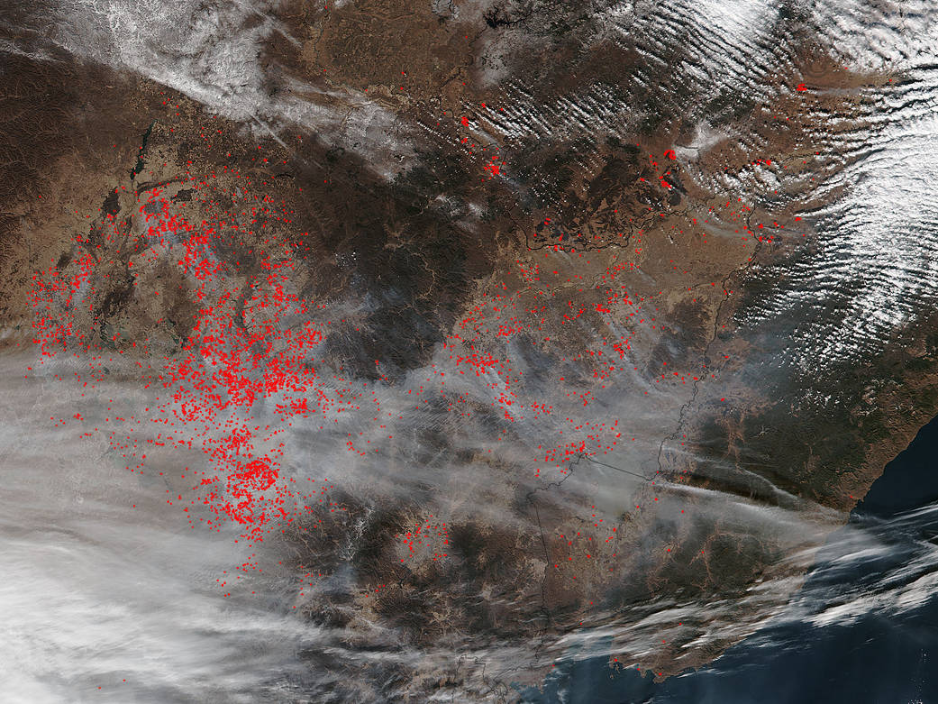
As the weeks roll by there doesn’t seem to be a slowing down in the number of agricultural fires that are lighting up Eastern China. As a matter of fact, this Suomi NPP satellite image from November 06, 2015, seems to show even more fires burning than the previously published image on November 02.
Most likely these fires were set to manage agricultural land. The North China Plain, the largest winter wheat production district in China, experiences extensive crop fires during harvest seasons. China uses biomass burning in agricultural more than most other countries. Farmers often employ fire to return nutrients to the soil and to clear the ground of unwanted plants. While fire helps enhance crops and grasses for pasture, the fires also produce smoke that degrades air quality. Even though China feels a world away from the Western hemisphere, the smoke travels along the jetstreams bringing smoke and its accompanying degraded air quality across the globe. Hazardous smoke emissions also contribute to climate change and those effects are also felt globally.
NASA’s Suomi NPP satellite collected this natural-color image using the VIIRS (Visible Infrared Imaging Radiometer Suite) instrument on November 06, 2015. Actively burning areas, detected by MODIS’s thermal bands, are outlined in red. NASA image courtesy Jeff Schmaltz LANCE/EOSDIS MODIS Rapid Response Team, GSFC. Caption by Lynn Jenner