


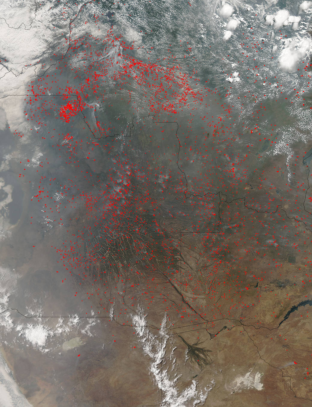
It seems as though the entire world is engulfed in flames. The western United States, Canada, and Russia have all had more than their share of huge fires this season. A few more countries are coming into the forefront with large widespread fires–Angola, Zambia, and the Democratic Republic of the Congo in Central Africa. In this natural-color image taken by NASA’s Aqua satellite on August 27, 2015 with the Moderate Resolution Imaging Spectroradiometer, MODIS, instrument actively burning areas are outlined in red. Each hot spot, which appears as a red mark, is an area where the thermal detectors on the MODIS instrument recognized temperatures higher than background. When accompanied by plumes of smoke, as in this image, such hot spots are diagnostic for fire.There seems to be more red than green or brown, meaning a large portion of land is ablaze. Most likely it is subsistence farmers using “slash and burn” agriculture to clear their fields for the growing season. Places where traditional plots of open land is not available because the vegetation in the area is dense are the places where “slash and burn” agriculture is practiced most often.
NASA image courtesy Jeff Schmaltz LANCE/EOSDIS MODIS Rapid Response Team, GSFC. Caption by Lynn Jenner