


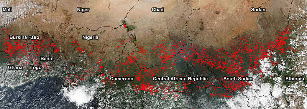
This composite of visible images shows a thick line of agricultural fires stretching from west to east across Central Africa.
This composite of visible images shows a thick line of agricultural fires stretching from west to east across Central Africa. Visible-light images were taken from the VIIRS instrument aboard NASA-NOAA’s Suomi NPP satellite on Nov. 27, 2015 12:50 UTC (7:50 a.m. EST). The VIIRS image showed the heat signatures from fires (in red) from Burkina Faso and northern Ghana, Togo and Benin stretch eastward across southern Nigeria, Chad and Sudan, Cameroon, Central Africa Republic, South Sudan and Ethopia.
VIIRS collects visible and infrared imagery and global observations of land, atmosphere, cryosphere and oceans.
NASA image courtesy Jeff Schmaltz, NASA Goddard Rapid Response Team, GSFC. Caption by Rob Gutro