


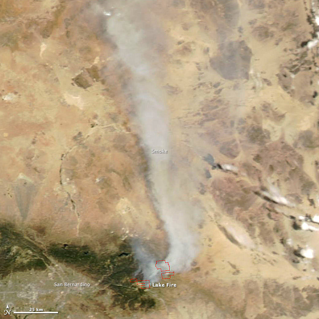
The Moderate Resolution Imaging Spectroradiometer (MODIS) aboard the Aqua satellite acquired this image of smoke from the Lake fire streaming north on June 25, 2015. The fire was burning in southern California near San Bernardino National Forest. Red outlines indicate hot spots where MODIS detected unusually warm surface temperatures associated with fire activity.
The Lake fire was reported on the afternoon of June 17, but it had grown to about 30,000 acres (12,000 hectares) by June 26. Unusually warm temperatures and strong winds have fueled the blaze. The communities of Burns Canyon and Rim Rock are under mandatory evacuation. Hobbyist drones have hampered firefighting efforts and contributed to the fire’s rapid growth, according to news reports.
Reference
- Inciweb (2015, June 26) Lake Fire. Accessed June 19, 2015
- Los Angeles Times (2015, June 26) Lake fire grew after private drone flights disrupted air drops. Accessed June 26, 2015.
- The Desert Sun (2015, June 19) Lake Fire increases to 29,813 acres. Accessed June 19, 2015.
NASA image by Jeff Schmaltz, LANCE/EOSDIS Rapid Response. Caption by Adam Voiland.
- Instrument(s):
- Aqua – MODIS