


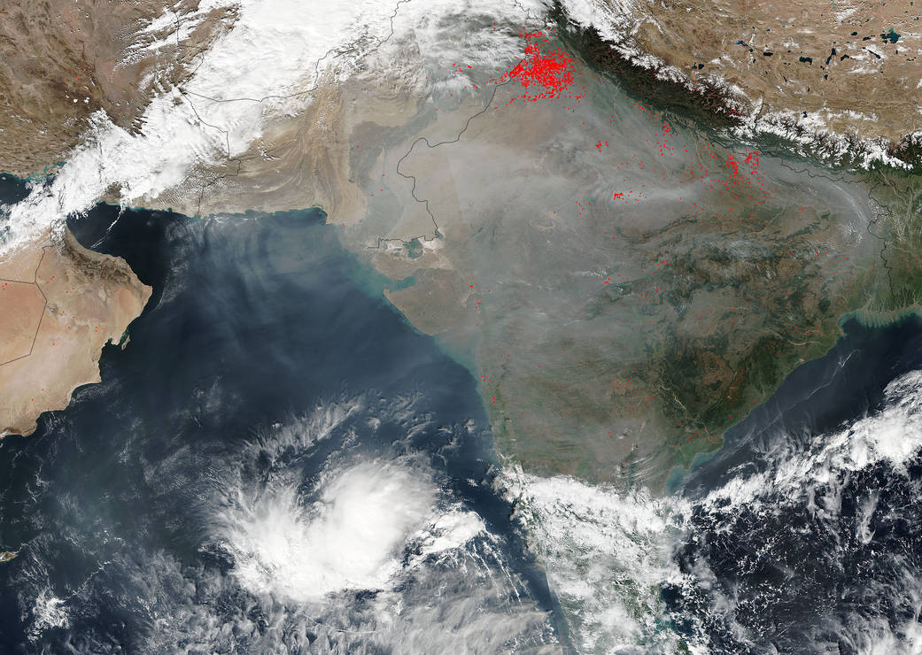
At the foothills of the Himalaya Mountains in northwest India, a broad swath of fertile terrain is created where the rivers and streams of the region spill out of the mountains. In this Visible Infrared Imaging Radiometer Suite (VIIRS) image from the Suomi NPP (National Polar-orbiting Partnership) satellite on November 12, 2015, numerous agricultural fires have been detected by the sensor and are marked with red dots. Each hot spot is an area where the thermal detectors on the MODIS instrument recognized temperatures higher than background. When accompanied by plumes of smoke, as in this image, such hot spots are diagnostic for fire.At image left is Pakistan and the broad, northern part of the Indus River Valley.
NASA image courtesy Jeff Schmaltz, MODIS Rapid Response Team. Caption: NASA/Goddard, Lynn Jenner