


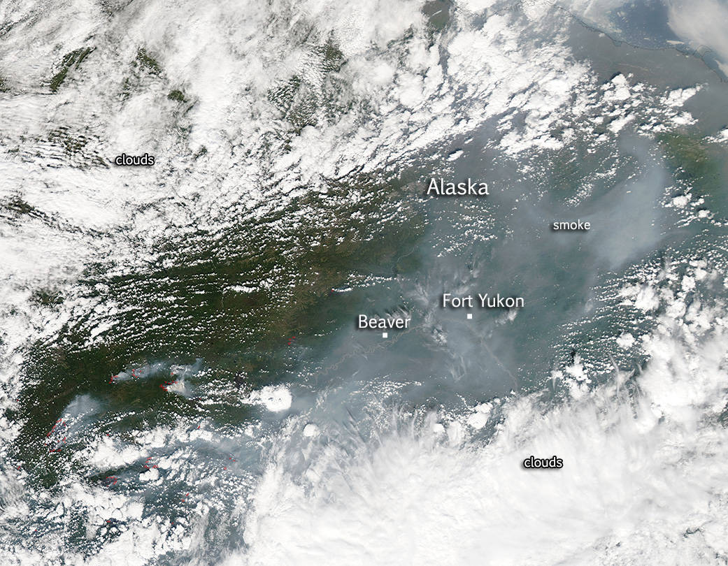
Dozens of wildfires have broken out in the Alaska wilderness this fire season and the Aqua satellite captured this image of the fires on July 1, 2015. Clouds obscure much of the image on either side of the fires and most probably have hidden other fires from being detected but a large swath of fires can be seen in this image with the requisite smoke from those fires drifting northward. It has been an early fire season for Alaska, mostly due to a light winter snowpack and little rain in the spring which left dry ground particularly vulnerable to fires that break out when lightning strikes. The fire season quickly escalated and according to the Active Fire Mapping Program there are at least 27 large fires in Alaska. Inciweb has these totals for Alaska: 3 new fires with 0.5 acres burned;
45 staffed fires with 461,734 acres burned; 250 monitored fires with 1,312,956 acres burned as of today, July 2.
This natural-color satellite image was collected by the Moderate Resolution Imaging Spectroradiometer (MODIS) aboard the Aqua satellite on July 1, 2015. Actively burning areas, detected by MODIS’s thermal bands, are outlined in red. NASA image courtesy Jeff Schmaltz, MODIS Rapid Response Team. Caption: NASA/Goddard, Lynn Jenner