


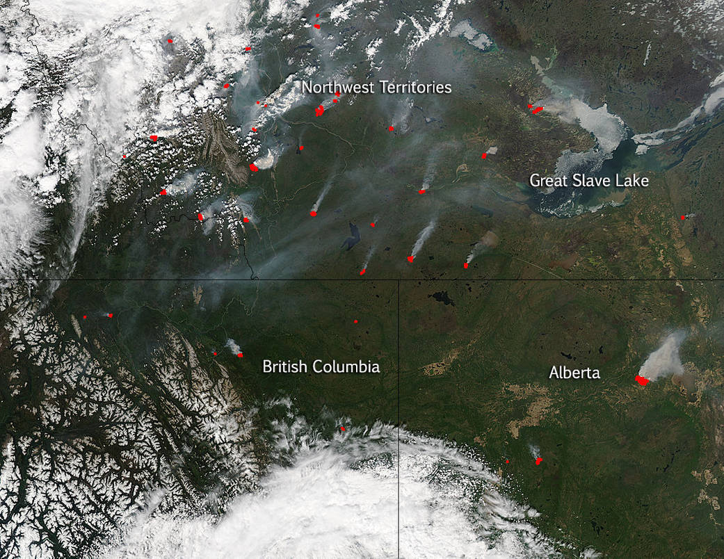
Hot spots abound in this image taken by NASA’s Aqua satellite on May 30, 2015. When accompanied by smoke, as they are in this image, these hot spots are indicative of fire. Wildfire season in Canada is starting somewhat early this year due to higher than normal temperatures earlier in the season. According to the Canadian Interagency Forest Fire Centre, Inc., the number of wildfires in 2014 was 1,178 burning a total of 24,022 hectares (59,360 acres). This year’s fire season, which is just underway the past month or so has already surpassed that with 2,503 fires burning 239,315 hectares (591,360 acres or 924 square miles) – this was as of May 31, 2015.
The Canadian Wildland Fire Information System website reports that, “Nationally, the number of fires and the area burned have increased dramatically from last week, and are now well above average for this time of year. The majority of this week’s fires have occurred in British Columbia, Alberta and Saskatchewan (21%, 26% and 13% respectively), while the majority of the area burned was in Alberta and Saskatchewan (23% and 40% respectively). Seasonal fire occurrence and area burned are both above the 10-year average.”
This natural-color satellite image was collected by the Moderate Resolution Imaging Spectroradiometer (MODIS) aboard the Aqua satellite on May 30, 2015. Actively burning areas, detected by MODIS’s thermal bands, are outlined in red. NASA image courtesy Jeff Schmaltz, MODIS Rapid Response Team. Caption: NASA/Goddard, Lynn Jenner